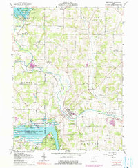
1961 Map of Perrysville
USGS Topo · Published 1990About this map
The Black Fork Mohican River defines the landscape of this southern Ashland County region, winding past the village of Perrysville and through a series of significant water management projects. Controlled by the Muskingum Watershed Conservancy District, the area features the expansive Charles Mill Lake and Pleasant Hill Lake, which altered the local topography for flood control and recreation. The Penn Central railroad tracks follow the river's path, serving the industry and agriculture of small settlements like Widowville and Coulter. Numerous family-named landmarks and rural burial grounds, such as Shambaugh Cem and Green Lawn Cem, are scattered across the surrounding Gas Field territories. This survey, photo-inspected in the early 1980s with 1974 revisions, captures the integration of mid-century infrastructure with the older rural fabric of Green and Monroe townships.
Find a feature on this map
52 named features on this map. Tap any name to fly to it.
Don’t see what you’re looking for? This feature index may not catch every label — zoom into the map to look around manually.
Map Details
Editions of this 1961 Perrysville Map
3 editions found
Other maps of this area

1906 · West Salem
USGS Topo · 1:62,500

1908 · Ashland
USGS Topo · 1:62,500

1908 · West Salem
USGS Topo · 1:62,500

1912 · Loudonville
USGS Topo · 1:62,500

1912 · Perrysville
USGS Topo · 1:62,500

1914 · Loudonville
USGS Topo · 1:62,500

1915 · Perrysville
USGS Topo · 1:62,500

1943 · Loudonville
USGS Topo · 1:62,500

1944 · Perrysville
USGS Topo · 1:62,500

1950 · Marion
USGS Topo · 1:250,000
Featured Places
- Perrysville, OH
- Mifflin Township, OH
- Green Township, OH
- Yacht Point Cottage Area, OH
- Monroe Township, OH