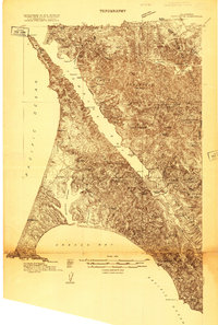
1916 Map of Point Reyes
USGS Topo · Published 1916This historical map portrays the area of Point Reyes in 1916, primarily covering Marin County as well as portions of Sonoma County. Featuring a scale of 1:48000, this map provides a highly detailed snapshot of the terrain, roads, buildings, counties, and historical landmarks in the Point Reyes region at the time. Published in 1916, it is one of 3 known editions of this map due to revisions or reprints.
Map Details
Editions of this 1916 Point Reyes Map
3 editions found
Historical Maps of Bivalve Through Time
22 maps found

1897 Tamalpais
Marin County, CA

1916 Point Reyes
Marin County, CA

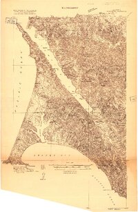
1918 Point Reyes
Marin County, CA

1941 Tamalpais
Marin County, CA

1947 San Quentin
Marin County, CA

1948 San Quentin
Marin County, CA

1950 Mt. Tamalpais
Marin County, CA

1951 Petaluma Point
Marin County, CA

1953 Drakes Bay
Marin County, CA

1954 Double Point
Marin County, CA

1954 Point Bonita
Marin County, CA

1954 Point Reyes
Marin County, CA

1954 Point Reyes NE
Marin County, CA

1959 Petaluma Point
Marin County, CA

1959 San Quentin
Marin County, CA

1993 Double Point
Marin County, CA

1993 Point Bonita
Marin County, CA

1993 San Quentin
Marin County, CA

1994 Double Point
Marin County, CA

1995 Drakes Bay
Marin County, CA

1995 Point Reyes NE
Marin County, CA

1995 San Quentin
Marin County, CA