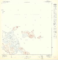
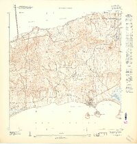
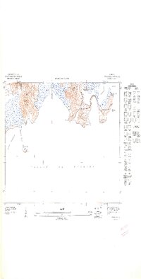
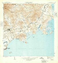
1947 Map of Punta Puerca NO
USGS Topo · Published 1947About this map
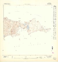
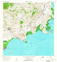
The U. S. Naval Reservation dominates this coastline, capturing a moment of significant military presence during the mid-1940s. The survey details a landscape of strategic importance, where the jagged shoreline of Punta Puerca and Pta Medio Mundo meets the waters of the Sonda de Vieques. Beyond the shore, a chain of islands including Isla Piñeros, North Cabras Island, and Isla Cabeza de Perro provides a natural buffer for the anchorage at Puerto Medio Mundo.
Find a feature on this map
19 named features on this map. Tap any name to fly to it.
Don’t see what you’re looking for? This feature index may not catch every label — zoom into the map to look around manually.
Map Details
Editions of this 1947 Punta Puerca NO Map
11 editions found
1947 edition
30.75 x 31.6 inches

1947 edition
30.8 x 31.66 inches
1947 edition
30.72 x 31.62 inches
1947 edition
30.59 x 31.72 inches
1947 edition
33.09 x 15.16 inches
1948 edition
31.04 x 32.09 inches
1948 edition
31.53 x 33.65 inches
1948 edition
31.85 x 33.63 inches
1948 edition
31.72 x 40.19 inches
1948 edition
31.88 x 33.66 inches
1948 edition
32.02 x 63.15 inches
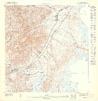
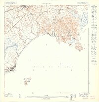
Other maps of this area
1945 · Cayo Icacos
USGS Topo · 1:30,000
1946 · Punta Puerca
USGS Topo · 1:30,000
1946 · Naguabo
USGS Topo · 1:30,000

1946 · Fajardo
USGS Topo · 1:30,000
1947 · Naguabo NE
USGS Topo · 1:10,000
1952 · Cayo Icacos
USGS Topo · 1:30,000
1952 · Punta Puerca
USGS Topo · 1:30,000
1952 · Naguabo
USGS Topo · 1:30,000

1952 · Fajardo
USGS Topo · 1:30,000
1957 · Naguabo
USGS Topo · 1:20,000