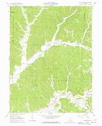
1961 Map of Ratcliffburg
USGS Topo · Published 1977About this map
Wayne National Forest and Tar Hollow State Forest dominate this landscape in the early 1960s, preserving a rugged section of the Ohio hill country where the boundaries of Ross, Hocking, and Vinton counties meet. The settlement pattern follows the drainage of Salt Creek and its many hollows, where small communities like Eagle Mills and Ratcliffburg served as local hubs. The map reveals deep roots in the land through numerous family-named landmarks and rural institutions, including the Eagle Sch and several country churches like Union Ch and Lebanon Ch.
Find a feature on this map
51 named features on this map. Tap any name to fly to it.
Don’t see what you’re looking for? This feature index may not catch every label — zoom into the map to look around manually.
Map Details
Editions of this 1961 Ratcliffburg Map
Other maps of this area

1906 · Waverly
USGS Topo · 1:62,500

1906 · Chillicothe
USGS Topo · 1:62,500

1908 · Chillicothe
USGS Topo · 1:62,500

1908 · Waverly
USGS Topo · 1:62,500

1910 · Laurelville
USGS Topo · 1:62,500

1912 · Laurelville
USGS Topo · 1:62,500

1913 · Jackson
USGS Topo · 1:62,500

1944 · Jackson
USGS Topo · 1:62,500

1944 · Laurelville
USGS Topo · 1:62,500

1947 · Columbus
USGS Topo · 1:250,000