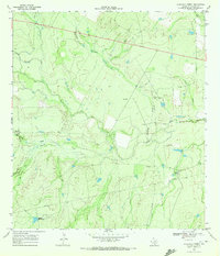
1969 Map of Rockaway Creek
USGS Topo · Published 1972About this map
The Frio River snakes across this South Texas landscape, creating a network of drainage channels and low-lying features like Mossy Slough. During this 1960s survey, the area was characterized by rural camps and resource extraction, with a growing energy footprint marked by scattered Gas Wells and an extensive Pipeline network. Settlement is sparse, anchored by locations such as Muerto Camp and Middle Mule-Pank.
Find a feature on this map
16 named features on this map. Tap any name to fly to it.
Don’t see what you’re looking for? This feature index may not catch every label — zoom into the map to look around manually.
Map Details
Editions of this 1969 Rockaway Creek Map
2 editions found
Other maps of this area

1925 · Tilden No. 1
USGS Topo · 1:48,000

1930 · Tilden
USGS Topo · 1:62,500

1942 · Fowlerton
USGS Topo · 1:62,500

1942 · Tilden
USGS Topo · 1:62,500

1953 · Crystal City
USGS Topo · 1:250,000

1955 · Crystal City
USGS Topo · 1:250,000

1956 · Hindes
USGS Topo · 1:62,500

1956 · Franklin Settlement
USGS Topo · 1:62,500

1956 · Fowlerton
USGS Topo · 1:62,500

1961 · Crystal City
USGS Topo · 1:250,000