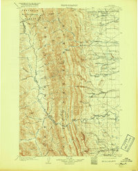
1903 Map of Saypo
USGS Topo · Published 1919About this map
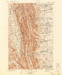
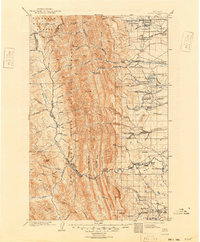
Saypo and a series of family ranch holdings characterize the eastern foothills of the Lewis and Clark Range at the dawn of the twentieth century. This early topographic survey captures a period of frontier settlement where the Teton River and Sun River drainage systems supported a sprawling network of homesteads, including Guerin's Ranch, Yeager's Ranch, and Christians Ranch. Industrial activity is sparse but present, marked by McGurk's Sawmill on the North Fork Sun River and a Coal Mine near the River Boundary Line. The western half of the map is dominated by the steep terrain of the Flathead National Forest, defined by the Continental Divide and prominent peaks like Rocky Mt. and Teton Pk.. This landscape, punctuated by gulches like Home Gulch and Hannan Gulch, illustrates the transition from high mountain wilderness to the irrigated valleys of the Rocky Mountain Front.
Find a feature on this map
110 named features on this map. Tap any name to fly to it.
Don’t see what you’re looking for? This feature index may not catch every label — zoom into the map to look around manually.
Map Details
Editions of this 1903 Saypo Map
7 editions found
Other maps of this area

1902 · Ovando
USGS Topo · 1:125,000

1903 · Saypo
USGS Topo · 1:125,000

1903 · Coopers Lake
USGS Topo · 1:125,000

1905 · Ovando
USGS Topo · 1:125,000

1913 · Marias Pass
USGS Topo · 1:125,000

1914 · Heart Butte
USGS Topo · 1:125,000

1918 · Heart Butte
USGS Topo · 1:125,000

1920 · Choteau
USGS Topo · 1:125,000

1920 · Dupuyer
USGS Topo · 1:125,000

1936 · Silvertip
USGS Topo · 1:96,000