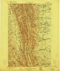
1903 Map of Saypo
USGS Topo · Published 1922About this map
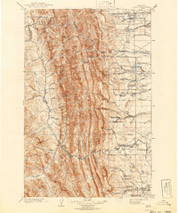
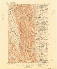
Flathead National Forest and Lewis and Clark National Forest dominate this early twentieth-century survey, bisected by the Continental Divide. The landscape is a study in the frontier economy of northern Montana, where industrial efforts like the McGuire Sawmill and a remote Coal Mine near the River Boundary Line sit alongside dozens of family ranching operations. The eastern plains are dotted with establishments such as Campbell's Ranch and Clark Bros Ranch, positioned near reliable water sources like Lake Theboe and the Teton River. High in the western mountains, small clearings such as Tie Camp reflect the timber needs of the era. The terrain transitions sharply from the verticality of Sawtooth Ridge and Rocky Mt down to the low-lying Alkali Flat, illustrating the diverse geography managed by the Flathead and Teton County line.
Find a feature on this map
97 named features on this map. Tap any name to fly to it.
Don’t see what you’re looking for? This feature index may not catch every label — zoom into the map to look around manually.
Map Details
Editions of this 1903 Saypo Map
7 editions found
Other maps of this area

1902 · Ovando
USGS Topo · 1:125,000

1903 · Saypo
USGS Topo · 1:125,000

1903 · Coopers Lake
USGS Topo · 1:125,000

1905 · Ovando
USGS Topo · 1:125,000

1913 · Marias Pass
USGS Topo · 1:125,000

1914 · Heart Butte
USGS Topo · 1:125,000

1918 · Heart Butte
USGS Topo · 1:125,000

1920 · Choteau
USGS Topo · 1:125,000

1920 · Dupuyer
USGS Topo · 1:125,000

1936 · Silvertip
USGS Topo · 1:96,000