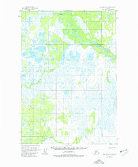
1954 Map of Sleetmute C-2
USGS Topo · Published 1977About this map
The Stony River winds through this interior landscape, defining a complex network of wetlands and meandering waterways as they appeared in the mid-1950s. The terrain is characterized by expansive muskeg and marshland, where drainage is dictated by smaller tributaries such as Basket Creek and Muskeg Creek. These features illustrate the hydrologic patterns of the region before significant modern development, showing the natural state of the Kuskokwim River basin area.
Find a feature on this map
6 named features on this map. Tap any name to fly to it.
Don’t see what you’re looking for? This feature index may not catch every label — zoom into the map to look around manually.
Map Details
Editions of this 1954 Sleetmute C-2 Map
3 editions found
Other maps of this area

1950 · Sleetmute
USGS Topo · 1:250,000

1954 · Sleetmute D-1
USGS Topo · 1:63,360

1954 · Sleetmute D-3
USGS Topo · 1:63,360

1954 · Sleetmute C-2
USGS Topo · 1:63,360

1954 · Sleetmute C-1
USGS Topo · 1:63,360

1954 · Sleetmute D-2
USGS Topo · 1:63,360

1954 · Sleetmute C-3
USGS Topo · 1:63,360

1954 · Sleetmute
USGS Topo · 1:250,000

1954 · Sleetmute B-2
USGS Topo · 1:63,360

1954 · Sleetmute B-3
USGS Topo · 1:63,360