
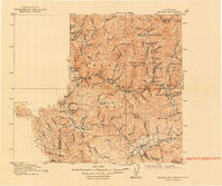
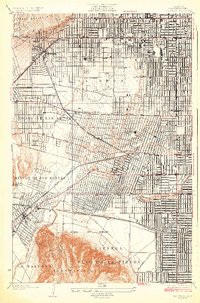
1904 Map of Southern California Sheet No. 1
USGS Topo · Published 1905About this map
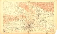
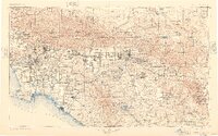
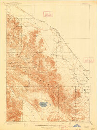
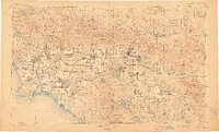
The Los Angeles basin and the surrounding mountain ranges appear at a transformative moment before the era of major freeway development. In this early twentieth-century landscape, the regional economy is defined by the Santa Ana River and San Gabriel River systems, which supported the burgeoning citrus belts around Riverside and San Bernardino. The map highlights the critical importance of water management in the arid West, featuring early infrastructure like the Bear Valley Reservoir and Hemet Reservoir. Coastal settlements such as Santa Monica, Redondo, and San Pedro are depicted as distinct port and resort towns, while the interior is dominated by expansive federal lands including the San Gabriel Timber Land Reserve and the San Jacinto Forest Reserve. Extensive rail networks, including the Southern Pacific RR and A.T. & S.F. RY., connect the coastal plains to the high desert, illustrating the transport corridors that dictated early Southern California growth.
Find a feature on this map
385 named features on this map. Tap any name to fly to it.
Don’t see what you’re looking for? This feature index may not catch every label — zoom into the map to look around manually.
Map Details
Editions of this 1904 Southern California Sheet No. 1 Map
2 editions found
Historical Maps of Menifee Lakes Through Time
28 maps found

1894 Los Angeles
California
1900 Los Angeles
California
1901 Southern California Sheet No. 1
California
1904 Indio
California
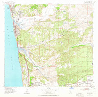
1904 Southern California Sheet No. 1
California
1904 Southern California Sheet No. 2
California
1906 Bakersfield
California
1915 Big Bar and Vicinity
California

1915 Spenceville
California

1924 Hollywood
California
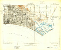
1925 Long Beach
California
1926 Hollywood
California

1928 Altadena
California

1929 Crescent City
California

1931 Tejon Hills
California

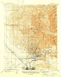
1933 Ontario
California

1942 Ontario and Vicinity
California
1942 Point Loma
California
1947 Casmalia
California
1950 Parker Dam Area
California
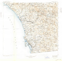
1953 Del Mar
California

1953 Point Loma
California

1967 Del Mar
California

1967 Point Loma
California

1976 Morro Bay South
California

1994 Del Mar
California

1996 Point Loma
California
1998 Morro Bay South
California