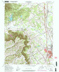
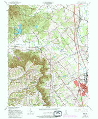
1963 Map of Speed
USGS Topo · Published 1994About this map
Clark State Forest dominates the northern reaches of this region, where the terrain rises toward Knob and Wieser Knob. The landscape is defined by the Illinois Grant Boundary, a historical surveying line that cuts diagonally across the township grids, influencing the irregular orientation of early farmsteads and road networks like Military Road. In the southeast, the growing community of Sellersburg serves as a hub of activity near Silver Creek, situated along the Louisville and Indiana Railroad.
Find a feature on this map
60 named features on this map. Tap any name to fly to it.
Don’t see what you’re looking for? This feature index may not catch every label — zoom into the map to look around manually.
Map Details
Editions of this 1963 Speed Map
5 editions found
Other maps of this area

1905 · Prospect
USGS Topo · 1:62,500

1912 · Prospect
USGS Topo · 1:62,500

1937 · Jeffersonville
USGS Topo · 1:24,000

1937 · Charlestown
USGS Topo · 1:24,000

1938 · Speed
USGS Topo · 1:24,000

1939 · New Albany
USGS Topo · 1:24,000

1939 · Georgetown
USGS Topo · 1:24,000

1941 · Borden
USGS Topo · 1:24,000

1946 · Jeffersonville
USGS Topo · 1:24,000

1946 · New Albany
USGS Topo · 1:24,000