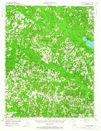
1951 Map of Summerfield
USGS Topo · Published 1964About this map
Summerfield and Lisbon anchor this mid-century portrait of Claiborne Parish, where the landscape is defined by the winding paths of Corney Bayou and Bayou D'Arbonne. The 1950s rural character of the region is reflected in its dense network of community landmarks, from the Rocky Springs Ch to the numerous local education sites like Spring Grove Sch and Mt Calm Sch. Settlement patterns follow the higher ground between creek drainages, with small hubs like Arizona and Colquitt connected by a web of unimproved roads and state routes.
Find a feature on this map
61 named features on this map. Tap any name to fly to it.
Don’t see what you’re looking for? This feature index may not catch every label — zoom into the map to look around manually.
Map Details
Editions of this 1951 Summerfield Map
5 editions found
Other maps of this area

1927 · El Dorado
USGS Topo · 1:62,500

1930 · El Dorado
USGS Topo · 1:62,500

1949 · Gibsland
USGS Topo · 1:62,500

1950 · Gibsland
USGS Topo · 1:62,500

1950 · Ruston
USGS Topo · 1:62,500

1950 · Arcadia
USGS Topo · 1:62,500

1951 · Arcadia
USGS Topo · 1:62,500

1951 · Ruston
USGS Topo · 1:62,500

1951 · Summerfield
USGS Topo · 1:62,500

1951 · Bernice
USGS Topo · 1:62,500