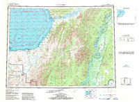
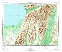
1952 Map of Unalakleet
USGS Topo · Published 1986About this map
Unalakleet serves as a vital coastal hub on this mid-century survey, situated where the Unalakleet River meets the waters of Norton Sound. The landscape is defined by its dramatic transition from the coastal Nunovulnuk Bluffs to the interior drainage systems of the Yukon River and the Anvik River. These waterways, including the complex network of Shageluk and Honeymoon Sloughs, illustrate a wilderness economy reliant on seasonal movement and river navigation. Local transit is marked by a Winter Trail stretching across the tundra toward Michael Bay.
Find a feature on this map
69 named features on this map. Tap any name to fly to it.
Don’t see what you’re looking for? This feature index may not catch every label — zoom into the map to look around manually.
Map Details
Editions of this 1952 Unalakleet Map
8 editions found

Other maps of this area

1945 · Nulato
USGS Topo · 1:250,000

1948 · Norton Bay
USGS Topo · 1:250,000

1950 · Solomon
USGS Topo · 1:250,000

1950 · Unalakleet D-3
USGS Topo · 1:63,360

1950 · Norton Bay A-4
USGS Topo · 1:63,360

1950 · Norton Bay A-3
USGS Topo · 1:63,360

1950 · Unalakleet D-4
USGS Topo · 1:63,360

1951 · Ophir
USGS Topo · 1:250,000

1951 · Nulato
USGS Topo · 1:250,000

1951 · Unalakleet
USGS Topo · 1:250,000