
1960 Map of Upper Sandusky
USGS Topo · Published 1962About this map
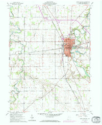
The city of Upper Sandusky serves as the focal point of this 1960s study, situated at a major crossing of the Sandusky River and the Pennsylvania and Chesapeake and Ohio railroads. The town's civic infrastructure is well-defined, showing the Courthouse, City Hall, and multiple educational buildings like High Sch and South Sch. Just north of the urban center, the County Fairgrounds and the Upper Sandusky Airport reflect the area's role as a regional hub.
Find a feature on this map
45 named features on this map. Tap any name to fly to it.
Don’t see what you’re looking for? This feature index may not catch every label — zoom into the map to look around manually.
Map Details
Editions of this 1960 Upper Sandusky Map
2 editions found
Other maps of this area

1903 · Marion
USGS Topo · 1:62,500

1905 · Marion
USGS Topo · 1:62,500

1906 · Sycamore
USGS Topo · 1:62,500

1907 · Upper Sandusky
USGS Topo · 1:62,500

1915 · La Rue
USGS Topo · 1:62,500

1950 · Marion
USGS Topo · 1:250,000

1960 · Sycamore
USGS Topo · 1:24,000

1960 · Nevada
USGS Topo · 1:24,000
1960 · Morral
USGS Topo · 1:24,000

1960 · Marseilles
USGS Topo · 1:24,000