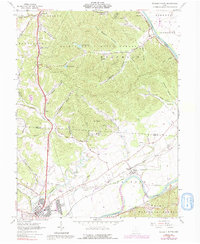
1961 Map of Waverly North
USGS Topo · Published 1992About this map
The Scioto River dominates the eastern and southern reaches of this landscape, its broad valley floor serving as a primary corridor for the Norfolk and Western and Chesapeake and Ohio railroads. The town of Waverly and the adjacent Bristol Village represent the primary centers of settlement, situated near the confluence of Crooked Creek and the river. To the north, the terrain rises sharply into the densely wooded ridges of the Scioto Trail State Forest, where a Lookout Tower stands as a landmark above Stewart Lake and Caldwell Lake.
Find a feature on this map
68 named features on this map. Tap any name to fly to it.
Don’t see what you’re looking for? This feature index may not catch every label — zoom into the map to look around manually.
Map Details
Editions of this 1961 Waverly North Map
4 editions found
Other maps of this area

1906 · Waverly
USGS Topo · 1:62,500

1906 · Chillicothe
USGS Topo · 1:62,500

1908 · Chillicothe
USGS Topo · 1:62,500

1908 · Waverly
USGS Topo · 1:62,500

1912 · Roxabell
USGS Topo · 1:62,500

1914 · Roxabell
USGS Topo · 1:62,500

1915 · Piketon
USGS Topo · 1:62,500

1917 · Piketon
USGS Topo · 1:62,500

1944 · Piketon
USGS Topo · 1:62,500

1944 · Roxabell
USGS Topo · 1:62,500