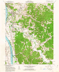
1961 Map of Wheelersburg
USGS Topo · Published 1963About this map
Wheelersburg serves as a hub of activity along the Ohio River in the early 1960s, where the convergence of the Norfolk and Western and Chesapeake and Ohio railroads supports the regional economy. The landscape is a study in contrasting land use, from the residential expansions of Garden City and Highland Park to the wooded expanse of the Wayne National Forest. The map documents a time of transitioning infrastructure, including the Greenup Locks and Dam and the industrial presence of a Clay Mine and Gravel Pit. Genealogists will find significant detail in the numerous burial sites, such as the Memorial Burial Park and Floral Hills Memory Gardens, alongside community pillars like the Hillcrest Childrens Home and Brick Union. The intricate mapping of Dogwood Ridge Road and Powellsville Road connects these riverfront settlements to the interior hollows.
Find a feature on this map
71 named features on this map. Tap any name to fly to it.
Don’t see what you’re looking for? This feature index may not catch every label — zoom into the map to look around manually.
Map Details
Editions of this 1961 Wheelersburg Map
4 editions found
Other maps of this area

1898 · Ironton
USGS Topo · 1:62,500

1900 · Ironton
USGS Topo · 1:62,500

1911 · Sciotoville
USGS Topo · 1:62,500

1912 · Oak Hill
USGS Topo · 1:62,500

1913 · Sciotoville
USGS Topo · 1:62,500

1926 · Greenup
USGS Topo · 1:48,000

1930 · Greenup
USGS Topo · 1:62,500
1953 · Load
USGS Topo · 1:24,000

1953 · Greenup
USGS Topo · 1:24,000
1953 · Portsmouth
USGS Topo · 1:24,000