
1892 Map of Wilmington
USGS Topo · Published 1892About this map
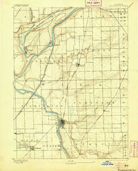
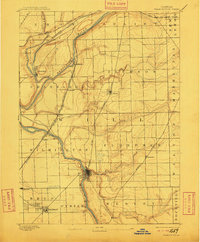
The Kankakee River and Desplaines River converge here, forming a complex waterway system that defined the industrial and agricultural development of Will County in the late 19th century. Near the confluence, the Michigan and Mississippi Canal cuts across the landscape, while the settlement of Wilmington serves as a central hub along the riverbanks. The southern portion of the map reveals the concentrated street grids of Braidwood and Diamond, areas historically tied to the region's coal mining heritage. A dense web of late-century rail infrastructure, including the Chicago and Alton Railway and the Santa Fe St. Louis and Chicago Railway, crisscrosses the townships of Channahon and Florence. These lines linked small shipping points like Blodget and Drummond to the larger Chicago markets, illustrating the era's transition from water-based transport to a dominant rail economy.
Find a feature on this map
41 named features on this map. Tap any name to fly to it.
Don’t see what you’re looking for? This feature index may not catch every label — zoom into the map to look around manually.
Map Details
Editions of this 1892 Wilmington Map
3 editions found
Other maps of this area

1890 · Des Plaines
USGS Topo · 1:62,500

1892 · Morris
USGS Topo · 1:62,500

1892 · Joliet
USGS Topo · 1:62,500

1894 · Des Plaines
USGS Topo · 1:62,500

1900 · Des Plaines
USGS Topo · 1:62,500

1901 · Des Plaines
USGS Topo · 1:62,500

1918 · Wilmington
USGS Topo · 1:62,500

1918 · Morris
USGS Topo · 1:62,500

1922 · Kankakee
USGS Topo · 1:62,500

1923 · Joliet
USGS Topo · 1:62,500