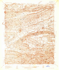
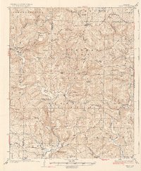
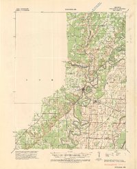
1930s Maps of Arkansas
Explore 105 historic maps of Arkansas from the 1930s. These maps offer a rare glimpse into what life looked like during the 1930s — showing old roads, neighborhoods, homes, and landmarks that have changed or disappeared over time.
Whether you're researching your family's past, planning a metal detecting trip, or studying how Arkansas's landscape evolved across the 1930s, these high-resolution maps are a powerful tool for exploring the history of this region.
- Focus on a specific era: All maps on this page are from the 1930s, giving you a focused view of this time period.
- See what’s changed: Compare century-old streets, trails, and buildings to today's modern landscape using overlays and satellite layers.
- Research with precision: Use these maps for genealogy, historical research, land use analysis, or educational projects.
- View, download, or print: Maps are fully viewable online in high resolution, and can be downloaded or printed for your own records.
Start exploring Arkansas's history through authentic maps from the 1930s. This is your window into the past.
Arkansas maps
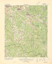
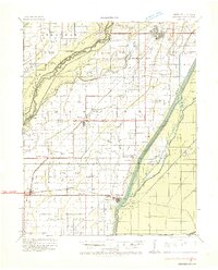
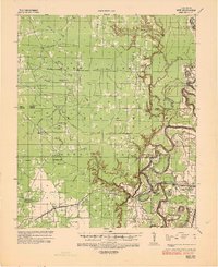
(105)- 1930 Map of Mellwood
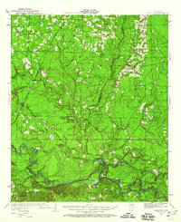
 1930 Mellwood1930 Print · USGSThe Mississippi Delta's shifting banks and rail-tied settlements are frozen in time just before the great mid-century levee expansions. Trace the history of the 1910s floods via the Ferguson Crevasse and locate river-dependent towns like Mellwood and Deeson.
 - 1930 Map of El Dorado, 1949 Print
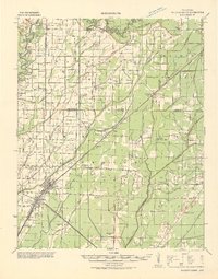
 1930 El Dorado1949 Print · USGSUnion County enters its oil boom era during the late twenties, with this survey capturing the burgeoning industry surrounding El Dorado. Genealogists and local historians can trace rural school districts like Shady Grove Sch and Fairview Sch, or locate family sites near Parnell Cemetery.
 - 1931 Map of Horseshoe Lake
 1931 Horseshoe Lake1931 Print · USGSThe Mississippi Delta's shifting landscape is captured here in the early thirties, centered on the great oxbow of Horseshoe Lake. Genealogists and historians can trace family-named tracts like the Tucker Plantation and Seyppel Plantation, alongside rural landmarks like the Y M C A Camp and Robinsonville.
 - 1931 Map of Jericho
 1931 Jericho1931 Print · USGSThe Arkansas-Tennessee borderlands appear here in the early 1930s, defined by the winding Mississippi and its evolving islands. Genealogists and researchers can trace old river landings like Pecan Point, rail stops at Jericho, and the rural Mt Vernon Church.
 - 1932 Map of Kensett
 1932 Kensett1932 Print · USGSWhite County in the early thirties is a bustling corridor of rail activity and river commerce. Genealogists and local historians can trace family-named sites across the bottomlands, including Dogwood Ch & Cem, Holloway Sch, and the junction at Kensett.
 - 1932 Map of Horn Lake
 1932 Horn Lake1932 Print · USGSNorthwest Mississippi and the river border come alive in the 1930s as the rail lines and river landings shaped local life. Genealogists can trace family footprints at Howards Store, Bynums Chapel, and Sunrise Sch and Ch near the banks of Horn Lake.3 unique versions available
 - 1932 Map of Strawberry
 1932 Strawberry1932 Print · USGSThe river bottoms of Northeast Arkansas are captured in the early 1930s, showing the intersection of the Strawberry River and Black River. Researchers can locate historic landmarks like the Pruitts Mill Site, Buck Cem, and local schools including Cord Sch.
 - 1932 Map of Walnut Ridge
 1932 Walnut Ridge1932 Print · USGSLawrence and Randolph counties come alive in the early thirties at the critical rail junction of Walnut Ridge. Genealogists and researchers can trace dozens of rural landmarks, from the Old Walnut Ridge Sch and Hoxie High Sch to local crossings like Indian Ford.
 - 1932 Map of Pastoria, 1965 Print
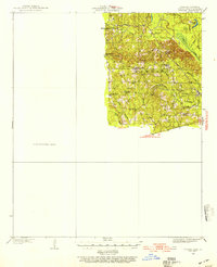
 1932 Pastoria1965 Print · USGSThe Arkansas River valley comes alive in the mid-1930s, showing a landscape defined by deep river bends and rural institutional life. Genealogists can trace family roots through numerous sites like Haywood College, Pastoria Ch & Cem, and the State Penal Farm.2 unique versions available
 - 1932 Map of Treat, 1972 Print
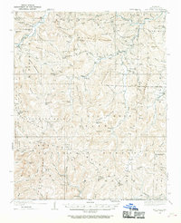
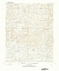
 1932 Treat1972 Print · USGSThe Arkansas Ozarks come alive in this early 1930s survey of the Piney Creek highlands. Researchers can trace rural life through numerous one-room schools like Ross Sch and remote outposts like Sand Gap Felsor PO or Fort Douglas.
 - 1933 Map of Lamont
 1933 Lamont1933 Print · USGSThe Mississippi River delta in the early 1930s is captured here just after the historic floods of the previous decade. Genealogists and historians can trace the foundations of Arkansas City, locate rural sites like Eutaw Store, and follow the tracks of the Mo Pac RR.
 - 1933 Map of Strong, 1954 Print
 1933 Strong1954 Print · USGSUnion County, Arkansas, was a landscape of bayous and timber mills during the early 1930s. Genealogists and local historians can trace the rural fabric of the region through landmarks like George Cem, New London, and the Mcclendon Mill.
 - 1933 Map of Mt Judea, 1970 Print
 1933 Mt Judea1970 Print · USGSNewton County's mountain communities were still deeply isolated during the early 1930s, connected by winding roads through the Boston Mountains. Genealogists can locate family homesteads near numerous local institutions like Union Hill Sch or the remote Macedonia Sch.
 - 1934 Map of Kennett
 1934 Kennett1934 Print · USGSDunklin County and the Arkansas borderlands are captured here during a period of intensive drainage and reclamation. Researchers can trace early infrastructure and family landmarks like Johnson Mill, American Legion Airport, and Bark Camp Sch.
 - 1934 Map of Booneville
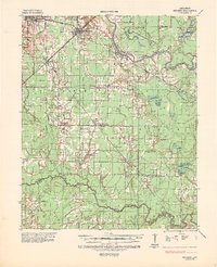
 1934 Booneville1934 Print · USGSLogan County during the mid-1930s reveals a network of small Arkansas settlements and mountain ridges connected by the Rock Island line. Researchers can trace family history through sites like the State Sanitarium, Wesley Chapel, and the Rocky Springs Cem.2 unique versions available
 - 1934 Map of Treat
 1934 Treat1934 Print · USGSPope County highlands during the early thirties show a rugged network of forest outposts and mountain schools. Researchers can trace the layout of community sites like Sand Gap Pelsor PO, Ross Sch, and the Fairview Fire Tower.3 unique versions available
 - 1934 Map of Powhatan
 1934 Powhatan1934 Print · USGSLawrence and Randolph counties are mapped here in the early 1930s, showing a river-dependent landscape tied to the Black River. Researchers can trace old ferry crossings like Gibson Ferry and family-named landmarks such as Whitlow Cem and Lauratown.
 - 1934 Map of Ingalls
 1934 Ingalls1934 Print · USGSBradley County during the mid-1930s shows a landscape of river-bottom camps and rural parish life. Researchers can trace family roots through numerous local landmarks, from Johnsville and Bogalusa Camp to country schools like Eagle Lake Sch and Broad Sch.
 - 1934 Map of Felsenthal, 1954 Print
 1934 Felsenthal1954 Print · USGSThe Ouachita and Saline River basins are captured here in the early 1930s as logging and rail shaped the Arkansas-Louisiana border. Trace the industrial footprint of the Logging RR and Missouri Pacific RR alongside local centers like Felsenthal, Huttig, and Smith Chapel.2 unique versions available
 - 1934 Map of Moro Bay, 1960 Print
 1934 Moro Bay1960 Print · USGSSouthern Arkansas at the height of the river-and-rail era is captured here, showing the intricate wetlands of the Ouachita valley. Researchers can locate old riverside hubs like Moro Bay, the tracks of the Chicago Rock Island and Pacific, and rural landmarks like Faustina Ch.
 - 1934 Map of Ozone, 1975 Print
 1934 Ozone1975 Print · USGSThe Boston Mountains of Arkansas appear in the mid-1930s as a landscape of isolated mountain settlements and family farms. Researchers can trace genealogical roots at the Gillian Settlement, locate long-gone schools like Mountain Hall Sch, or find rural landmarks including the Devils Knob Fire Tower.
 - 1935 Map of Mc Almont
 1935 Mc Almont1935 Print · USGSPulaski County during the mid-1930s is mapped here with a focus on the railroad hubs and river bottomlands northeast of the capital. Genealogists can trace family landmarks like Brushy Cem, St Luke Ch, and the Sylvan Hills Res settlement.
 - 1935 Map of Little Rock
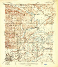
 1935 Little Rock1935 Print · USGSLittle Rock and its southern outskirts are captured in the mid-thirties, showcasing a city defined by its railroads and quarrying industry. Genealogists can trace family footprints near Oakland Cem or the rural community of Geyer Springs, while identifying landmarks like the Old Penitentiary Site and Biddle Shops.
 - 1935 Map of Kensett
 1935 Kensett1935 Print · USGSWhite County in the mid-1930s was defined by the winding Little Red River and a busy network of Missouri Pacific rail lines. Local historians can locate vanished community landmarks like Holloway Sch, Egbert Cem, and the village of Griffithville.2 unique versions available
 - 1935 Map of Mist
 1935 Mist1935 Print · USGSSoutheastern Arkansas during the mid-1930s is revealed here as a landscape of bayous and winding timber rails. Genealogists can trace family footprints at Promised Land Ch & Sch or Grizzle Cem, and map the defunct Abandoned Logging Railroad lines.
Showing maps 1-25 of 105
Top cities of Arkansas
- Little Rock historical maps
- Fayetteville historical maps
- Fort Smith historical maps
- Springdale historical maps
- Jonesboro historical maps
- Rogers historical maps
See more
Top counties of Arkansas
- Pulaski County historical maps
- Benton County historical maps
- Washington County historical maps
- Sebastian County historical maps
- Faulkner County historical maps
- Saline County historical maps
See more
Frequently asked questions
- What are the different types of historical maps available for Arkansas?
- What is the oldest map of Arkansas?
- Where can I purchase historical maps of Arkansas for my home or office?
- Where can I download high-res historical maps of Arkansas?
- Are there historical topographic maps available for Arkansas?
- Is there historical aerial imagery available for Arkansas?
- Where are historical maps of Arkansas sourced from?