1980s Maps of Arkansas
Explore 283 historic maps of Arkansas from the 1980s. These maps offer a rare glimpse into what life looked like during the 1980s — showing old roads, neighborhoods, homes, and landmarks that have changed or disappeared over time.
Whether you're researching your family's past, planning a metal detecting trip, or studying how Arkansas's landscape evolved across the 1980s, these high-resolution maps are a powerful tool for exploring the history of this region.
- Focus on a specific era: All maps on this page are from the 1980s, giving you a focused view of this time period.
- See what’s changed: Compare century-old streets, trails, and buildings to today's modern landscape using overlays and satellite layers.
- Research with precision: Use these maps for genealogy, historical research, land use analysis, or educational projects.
- View, download, or print: Maps are fully viewable online in high resolution, and can be downloaded or printed for your own records.
Start exploring Arkansas's history through authentic maps from the 1980s. This is your window into the past.
Arkansas maps
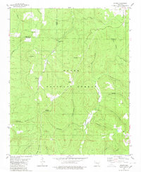
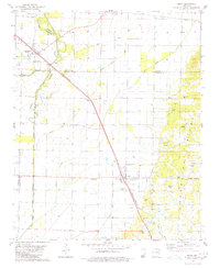
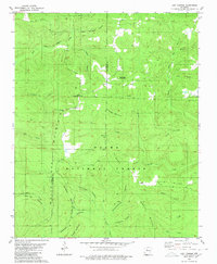
(283)- 1980 Map of Otwell
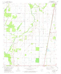
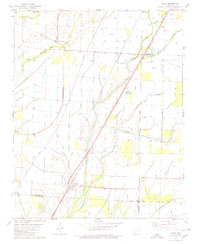
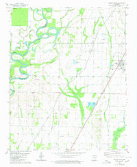
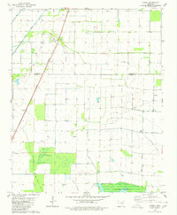 1980 Otwell1980 Print · USGSOtwell and the surrounding Arkansas Delta are captured here in the late 1970s as a landscape of managed waterways and rail transport. Researchers can trace the St Louis Southwestern tracks past Otwell Cem and explore the irrigation networks of Big Creek Ditch and Claypool Reservoir.
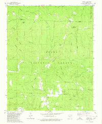
 - 1980 Map of Hagarville
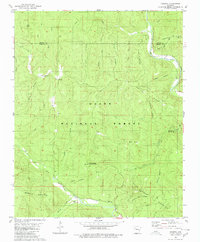
 1980 Hagarville1980 Print · USGSHagarville and its surrounding mountain hollows are shown in detail during the late 1970s. Genealogists can trace family landmarks and burial sites including Adkins Cem, Russell Cem, and Minnow Creek Cem, alongside old rural churches like Lees Chapel.
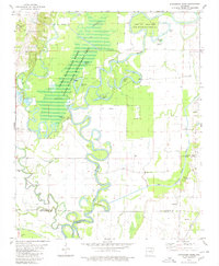
 - 1980 Map of Tilton
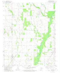
 1980 Tilton1980 Print · USGSNear the Woodruff and Jackson county lines in the 1970s, this area shows a landscape of bayous and rail-side settlements. Genealogists and local historians can trace the rural communities of Pumpkin Bend and Tilton, or locate the Morton Cem and Betts Cem.
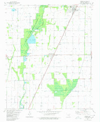
 - 1980 Map of Moore
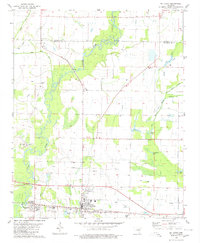
 1980 Moore1980 Print · USGSThe high Ozarks along the Newton and Searcy County line are documented here in the early eighties. Genealogists and hikers can trace family-named sites like Jack Jones Hollow and Hill Cem or locate old outposts at Moore and Iceledo.2 unique versions available
 - 1980 Map of Smyrna
 1980 Smyrna1980 Print · USGSPope County and the surrounding Ozark highlands are captured here in the late seventies as a landscape of isolated mountain communities and deep hollows. Researchers can locate remote landmarks like Ben Hur, the Old Smyrna Cem, and the Smyrna Ch near the banks of the Illinois Bayou.2 unique versions available
 - 1980 Map of Ozone
 1980 Ozone1980 Print · USGSUpper Johnson County was a landscape of remote ridges and scattered mountain settlements at the dawn of the 1980s. Genealogists and local historians can trace the foundations of Gillian Settlement or locate rural landmarks like Miracle Temple Ch and Salus.
 - 1980 Map of Strangers Home
 1980 Strangers Home1980 Print · USGSThe Black River lowlands of northeast Arkansas are shown here in the late twentieth century, where river bends meet managed wetlands. Family historians can locate several rural burial grounds including Pleasant Hill Cem and Ruffner Cem near the settlement of Strangers Home.
 - 1980 Map of Weiner
 1980 Weiner1980 Print · USGSWestern Poinsett County in the early eighties was a landscape where the railroad and the wetlands shaped local life. Genealogists and historians can trace the foundations of Weiner, find Harmony Grove Ch, or locate the Zion Cem near Waldenburg.
 - 1980 Map of Simpson
 1980 Simpson1980 Print · USGSThe Ozark highlands of Pope County appear here in the late seventies, showing a landscape of deep timber and winding bayous. Researchers can locate remote family burials at Oak Grove Cem and Sherman Cem or trace old tracks through Moccasin Gap.2 unique versions available
 - 1980 Map of Alicia
 1980 Alicia1980 Print · USGSLawrence County and the Arkansas Delta are captured here in the late 1970s as the rail-and-creek economy maintained its traditional footprint. Researchers can trace family history through several burial sites like Clover Bend Cemetery and Davenport Cemetery or locate the community at Hopewell Church.
 - 1980 Map of Beedeville
 1980 Beedeville1980 Print · USGSBeedeville and the surrounding delta wetlands were undergoing significant hydrological shifts by the 1980s. Genealogists and local historians can trace family roots through the Citizenship Ch and several rural burial grounds like Eight Mile Cem and Jones Cem.
 - 1980 Map of Sand Gap
 1980 Sand Gap1980 Print · USGSThe Ozark highlands on the Newton and Pope county line are captured here in the late seventies. Researchers can trace rural life through secluded sites like Freeman Springs Cemetery and remote settlements such as Sand Gap.2 unique versions available
 - 1980 Map of Cash
 1980 Cash1980 Print · USGSSettlement and agriculture define the Craighead County landscape in the late seventies. Researchers can trace rural landmarks and family histories through sites like Johnson Cem, the community of Little Texas, and the Red Ch near the Fisher area.
 - 1980 Map of Lurton
 1980 Lurton1980 Print · USGSThe Boston Mountains of Newton County appear in high detail during the late 1970s, showcasing the isolated high-altitude settlements of the Ozarks. Researchers can trace family sites at Tarlton Flats, Lurton, and Spence Junction, or locate the hilltop Tarlton Cem.3 unique versions available
 - 1980 Map of Bono
 1980 Bono1980 Print · USGSNortheast Arkansas in the late seventies is marked by the unique topography of Crowleys Ridge and the winding Cache River. Genealogists and historians can trace rural lifeways through several country landmarks like Old Military Cem, Bells Chapel Ch, and the rail stop at Pauls Switch.
 - 1980 Map of Podo Creek
 1980 Podo Creek1980 Print · USGSLawrence and Craighead counties in the late 1970s show a landscape shaped by drainage projects and rail transport. Genealogists can locate family-named sites like Markham Cem and Aldridge Cem or trace the old St Louis-San Francisco line.
 - 1980 Map of Swifton East
 1980 Swifton East1980 Print · USGSJackson and Craighead Counties are shown here during a period of steady delta farming and rural growth. Genealogists and local historians can locate early landmarks like Arnold Cem, Morrow Chapel, and the Missouri Pacific railroad line.
 - 1980 Map of Herman
 1980 Herman1980 Print · USGSIn the early eighties, this Craighead County landscape reveals the sharp meeting point between the uplands of Crowleys Ridge and the engineered drainage of the lowlands. Researchers can locate family landmarks like Gibson Cem and West Side High Sch alongside the tracks of the St Louis - Southwestern railroad.
 - 1980 Map of Lost Corner
 1980 Lost Corner1980 Print · USGSThe high ridges of the Ozarks are documented here in the early eighties, where the Pope and Van Buren county lines meet. Researchers can trace rural settlement patterns through family-named landmarks like Snowlick Mountain and sites such as New Hope Cem and Lost Corner.
 - 1980 Map of Rosetta
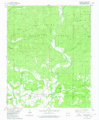
 1980 Rosetta1980 Print · USGSThe Ozark highlands near the Johnson and Newton County border are documented here during the late twentieth century. Genealogists and hikers can trace remote landmarks like Rosetta Cem, the peaks of Pilot Rock Mountain, and the waters of Big Piney Creek.
 - 1980 Map of Treat
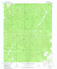
 1980 Treat1980 Print · USGSThe Ozark National Forest's deep valleys and high ridges are documented here in the late seventies. Researchers can trace rural life through the Treat settlement, several family cemeteries like Shannon Cem, and local landmarks such as Bullfrog Valley.2 unique versions available
 - 1980 Map of Solo
 1980 Solo1980 Print · USGSPope County’s high country is captured here in the 1980s as a landscape of deep hollows and isolated mountain settlements. Genealogists can trace family landmarks like Barkers Cem and Tripp Cem near the quiet communities of Solo and Retta.
 - 1980 Map of Tupelo
 1980 Tupelo1980 Print · USGSThe agricultural plains of Jackson County are shown in the early eighties as a sophisticated landscape of drainage canals and small-town junctions. Researchers can locate family sites and rural landmarks like McDonald Cem, the Fish Hatchery, and Breckenridge Landing Field.
 - 1980 Map of Mc Crory
 1980 Mc Crory1980 Print · USGSWoodruff County in the late seventies is captured here at the intersection of the Missouri Pacific rail line and the meandering Cache River. Genealogists and local historians can locate several rural landmarks including Fakes Chapel Cem, Morning View Ch, and the settlement of Overcup.
 - 1980 Map of Swifton West
 1980 Swifton West1980 Print · USGSThe Black River bottoms in Jackson and Independence counties are captured here in the early eighties. Genealogists can locate family burial grounds like Harrison Cem and Bandy Cem or trace the Missouri Pacific rail line through Swifton.
Showing maps 1-25 of 283
Top cities of Arkansas
- Little Rock historical maps
- Fayetteville historical maps
- Fort Smith historical maps
- Springdale historical maps
- Jonesboro historical maps
- Rogers historical maps
See more
Top counties of Arkansas
- Pulaski County historical maps
- Benton County historical maps
- Washington County historical maps
- Sebastian County historical maps
- Faulkner County historical maps
- Saline County historical maps
See more
Frequently asked questions
- What are the different types of historical maps available for Arkansas?
- What is the oldest map of Arkansas?
- Where can I purchase historical maps of Arkansas for my home or office?
- Where can I download high-res historical maps of Arkansas?
- Are there historical topographic maps available for Arkansas?
- Is there historical aerial imagery available for Arkansas?
- Where are historical maps of Arkansas sourced from?