1960s Maps of Arkansas
Explore 417 historic maps of Arkansas from the 1960s. These maps offer a rare glimpse into what life looked like during the 1960s — showing old roads, neighborhoods, homes, and landmarks that have changed or disappeared over time.
Whether you're researching your family's past, planning a metal detecting trip, or studying how Arkansas's landscape evolved across the 1960s, these high-resolution maps are a powerful tool for exploring the history of this region.
- Focus on a specific era: All maps on this page are from the 1960s, giving you a focused view of this time period.
- See what’s changed: Compare century-old streets, trails, and buildings to today's modern landscape using overlays and satellite layers.
- Research with precision: Use these maps for genealogy, historical research, land use analysis, or educational projects.
- View, download, or print: Maps are fully viewable online in high resolution, and can be downloaded or printed for your own records.
Start exploring Arkansas's history through authentic maps from the 1960s. This is your window into the past.
Arkansas maps
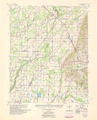
(417)- 1960 Map of Gainesville
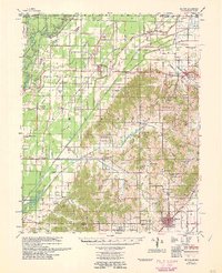
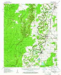
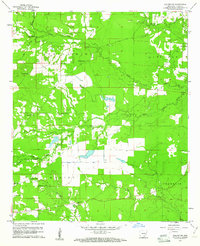
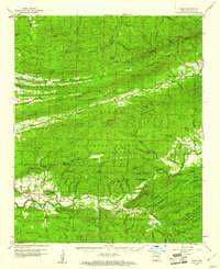
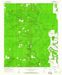
 1960 Gainesville1960 Print · USGSNortheast Arkansas in the late fifties shows the sharp contrast between the managed Cache River bottoms and the heights of Crowleys Ridge. Genealogists can locate family landmarks like Bonds Cem, Pruitt Ch, and the original settlement at Gainesville.
 - 1960 Map of El Dorado
 1960 El Dorado1960 Print · USGSSouth Central Arkansas in the late fifties was a hub of energy production and defense industry. Researchers can trace the extensive Oil and Gas Fields around El Dorado or locate family landmarks like Old Park Cem and New Hope Church.
 - 1960 Map of Madison
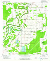
 1960 Madison1960 Print · USGSEastern Arkansas at the dawn of the sixties shows a landscape shaped by the ridge and the river's winding oxbows. Genealogists can trace family names at Dorriss Cem and New Hebron Cem or locate old community hubs like Wynne Chapel.3 unique versions available
 - 1960 Map of Weiner
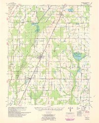 1960 Weiner1960 Print · USGSNortheast Arkansas at the dawn of the 1960s shows a landscape defined by the ST LOUIS SOUTHWESTERN rail line and reclaimed delta bottomlands. Researchers can trace rural life through landmarks like Walker Cem, Chilson Ch, and the sprawling Public Hunting Area.
 - 1960 Map of Sedgwick
 1960 Sedgwick1960 Print · USGSNortheast Arkansas in the late fifties was a landscape of river bottomlands and rail-hub towns like Sedgwick and Bono. Researchers can trace old family burial grounds and country parishes such as Manning Cem, Egypt Sch, and Little Brown Ch.
 - 1960 Map of Little Rock
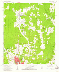
 1960 Little Rock1960 Print · USGSCentral Arkansas in the late fifties shows a landscape of growing military bases and massive new reservoirs. Local historians can trace the mid-century expansion of Little Rock and Hot Springs alongside the industrial works at Bauxite and the Pine Bluff Arsenal.
 - 1960 Map of Rector
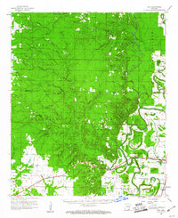
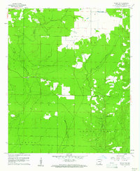
 1960 Rector1960 Print · USGSClay County at the end of the fifties reveals a landscape shaped by the rise of Crowleys Ridge and an intricate network of drainage ditches. Local historians can trace the foundations of Rector and Boydsville or locate rural landmarks like the Knob Sch and Purcell Mill.
 - 1960 Map of Poplar Bluff
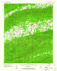
 1960 Poplar Bluff1960 Print · USGSSoutheast Missouri and Northeast Arkansas are captured here during the post-war era, showing the transition from the Ozark highlands to the Delta. Genealogists and historians can trace rail corridors like the St. Louis Southwestern RR and remote settlements such as Birch Tree and Warm Springs.
 - 1960 Map of Helena
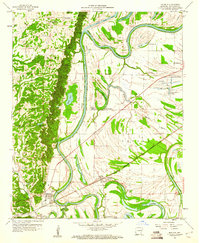
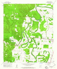
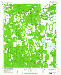
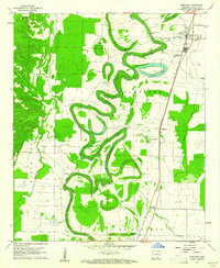
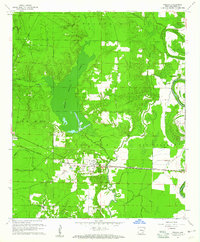
 1960 Helena1960 Print · USGSThe Arkansas and Mississippi Delta regions meet along the great river bends during a period of significant agricultural and rail expansion. Genealogists and historians can trace the paths of the Missouri Pacific railroad through Clarendon or locate landings along the Mississippi River and White River.
 - 1960 Map of Snyder, 1961 Print
 1960 Snyder1961 Print · USGSIn the early 1960s, the Ashley County delta landscape was defined by the meandering Bayou Bartholomew and the vital Missouri Pacific rail line. Researchers can trace the layout of small settlements like Montrose and Snyder or locate rural landmarks such as Evening Star Ch.2 unique versions available
 - 1960 Map of Gravelly, 1961 Print
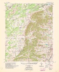
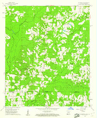
 1960 Gravelly1961 Print · USGSYell and Scott Counties appear here in the early sixties, as small rural communities thrived along the winding Fourche River. Genealogists and local historians can trace family roots through landmarks like Mt Pleasant Cem, Mulberry Ch, and the Fourche Valley Sch.3 unique versions available
 - 1960 Map of Mist, 1961 Print
 1960 Mist1961 Print · USGSSoutheast Arkansas in the early sixties was a landscape of winding bayous and rail-dependent towns like Montrose and Snyder. Genealogists can locate family-named sites such as Townsend Cem and Judking Cem along the bends of Bayou Bartholomew.2 unique versions available
 - 1960 Map of Wilmot, 1961 Print
 1960 Wilmot1961 Print · USGSThe borderlands of southeast Arkansas and northeast Louisiana are defined by the winding oxbows of Bayou Bartholomew and the Missouri Pacific railroad. Genealogists can trace early rural life through landmarks like Chiller Chapel Cem, Savage High Sch, and the town of Wilmot.2 unique versions available
 - 1960 Map of Selma, 1961 Print
 1960 Selma1961 Print · USGSIn the early sixties, the rural Arkansas landscape around Selma remained a network of family-named cemeteries and creek-side settlements. Genealogists can trace local heritage through sites like Dishongh Cem, Sweet Hope Ch, and the many brakes along Bayou Bartholomew.2 unique versions available
 - 1960 Map of Bussey, 1961 Print
 1960 Bussey1961 Print · USGSSouthwest Arkansas at the start of the sixties reveals a landscape of rural townships and oil production. Genealogists and historians can trace the foundations of local communities at Bussey and Sharman, alongside the Woodard Sch and the Kansas City Southern line.3 unique versions available
 - 1960 Map of Portland, 1961 Print
 1960 Portland1961 Print · USGSSoutheast Arkansas in the early sixties is defined here by the winding Bayou Bartholomew and the Missouri Pacific rail corridor. Genealogists can locate family landmarks like Tillis High Sch Cem, Holly Grove Ch, and the small community of Sunshine.2 unique versions available
 - 1960 Map of Collins NW, 1961 Print
 1960 Collins NW1961 Print · USGSSoutheast Arkansas in the early sixties reveals a landscape of scattered family farms and rural parish life. Researchers can trace ancestral locations through several country churches and cemeteries like Jose Chapel, Shady Grove Cem, and Zion Hill Ch.2 unique versions available
 - 1960 Map of Wilmot NW, 1961 Print
 1960 Wilmot NW1961 Print · USGSAshley County timber and bottomlands are mapped in detail during the early sixties, showing a landscape defined by winding watercourses and prairie openings. Genealogists and local historians can locate remote landmarks like New Texas Cem, Beech Creek Ch, and the Lookout tower.2 unique versions available
 - 1960 Map of Collins, 1961 Print
 1960 Collins1961 Print · USGSSoutheast Arkansas in the early sixties was defined by the winding waters of the bayou and the vital rail link of the Missouri Pacific. Genealogists can trace family roots at Solomon Allen Cem or Little Zion Ch and locate rural homesteads near Collins and Baxter.2 unique versions available
 - 1960 Map of Taylor, 1961 Print
 1960 Taylor1961 Print · USGSThe Arkansas-Louisiana state line comes alive in the early sixties, showing the industrial heart of the Springhill Oil Field and Taylor. Trace the family-named landmarks of the day, from the Kansas City Southern rail line to Salem Grace Ch and Browning Sch.2 unique versions available
 - 1960 Map of Parks, 1961 Print
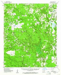
 1960 Parks1961 Print · USGSScott County, Arkansas, is captured here in the early sixties, a landscape defined by the ridgelines of the Ouachita Mountains. Genealogists and local historians can trace family locations near Parks and Ballard, or find rural landmarks like Mt Moriah Ch and the Friendship Cem.2 unique versions available
 - 1960 Map of Walkerville, 1961 Print
 1960 Walkerville1961 Print · USGSThe borderlands of southern Arkansas and northern Louisiana come into focus in the early 1960s, showing a landscape defined by timber and the oil industry. Trace rural family roots at Old Shongaloo Ch or Stewart-Walkerville Cem, and locate early infrastructure like the Horsehead Oil Field.3 unique versions available
 - 1960 Map of Wilmot, 1961 Print
 1960 Wilmot1961 Print · USGSThe Arkansas delta near the Louisiana border is captured here in the early sixties, centered on the river-and-rail corridor of the Missouri Pacific. Researchers can trace rural life through sites like Savage High Sch, Wilmot Cem, and the winding Bayou Bartholomew.3 unique versions available
 - 1960 Map of Collins, 1961 Print
 1960 Collins1961 Print · USGSIn the early sixties, the Drew County landscape was a tapestry of rail-side settlements and brake-water bayous. Researchers can trace family history through sites like Selma, the Missouri Pacific line, and cemeteries such as Dabney Cem or Mt Olive Cem.
 - 1960 Map of Line, 1961 Print
 1960 Line1961 Print · USGSSoutheast Arkansas in the early sixties is captured here as a landscape of winding waterways and rural outposts. Genealogists can locate family landmarks like Roper Cem, Mt Calvary Ch, and the small settlement of Line near the county border.2 unique versions available
Showing maps 1-25 of 417
Top cities of Arkansas
- Little Rock historical maps
- Fayetteville historical maps
- Fort Smith historical maps
- Springdale historical maps
- Jonesboro historical maps
- Rogers historical maps
See more
Top counties of Arkansas
- Pulaski County historical maps
- Benton County historical maps
- Washington County historical maps
- Sebastian County historical maps
- Faulkner County historical maps
- Saline County historical maps
See more
Frequently asked questions
- What are the different types of historical maps available for Arkansas?
- What is the oldest map of Arkansas?
- Where can I purchase historical maps of Arkansas for my home or office?
- Where can I download high-res historical maps of Arkansas?
- Are there historical topographic maps available for Arkansas?
- Is there historical aerial imagery available for Arkansas?
- Where are historical maps of Arkansas sourced from?