1940s Maps of Arkansas
Explore 95 historic maps of Arkansas from the 1940s. These maps offer a rare glimpse into what life looked like during the 1940s — showing old roads, neighborhoods, homes, and landmarks that have changed or disappeared over time.
Whether you're researching your family's past, planning a metal detecting trip, or studying how Arkansas's landscape evolved across the 1940s, these high-resolution maps are a powerful tool for exploring the history of this region.
- Focus on a specific era: All maps on this page are from the 1940s, giving you a focused view of this time period.
- See what’s changed: Compare century-old streets, trails, and buildings to today's modern landscape using overlays and satellite layers.
- Research with precision: Use these maps for genealogy, historical research, land use analysis, or educational projects.
- View, download, or print: Maps are fully viewable online in high resolution, and can be downloaded or printed for your own records.
Start exploring Arkansas's history through authentic maps from the 1940s. This is your window into the past.
Arkansas maps
(95)- 1940 Map of Mt Judea
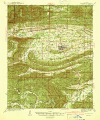
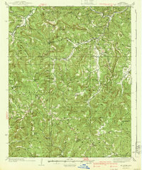 1940 Mt Judea1940 Print · USGSThe high ridges of the Arkansas Ozarks appear here in the early 1940s, showing a landscape of isolated mountain settlements and national forest land. Researchers can find many rural landmarks, from Diamond Cave and Mt Judea to the Smith Cem and Deer Fire Tower.3 unique versions available
 - 1940 Map of Lonoke
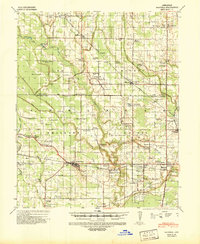
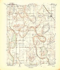
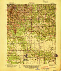 1940 Lonoke1940 Print · USGSThe Lonoke County interior during the late Depression era shows a landscape of rail-dependent towns and prairie farmsteads. Researchers can trace the early road network and family history through sites like Butlerville, the Confederate Cemetery, and Carlisle.
 - 1940 Map of Waldron
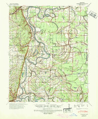
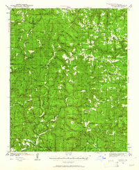
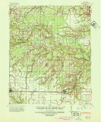
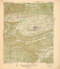 1940 Waldron1940 Print · USGSWaldron and the surrounding Ouachita highlands are shown here in the years leading up to the Second World War. Researchers can trace the heritage of rural Scott County through its many local schools and cemeteries, from Evening Shade Sch to the County Farm and Hon Cem.
 - 1940 Map of Deckerville, 1942 Print
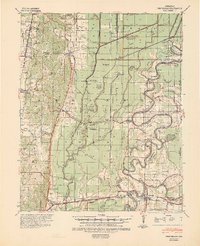
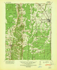
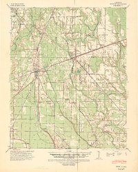
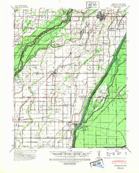
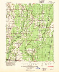
 1940 Deckerville1942 Print · USGSCrittenden and Poinsett counties are shown here as the local river-and-rail economy matured before the war. Genealogists can trace family landmarks like the King Solomon Sch & Cem, Booker Sch, and New Bethlehem Ch & Cem.
 - 1940 Map of Princedale, 1942 Print
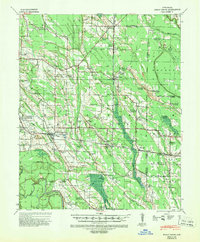
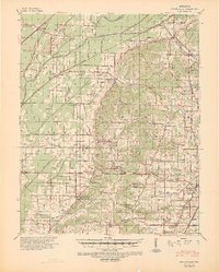
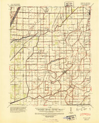
 1940 Princedale1942 Print · USGSEastern Arkansas at the cusp of World War II is mapped here as a land of managed floodways and emerging rail towns. Genealogists can trace family footprints at Hare Farm Sch, Sharps Chapel, and along the banks of the St Francis River.2 unique versions available
 - 1940 Map of Marvell, 1942 Print
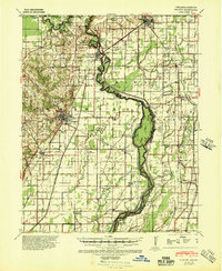
 1940 Marvell1942 Print · USGSPhillips and Lee counties come alive in the 1940s as a thriving Delta agricultural region centered on Marvell. Researchers can trace old family roots through numerous landmarks like the Rosenwald Sch, Tucker Grove Ch & Cem, and the Missouri Pacific rail line.
 - 1940 Map of Whitmore, 1942 Print
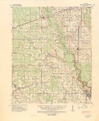
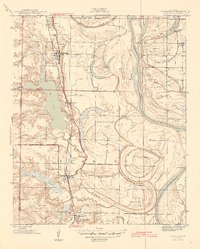
 1940 Whitmore1942 Print · USGSSt. Francis County in the early 1940s shows a complex river-and-rail landscape shaped by the meanders of the St Francis River. Researchers can trace old family settlements and rural institutions like Wittsburg, the Church of Bethlehem, and Walters Cem.2 unique versions available
 - 1940 Map of Dee, 1942 Print
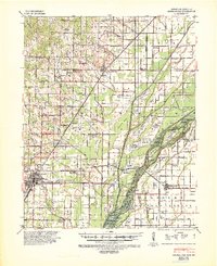
 1940 Dee1942 Print · USGSPoinsett County at the start of the 1940s reveals a landscape split between the natural rises of Crowleys Ridge and an expansive system of reclamation drainage. Trace family roots through numerous country schools like Judd Hill Sch or sites like Bolivar Cem.
 - 1940 Map of Holly Grove, 1942 Print
 1940 Holly Grove1942 Print · USGSMonroe County was a landscape of rail-driven trade and rural community anchors in the years just before the war. Genealogists and historians can trace dozens of family landmarks, from the Masonic Hall School and Travelers Rest Cem to the local siding at Chimney Spur.2 unique versions available
 - 1940 Map of Brinkley, 1942 Print
 1940 Brinkley1942 Print · USGSBrinkley and the surrounding Delta counties are shown in the 1940s as a bustling junction of three major railroads. Researchers can trace the legacy of local agriculture and community life through sites like Bemis Plantation, Lennon High School, and Garret Grove Ch Sch & Cem.3 unique versions available
 - 1940 Map of Gainesville, 1942 Print
 1940 Gainesville1942 Print · USGSGreene County was defined by its ridge and river bottomlands in the early 1940s, as rural communities thrived along the local railroads. Genealogists can trace family names through dozens of landmarks like Jones Ridge Cem, St Johns Ch & Cem, and Greene Co High Sch.2 unique versions available
 - 1940 Map of Marianna, 1942 Print
 1940 Marianna1942 Print · USGSEastern Arkansas at the start of the 1940s is captured here in a landscape of river-bottom farms and rail-line towns. Researchers can locate numerous local landmarks including Scruggs Chapel, the Haunted Cem, and the river crossing at Felton.2 unique versions available
 - 1940 Map of Marmaduke, 1942 Print
 1940 Marmaduke1942 Print · USGSThe lowland border between Arkansas and Missouri comes into focus in the early 1940s, showing a landscape of river islands and new drainage ditches. Researchers can locate vanished rural landmarks like Bonecamp Sch, the Reddick Cem, and the tracks of the St Louis Southwestern Railway.3 unique versions available
 - 1940 Map of Kennett, 1943 Print
 1940 Kennett1943 Print · USGSDunklin County and the Missouri-Arkansas border are mapped here during the early 1940s, showing a landscape defined by drainage ditches and rail lines. You can trace the St Louis Southwestern RR through Senath and Arbyrd, or locate family sites like Lula Ch & Cem and Johnson Mill.
 - 1940 Map of Hayti, 1943 Print
 1940 Hayti1943 Print · USGSSoutheast Missouri’s fertile lowlands are captured here in the early 1940s, showing a landscape defined by drainage canals and rail-side commerce. Genealogists can trace family roots through numerous small schools and cemeteries, such as Cupp Cem and Gibson Sch.2 unique versions available
 - 1940 Map of Piggott, 1945 Print
 1940 Piggott1945 Print · USGSNortheast Arkansas and the Missouri Bootheel meet along the winding St Francis River in the decade before the post-war era. Genealogists and local historians can locate numerous rural landmarks including Gravel Hill Ch & Cem, Pine City, and the St Louis Southwestern RR line.
 - 1940 Map of Woodson, 1945 Print
 1940 Woodson1945 Print · USGSPulaski County at the start of the 1940s reveals a riverside landscape of bayous and railroad towns. Researchers can trace rural life through landmarks like Gospel Temple Ch, the State Industrial School, and Campbell Cem.2 unique versions available
 - 1940 Map of Tilton, 1947 Print
 1940 Tilton1947 Print · USGSEastern Arkansas at the start of the 1940s is captured here as a landscape of river-fed bottoms and thriving rail-side towns. Genealogists and local historians can trace family roots through the numerous rural landmarks like Fakes Chapel & Cem, Pumpkin Bend Cem, and Weldon Sch.2 unique versions available
 - 1940 Map of Smyrna, 1961 Print
 1940 Smyrna1961 Print · USGSThe Arkansas Ozarks around the Pope and Searcy county lines are shown here at a time when small mountain schools and isolated settlements were the heart of the community. Researchers can trace family roots at Old Smyrna Cem or find the sites of vanished homesteads near Lost Corner and Nogo Sch.2 unique versions available
 - 1941 Map of Alexander
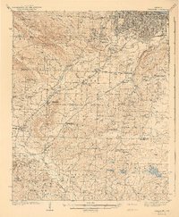 1941 Alexander1941 Print · USGSIn the 1930s, the corridor between Pulaski and Saline County was a bustling landscape of rail lines and rural townships. Genealogists and historians can trace family roots through numerous local landmarks, including the Dawson Sch, Vimy Ridge, and the Industrial Home.2 unique versions available
 - 1941 Map of Snowball
 1941 Snowball1941 Print · USGSThe Buffalo River highlands of Searcy and Newton counties are shown here just before the Second World War. Genealogists and local historians can trace family roots through a dense network of country schools and churches, from Snowball to Faith Mission and the Welcome Home Sch.
 - 1941 Map of Waldron
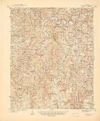
 1941 Waldron1941 Print · USGSThe Scott County highlands come alive in the late 1930s, showing the vital rail junction at Waldron. Researchers can locate rural landmarks like Old Salem Ch, Hon Cem, and old mountain schoolhouses like Whisenhunt Sch.
 - 1941 Map of Keo
 1941 Keo1941 Print · USGSThe river bottomlands of Lonoke and Pulaski County are revealed here just before the war, dominated by the serpentine curves of the Arkansas River. Genealogists can trace the rural community through numerous local landmarks like Paradise Ch, Millers Chapel, and the settlement at Wampoo.
 - 1941 Map of Hazen, 1942 Print
 1941 Hazen1942 Print · USGSThe Grand Prairie region of Arkansas is captured here during the early 1940s, showing a landscape defined by the arrival of the Chicago Rock Island and Pacific railroad. Genealogists can locate family sites among numerous rural hubs like Philadelphia Ch, Hazen, and Barrettsville Sch.2 unique versions available
 - 1941 Map of De Witt, 1942 Print
 1941 De Witt1942 Print · USGSArkansas County’s rice-growing prairie is shown in detail during the early 1940s, revealing a landscape transformed by intensive irrigation and rail transport. Genealogists and local historians can trace family roots through numerous rural landmarks like Wofford Chapel, Prairieville Sch, and the St Louis Southwestern rail line.
Showing maps 1-25 of 95
Top cities of Arkansas
- Little Rock historical maps
- Fayetteville historical maps
- Fort Smith historical maps
- Springdale historical maps
- Jonesboro historical maps
- Rogers historical maps
See more
Top counties of Arkansas
- Pulaski County historical maps
- Benton County historical maps
- Washington County historical maps
- Sebastian County historical maps
- Faulkner County historical maps
- Saline County historical maps
See more
Frequently asked questions
- What are the different types of historical maps available for Arkansas?
- What is the oldest map of Arkansas?
- Where can I purchase historical maps of Arkansas for my home or office?
- Where can I download high-res historical maps of Arkansas?
- Are there historical topographic maps available for Arkansas?
- Is there historical aerial imagery available for Arkansas?
- Where are historical maps of Arkansas sourced from?