1940s Maps of California
Explore 2,086 historic maps of California from the 1940s. These maps offer a rare glimpse into what life looked like during the 1940s — showing old roads, neighborhoods, homes, and landmarks that have changed or disappeared over time.
Whether you're researching your family's past, planning a metal detecting trip, or studying how California's landscape evolved across the 1940s, these high-resolution maps are a powerful tool for exploring the history of this region.
- Focus on a specific era: All maps on this page are from the 1940s, giving you a focused view of this time period.
- See what’s changed: Compare century-old streets, trails, and buildings to today's modern landscape using overlays and satellite layers.
- Research with precision: Use these maps for genealogy, historical research, land use analysis, or educational projects.
- View, download, or print: Maps are fully viewable online in high resolution, and can be downloaded or printed for your own records.
Start exploring California's history through authentic maps from the 1940s. This is your window into the past.
California maps
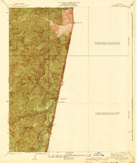
- 1940 Map of Trail Canyon
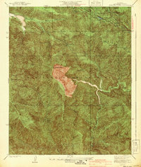
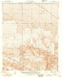
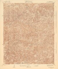 1940 Trail Canyon1940 Print · USGSThe high San Gabriel peaks and canyons are captured here in the mid-1930s, showing the early infrastructure of the Angeles National Forest. Researchers can trace old utility routes like the transmission line and local landmarks like Yerba Buena Spring and Condor Peak.4 unique versions available
 - 1940 Map of Valyermo
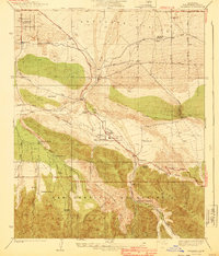 1940 Valyermo1940 Print · USGSThe northern slopes of the San Gabriel Mountains meet the Antelope Valley in the late 1930s. Genealogists and historians can trace old homesteads and local infrastructure like the Aldrich Ranch, the Llano P O, and the Valyermo Ranger Sta.4 unique versions available
 - 1940 Map of Evey Canyon
 1940 Evey Canyon1940 Print · USGSThe foothills of the San Gabriel Mts meet the growing community of Claremont in this 1940s-era survey. Genealogists and local historians can trace the early road network of the valley and find mountain landmarks like the Norton Sch and Lower San Antonio Guard Station.3 unique versions available
 - 1940 Map of San Juan Bautista
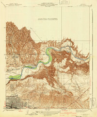
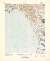
 1940 San Juan Bautista1940 Print · USGSCentral California coastal and valley life at the start of the 1940s is captured here, where four counties meet. Genealogy researchers can trace family-named sites like Patrick Breen, old rural institutions like the St Francis Orphan Asylum, and the early Sargent Oil Fields.
 - 1940 Map of Dome Rock Mts
 1940 Dome Rock Mts1940 Print · USGSThe Arizona and California borderlands along the Colorado River are captured here during the 1930s mining era. Researchers can trace historic prospecting sites like the Darling Mine and Goodman Mine or locate crossings at Diablo Pass.3 unique versions available
 - 1940 Map of Metz
 1940 Metz1940 Print · USGSThe Salinas River valley and the Gabilan Range come into sharp focus just before the war, showing the area's transition into a major agricultural corridor. Genealogists and historians can locate specific family landmarks like Schmidt Ranch, the Metz School, and early layouts of Greenfield.
 - 1940 Map of La Verne
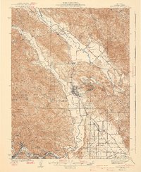
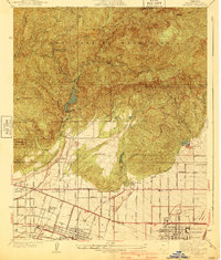 1940 La Verne1940 Print · USGSLa Verne and Claremont are captured here just before the mid-century population boom, showing a landscape defined by foothill canyons and early college campuses. Genealogists and historians can trace local landmarks like Scripps College, the Metropolitan Aqueduct, and Wolfskill Camp.4 unique versions available
 - 1940 Map of Pico
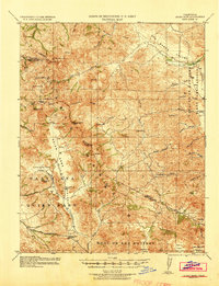
 1940 Pico1940 Print · USGSThe northern reaches of the Santa Susana Mountains appear here in the late 1930s, showing the complex canyons of the Los Angeles and Ventura county line. Researchers can trace early settlements and remote outposts like Pico and La Quinta or locate high-country landmarks such as Oat Mtn Lookout.
 - 1940 Map of Gilroy Hot Springs
 1940 Gilroy Hot Springs1940 Print · USGSThe Diablo Range rises above the Santa Clara Valley in the early 1940s, showing a landscape of remote cattle ranches and high peaks. Genealogists and hikers can trace historic properties like Robeson Ranch or navigate the routes through Pacheco Pass and Gilroy Hot Springs.
 - 1940 Map of Halfmoon Bay
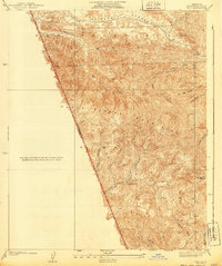
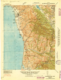 1940 Halfmoon Bay1940 Print · USGSThe San Mateo coast and Santa Cruz Mountains appear here in the early 1940s, balancing rural ranching with early oil exploration. Genealogists and local historians can trace family-named sites like Bowman Ranch and old rural hubs including Pescadero and La Honda.2 unique versions available
 - 1940 Map of Truckee
 1940 Truckee1940 Print · USGSThe High Sierra and Lake Tahoe shoreline appear here in the pre-war era, showing a landscape defined by timber, tourism, and transit. Genealogists and historians can trace the early resort development at Tahoe Vista, the lumber works at Hobart Mills, and the vital Southern Pacific rail line.4 unique versions available
 - 1940 Map of Hollister
 1940 Hollister1940 Print · USGSSan Benito County is shown just before the war as a landscape of productive ranches and emerging civic infrastructure. Genealogists and local historians can trace rural school districts like Anasymas School and the Southern Pacific rail line through Tres Pinos.2 unique versions available
 - 1940 Map of Pacheco Pass
 1940 Pacheco Pass1940 Print · USGSPacheco Pass and the surrounding Merced County foothills are captured here in the years leading up to the war. Genealogists can locate family holdings like Howard Ranch and Fifield Ranch, or trace rural education at Romero School.
 - 1940 Map of Camp Baldy
 1940 Camp Baldy1940 Print · USGSMount Baldy’s early high-altitude culture and canyon mining are frozen in time just before the mid-century. Researchers can trace the paths to the Gold Dollar Mine, locate the Camp Baldy Guard Station, and see the early route of Baldy Road.3 unique versions available
 - 1940 Map of Mt. Baden-Powell
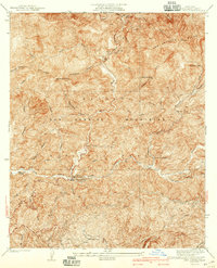
 1940 Mt. Baden-Powell1940 Print · USGSThe high peaks and deep canyons of the San Gabriel Mountains are captured here in the 1940s, showing the early recreational and industrial footprint in the national forest. Researchers can trace the path of the San Andreas Rift Zone and locate historic sites like the Big Horn Mine and the Boy Scout Camp.4 unique versions available
 - 1940 Map of Camp Bonita
 1940 Camp Bonita1940 Print · USGSThe San Gabriel Mountains in the 1930s reveal a landscape of mining, ranching, and early forest management. Trace the historic East Fork San Gabriel River to find sites like the Allison Mine, Thompson Ranch, and Camp Bonita.3 unique versions available
 - 1940 Map of Healdsburg
 1940 Healdsburg1940 Print · USGSSonoma County's wine and timber country is captured here just before the mid-century, following the winding Russian River through thriving valley towns. Genealogists can locate family-named landmarks and rural schoolhouses like Guilford Sch, Lytton Sch, and the Oak Mound Cem.3 unique versions available
 - 1940 Map of Quien Sabe
 1940 Quien Sabe1940 Print · USGSThe San Benito and Merced county lines meet in this 1940 survey of the Diablo Range highlands and interior ranch lands. Researchers can trace the early property lines of the Real de las Aguilas, find the Stayton Mine, and locate the old Quien Sabe School.2 unique versions available
 - 1940 Map of Mescal Creek
 1940 Mescal Creek1940 Print · USGSThe San Gabriel Mountains meet the Antelope Valley in the late 1940s, revealing a landscape shaped by geological forces and early ranching. Trace local history at Hagenbaugh Ranch, the San Andreas Rift Zone, and the settlement of Largo Vista.3 unique versions available
 - 1940 Map of Salinas
 1940 Salinas1940 Print · USGSThe Salinas Valley at the start of the 1940s shows an agricultural landscape defined by historic land grants and expanding industry. Researchers can trace rural school locations like Natividad School and established landmarks such as Hartnell College and the railroad hub at Spreckles.
 - 1940 Map of Oil Center
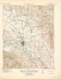
 1940 Oil Center1940 Print · USGSBakersfield and its surrounding oil fields are caught here at a moment of intense industrial development during the late thirties and early fourties. Genealogists and researchers can trace local landmarks like Oil Center, the County Hospital, and several rural schools including Petroleum Sch.2 unique versions available
 - 1940 Map of Reynolds Ranch
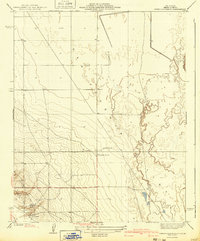 1940 Reynolds Ranch1940 Print · USGSKern County ranching and early irrigation projects are preserved here in the years leading up to the mid-century. Genealogists and local historians can trace the footprints of Reynolds Ranch, Gilbert Ranch, and the path of the Goose Lake Canal.
 - 1940 Map of Camp Rincon
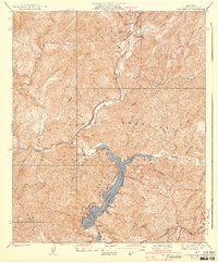 1940 Camp Rincon1940 Print · USGSThe San Gabriel Mountains in the 1940s showcase a landscape being transformed by flood control and forest management. Researchers can trace the early footprint of San Gabriel Dam No 1 and find isolated local landmarks like Coldbrook Camp and the Canyon Sch.4 unique versions available
 - 1940 Map of Capitola
 1940 Capitola1940 Print · USGSCoastal Monterey Bay comes alive in the late 1930s, showing a landscape of rail-linked beach towns and sprawling ranchos. Genealogists and historians can trace family-named schools and early airfields like Santa Cruz Airport, Camp McQuaide, and the original rail stops of the Southern Pacific.
 - 1940 Map of Jamesburg
 1940 Jamesburg1940 Print · USGSThe rugged Santa Lucia interior during the early 1940s is shown here through its network of remote ranching outposts and canyon settlements. Local researchers can trace family landmarks like Tularcitos Ranch, Bruce Ranch, and the isolated Tularcitos School.2 unique versions available
Showing maps 1-25
Top cities of California
- Los Angeles historical maps
- San Diego historical maps
- San Jose historical maps
- San Francisco historical maps
- Fresno historical maps
- Sacramento historical maps
See more
Top counties of California
- San Diego County historical maps
- Orange County historical maps
- San Bernardino County historical maps
- Santa Clara County historical maps
- Alameda County historical maps
- Sacramento County historical maps
See more
Frequently asked questions
- What are the different types of historical maps available for California?
- What is the oldest map of California?
- Where can I purchase historical maps of California for my home or office?
- Where can I download high-res historical maps of California?
- Are there historical topographic maps available for California?
- Is there historical aerial imagery available for California?
- Where are historical maps of California sourced from?