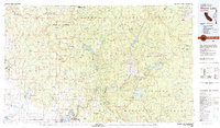
1980s Maps of California
Explore 1,531 historic maps of California from the 1980s. These maps offer a rare glimpse into what life looked like during the 1980s — showing old roads, neighborhoods, homes, and landmarks that have changed or disappeared over time.
Whether you're researching your family's past, planning a metal detecting trip, or studying how California's landscape evolved across the 1980s, these high-resolution maps are a powerful tool for exploring the history of this region.
- Focus on a specific era: All maps on this page are from the 1980s, giving you a focused view of this time period.
- See what’s changed: Compare century-old streets, trails, and buildings to today's modern landscape using overlays and satellite layers.
- Research with precision: Use these maps for genealogy, historical research, land use analysis, or educational projects.
- View, download, or print: Maps are fully viewable online in high resolution, and can be downloaded or printed for your own records.
Start exploring California's history through authentic maps from the 1980s. This is your window into the past.
California maps
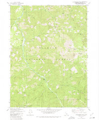
- 1980 Map of Cambria
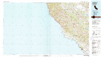 1980 Cambria1980 Print · USGSThe Central Coast in the early eighties shows a landscape of grand estates and isolated seaside outposts. Trace family roots and local history through the coastal village of Cambria, the Hearst Castle grounds, and the historic Lighthouse at Piedras Blancas.2 unique versions available
 - 1980 Map of Dutch Creek
 1980 Dutch Creek1980 Print · USGSSiskiyou County's high ridges are captured in the early 1980s as the wilderness was managed for both mining and recreation. Trace local history through Blue Ledge Mine, Knutzen Cabin, and the former Johnsons Dairy.2 unique versions available
 - 1980 Map of Big Hat Mtn
 1980 Big Hat Mtn1980 Print · USGSThe high desert of Washoe County and the California border are captured here during the 1970s, showcasing a landscape defined by ranching and volcanic geology. Researchers can trace remote livestock outposts like Long Ranch and topographic landmarks such as The Craters and Big Hat Mountain.2 unique versions available
 - 1980 Map of Pegleg Mountain
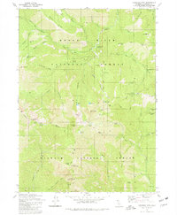
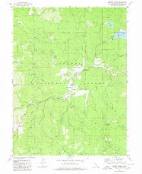
 1980 Pegleg Mountain1980 Print · USGSHigh in the Lassen National Forest during the late twentieth century, this terrain reveals the vital intersection of water storage and mountain transit. Trace the rail heritage of the Western Pacific and Westwood Junction alongside Pegleg Mtn.
 - 1980 Map of Taylorsville
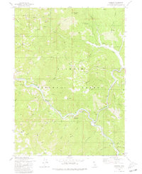
 1980 Taylorsville1980 Print · USGSIndian Valley and the surrounding Plumas mountains are captured here in the early eighties, centered on the historic town of Taylorsville. Researchers can trace old mining operations at Iron Dyke Mine and Taylor Diggings, or locate family sites like Rhinehart Cabin and Shim Flat Cem.2 unique versions available
 - 1980 Map of Chico
 1980 Chico1980 Print · USGSButte County and the Sierra foothills are shown here in the 1980s as the region's water and timber economies matured. Genealogists and researchers can trace old land grants like Rancho Capay or locate mountain mining sites and settlements such as Cherokee, Magalia, and the Big Bend Mine.2 unique versions available
 - 1980 Map of Huckleberry Mtn.
 1980 Huckleberry Mtn.1980 Print · USGSSiskiyou County as it appeared in the 1980s is captured here through its remote forest camps and high-elevation ridgelines. Researchers can locate named sites like the settlement at Hoskin., Johnsons Hunting Grounds, and the waters of Sulphur Springs.
 - 1980 Map of Moonlight Peak
 1980 Moonlight Peak1980 Print · USGSThe high Sierra terrain of Plumas County is mapped here in the late twentieth century, showing a landscape defined by forest boundaries and remote mining. Historians can trace early industry and mountain life at the Engel Mine, Shake Cabin, and Ruins.2 unique versions available
 - 1980 Map of Haskins Valley
 1980 Haskins Valley1980 Print · USGSHaskins Valley and the high Sierras are depicted in the late 1970s as a landscape of active mining and seasonal ranching. Researchers can trace historic claims like the Robinson Mine and Ontop Mine or locate family-named sites such as Paulson Place.
 - 1980 Map of Kangaroo Mtn.
 1980 Kangaroo Mtn.1980 Print · USGSThe high Siskiyou Mountains backcountry is captured here in the 1980s, marking the border between two major national forests. Hikers and historians can trace the Pacific Crest National Scenic Trail past remote sites like No-See-Um Camp and Hello Lake.2 unique versions available
 - 1980 Map of Paradise East
 1980 Paradise East1980 Print · USGSButte County communities like Magalia and Paradise are shown in detail during the 1970s and 1980s. Genealogists and researchers can locate old mining sites like the Steifer Mine, the Historic Pioneer Church, and the former settlement of Irish Town.
 - 1980 Map of Carpinteria
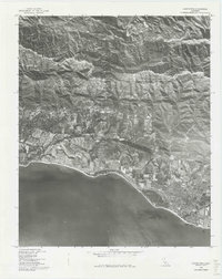 1980 Carpinteria1980 Print · USGSCovers California, including Carpinteria, Montecito, and other nearby areas
 - 1980 Map of Roop Mountain
 1980 Roop Mountain1980 Print · USGSLassen County's high forest terrain is documented here in the early eighties, showing the transition from mountain peaks to ranching lands. Researchers can locate established sites like Barrell Ranch and Sunan or trace the course of the Susan River.2 unique versions available
 - 1980 Map of Shaver Lake
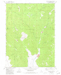
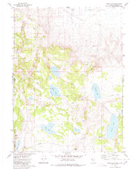
 1980 Shaver Lake1980 Print · USGSThe Sierra Nevada foothills and high country come into focus during the early eighties, showing the region's complex water and timber infrastructure. Researchers can trace the heritage of local industry at Knowles Quarry, Buchanan Mine, and the hydroelectric works around Big Creek.3 unique versions available
 - 1980 Map of Fredonyer Pass
 1980 Fredonyer Pass1980 Print · USGSThe high Sierra Nevada divide between Lassen and Plumas counties comes into focus in the early 1980s. Researchers can trace the legacy of mountain ranching at Stephens Ranch and Flemings Sheep Camp, or locate landmarks like Fredonyer Pass and Coyote Peak.
 - 1980 Map of Burnt Lake
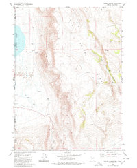
 1980 Burnt Lake1980 Print · USGSThe Nevada-California borderlands are shown in the early 1980s as a landscape of remote basins and essential desert springs. Researchers can trace historic water sources like Pilgrim Spring and Rowland Spring or locate the Lackerman Airstrip near the edge of Duck Flat.2 unique versions available
 - 1980 Map of Dos Pueblos Canyon
 1980 Dos Pueblos Canyon1980 Print · USGSCovers California, including Goleta, Isla Vista, and other nearby areas
 - 1980 Map of Meadow Valley
 1980 Meadow Valley1980 Print · USGSMeadow Valley and the Plumas National Forest are shown here in the 1970s, detailed at a moment when mountain settlements and forestry camps defined the local culture. Researchers can trace the heritage of Spanish Ranch, locate the Pineleaf Mine, or find the secluded Cem near the valley floor.
 - 1980 Map of Scott Bar
 1980 Scott Bar1980 Print · USGSThe Scott River corridor in northern Siskiyou County is shown here in the 1980s, documenting a landscape of mountain forestry and riverside recreation. Genealogists and historians can trace local landmarks like Scott Bar, a riverside Grave, and numerous backcountry sites from Gold Flat to Beauty Flat.
 - 1980 Map of Crescent Mills
 1980 Crescent Mills1980 Print · USGSThe high Sierra rail-and-river network of Plumas County is on display in the 1980s, centered on the dramatic canyons and mining legacy of the northern mountains. Trace the winding Western Pacific Railroad as it passes through Keddie, the Wye, and the historic mining operations at Arcadia Mine and Standart Mine.3 unique versions available
 - 1980 Map of Red Rock Canyon
 1980 Red Rock Canyon1980 Print · USGSThe high desert border between Nevada and California comes into focus in the early eighties. Researchers can trace water rights and grazing history through landmarks like Sheep Camp Draw Reservoir, Mustang Spring, and Willow Reservoir.
 - 1980 Map of Westwood East
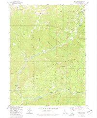
 1980 Westwood East1980 Print · USGSWestwood and Pine Town are documented here in the mid-1970s, nestled within the timberlands of the Lassen National Forest. Local historians can trace the Pacific Western route, locate the Westwood Cemetery, and find family-named outposts like 101 Ranch.2 unique versions available
 - 1980 Map of Twain
 1980 Twain1980 Print · USGSThe Plumas County mountains in the late 1970s reveal a landscape shaped by gold mining and the railroad. Genealogists and historians can trace family-named sites like Perini Place, locate the Big Flat Cem, and explore the canyon rail sidings at Twain and Virgilia.2 unique versions available
 - 1980 Map of Hamburg
 1980 Hamburg1980 Print · USGSThe Klamath and Scott Rivers meet in the rugged Siskiyou backcountry during the late 1970s. Trace the history of mining and mountain life at Hamburg, Ladd Mine, and the Horse Creek Cemetery.
 - 1980 Map of Pegleg Canyon
 1980 Pegleg Canyon1980 Print · USGSThe California-Nevada borderlands are captured in the early eighties as a landscape of remote ranching and rugged desert hydrology. Trace early water rights and land use at the Murphy Ranch, Pegleg Reservoir, and a geothermal Spring (Hot).
Showing maps 1-25
Top cities of California
- Los Angeles historical maps
- San Diego historical maps
- San Jose historical maps
- San Francisco historical maps
- Fresno historical maps
- Sacramento historical maps
See more
Top counties of California
- San Diego County historical maps
- Orange County historical maps
- San Bernardino County historical maps
- Santa Clara County historical maps
- Alameda County historical maps
- Sacramento County historical maps
See more
Frequently asked questions
- What are the different types of historical maps available for California?
- What is the oldest map of California?
- Where can I purchase historical maps of California for my home or office?
- Where can I download high-res historical maps of California?
- Are there historical topographic maps available for California?
- Is there historical aerial imagery available for California?
- Where are historical maps of California sourced from?