1970s Maps of California
Explore 442 historic maps of California from the 1970s. These maps offer a rare glimpse into what life looked like during the 1970s — showing old roads, neighborhoods, homes, and landmarks that have changed or disappeared over time.
Whether you're researching your family's past, planning a metal detecting trip, or studying how California's landscape evolved across the 1970s, these high-resolution maps are a powerful tool for exploring the history of this region.
- Focus on a specific era: All maps on this page are from the 1970s, giving you a focused view of this time period.
- See what’s changed: Compare century-old streets, trails, and buildings to today's modern landscape using overlays and satellite layers.
- Research with precision: Use these maps for genealogy, historical research, land use analysis, or educational projects.
- View, download, or print: Maps are fully viewable online in high resolution, and can be downloaded or printed for your own records.
Start exploring California's history through authentic maps from the 1970s. This is your window into the past.
California maps
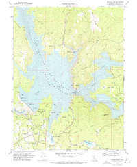
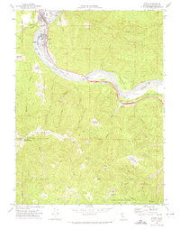
(442)- 1970 Map of Davis
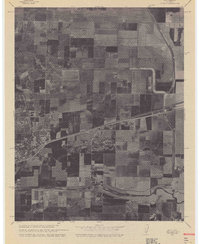 1970 Davis1970 Print · USGSCovers California, including Davis, El Macero, and other nearby areas
 - 1970 Map of Burrel
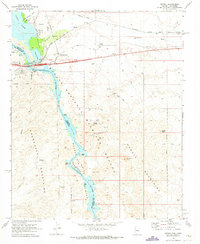
 1970 Burrel1970 Print · USGSAgricultural and industrial growth converge in Fresno County at the start of the seventies. Genealogists and historians can trace the irrigation networks of Murphy Slough and locate sites like Bender Union Sch or the Oil Field near Lanare.
 - 1970 Map of Cherokee, 1973 Print
 1970 Cherokee1973 Print · USGSButte County’s transition from mining legacy to reservoir recreation is captured here as the new shoreline of Lake Oroville takes shape. Genealogy and local-history researchers can trace family landmarks like Messilla Valley Sch, the Cherokee Placer Mine, and Yankee Hill.2 unique versions available
 - 1970 Map of Needles SW, 1973 Print
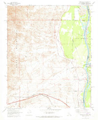
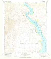
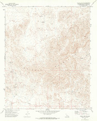
 1970 Needles SW1973 Print · USGSThe high desert of San Bernardino County meets the Arizona border in the early 1970s, showcasing the transportation and mining roots of the region. Local researchers can trace the National Old Trails Road and locate remote mining prospects near Shadow Canyon.2 unique versions available
 - 1970 Map of Needles NW, 1973 Print
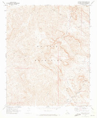
 1970 Needles NW1973 Print · USGSThe Colorado River borderlands in the early 1970s reveal a mix of desert ranching and heavy rail infrastructure. Researchers can locate the Soto Ranch, the rail stop at Java, and the Walters Ranch Landing Field along the Mohave Valley floor.2 unique versions available
 - 1970 Map of Biggs, 1973 Print
 1970 Biggs1973 Print · USGSButte County agriculture is at its height in the early 1970s as massive irrigation projects reshape the Sacramento Valley. Researchers can trace family-named roads and landmarks like the Gridley-Biggs Cemetery, the USDA Rice Experimental Sta, and the shoreline of the Thermalito Afterbay.2 unique versions available
 - 1970 Map of Parker, 1973 Print
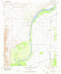
 1970 Parker1973 Print · USGSThe Colorado River borderlands in the early 1970s reveal the growth of Parker alongside massive water infrastructure like the Headgate Rock Dam. Genealogists and historians can trace the Wyatt Earp House and the Indian Agency Headquarters.3 unique versions available
 - 1970 Map of Needles, 1973 Print
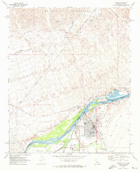
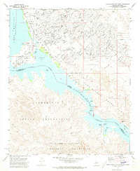
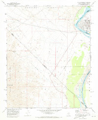
 1970 Needles1973 Print · USGSNeedles and the Colorado River corridor are captured here in the early 1970s as the town serves as a vital rail and river junction. Trace the Atchison Topeka and Santa Fe Railroad through the valley or locate early landmarks like Fivemile Landing and the Needles Municipal Airport.4 unique versions available
 - 1970 Map of Oroville Dam, 1973 Print
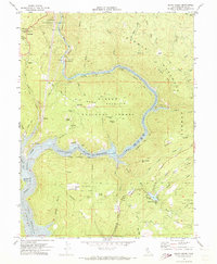
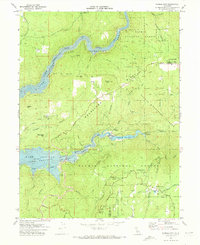
 1970 Oroville Dam1973 Print · USGSButte County in the early seventies shows the massive impact of the Oroville Dam project on the Feather River forks. Genealogists and local historians can trace the new shoreline and recreation sites alongside older landmarks like Hurleton, Lake Wyandotte, and the Bidwell Bar Bridge.2 unique versions available
 - 1970 Map of Topock, 1973 Print
 1970 Topock1973 Print · USGSThe Colorado River corridor near the Arizona-California border is shown here at the start of the 1970s, focused on the rail and road crossing at Topock. Trace the old mining claims of the Mohave Mountains, including the Gold Dome Mine and Jackpot Mine.2 unique versions available
 - 1970 Map of Parker SE, 1973 Print
 1970 Parker SE1973 Print · USGSThe Colorado River Indian Reservation in the early seventies shows a landscape defined by industrial-scale irrigation and desert transit. Genealogists and historians can trace local landmarks like the Cremation Ground (Cem) or the path of the Atchison Topeka and Santa Fe railroad.2 unique versions available
 - 1970 Map of Havasu Lake, 1973 Print
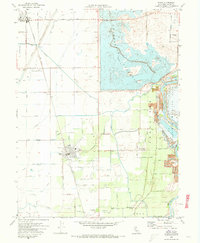
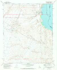 1970 Havasu Lake1973 Print · USGSThe Chemehuevi Indian Reservation meets the shoreline of Lake Havasu in the early 1970s. Researchers can locate the early layout of the Havasu Lake settlement, including Needles Ldg and various Jeep Trails heading into the Chemehuevi Valley.3 unique versions available
 - 1970 Map of Lake Havasu City South, 1973 Print
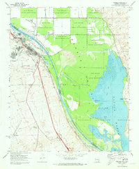
 1970 Lake Havasu City South1973 Print · USGSArizona's desert landscape meets the rising waters of the Colorado River during the early 1970s expansion of Lake Havasu City. Genealogists and local historians can trace the early suburban footprint near Thompson Bay and locate landmarks like the Roulette Mine and Lake Havasu City Airport.3 unique versions available
 - 1970 Map of Parker SW, 1973 Print
 1970 Parker SW1973 Print · USGSThe Colorado River borderlands in the early seventies reveal an intensive irrigation network carved into the desert floor. Researchers can trace the water infrastructure of the Main Canal alongside local landmarks like the Colorado River Day School and Lost Lake Resort.3 unique versions available
 - 1970 Map of Oroville, 1973 Print
 1970 Oroville1973 Print · USGSThe Gold Country meets modern hydro-engineering in Butte County during the early seventies. Trace the evolution of Oroville from its mining roots at Oregon City to the complex water systems of the Thermalito Afterbay and Lake Oroville.2 unique versions available
 - 1970 Map of Palermo, 1973 Print
 1970 Palermo1973 Print · USGSButte County saw significant industrial and residential shifts in the early seventies as mining landscapes met expanding suburbs. You can trace the path of the Western Pacific Railroad or locate local landmarks like Lone Tree School and the Oroville Cem.3 unique versions available
 - 1970 Map of Castle Rock, 1973 Print
 1970 Castle Rock1973 Print · USGSThe Colorado River and its transformation into Lake Havasu define this desert landscape during the early 1970s. Trace the intersection of tribal land and federal refuge while locating Picture Rock Petroglyphs, Jops Harbor, and the Chemehuevi Landing Field.2 unique versions available
 - 1970 Map of Brush Creek, 1973 Print
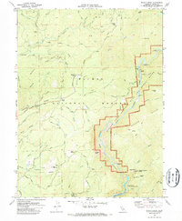 1970 Brush Creek1973 Print · USGSButte County's rugged foothills are captured here in the early seventies, showing the area as new water projects began to alter the landscape. Genealogists and hikers can trace the Oroville Quincy Road, locate the Berry Creek Rancheria, and find historic sites like Mountain House.2 unique versions available
 - 1970 Map of Mt. Manchester, 1973 Print
 1970 Mt. Manchester1973 Print · USGSThe tri-state border region along the Colorado River is captured here as it appeared in the early 1970s. Researchers can trace the Von Schmidt Line, locate the Riviera settlement, and find historical Petroglyphs in the desert mountains.3 unique versions available
 - 1970 Map of Parker NW, 1973 Print
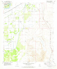
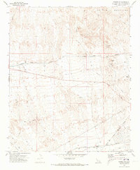 1970 Parker NW1973 Print · USGSSoutheastern San Bernardino County is documented here during the early 1970s, showcasing a landscape of high desert peaks and vital water infrastructure. Researchers can locate remote mining sites like the Lucky Day Mine and the rail-side settlement of Calzona.2 unique versions available
 - 1970 Map of Whipple Mts SW, 1973 Print
 1970 Whipple Mts SW1973 Print · USGSThe San Bernardino desert during the early seventies reveals a landscape of industrial extraction and rugged isolation. Researchers can trace the paths of old prospectors through sites like the American Eagle Mine, the B and W Mine, and ancient Leaching Tanks.
 - 1970 Map of Whipple Wash, 1973 Print
 1970 Whipple Wash1973 Print · USGSThe Whipple Mountains in the early 1970s reveal a landscape of deep desert washes and mid-century industrial infrastructure. Researchers can trace the path of the Colorado River Aqueduct Tunnel and locate mining sites like the Islander Mine and the Whipple Mtn Adit.2 unique versions available
 - 1970 Map of Berry Creek, 1973 Print
 1970 Berry Creek1973 Print · USGSThe Butte County hills meet the rising waters of the Feather River during the transition to a reservoir-based economy. Researchers can trace the legacy of local mining at the Bunker Hill Mine and follow the old Western Pacific Railroad route.2 unique versions available
 - 1970 Map of Forbestown, 1973 Print
 1970 Forbestown1973 Print · USGSThe foothills of the Sierra Nevada are captured here in the early 1970s as water infrastructure and timber history shape the land. Genealogists and historians can trace Old Forbestown, locate the Gold Bank Mine, or follow the Old Lumpkin Grade Railroad.
 - 1970 Map of Scotia, 1974 Print
 1970 Scotia1974 Print · USGSHumboldt County’s river-bound lumber towns are shown in the early 1970s as they transition from industrial hubs into parklands. You can trace the Northwestern Pacific railroad corridor and locate named clearings like Barkdull Prairie and Harrow Springs.
Showing maps 1-25 of 442
Top cities of California
- Los Angeles historical maps
- San Diego historical maps
- San Jose historical maps
- San Francisco historical maps
- Fresno historical maps
- Sacramento historical maps
See more
Top counties of California
- San Diego County historical maps
- Orange County historical maps
- San Bernardino County historical maps
- Santa Clara County historical maps
- Alameda County historical maps
- Sacramento County historical maps
See more
Frequently asked questions
- What are the different types of historical maps available for California?
- What is the oldest map of California?
- Where can I purchase historical maps of California for my home or office?
- Where can I download high-res historical maps of California?
- Are there historical topographic maps available for California?
- Is there historical aerial imagery available for California?
- Where are historical maps of California sourced from?