1990s Maps of California
Explore 1,532 historic maps of California from the 1990s. These maps offer a rare glimpse into what life looked like during the 1990s — showing old roads, neighborhoods, homes, and landmarks that have changed or disappeared over time.
Whether you're researching your family's past, planning a metal detecting trip, or studying how California's landscape evolved across the 1990s, these high-resolution maps are a powerful tool for exploring the history of this region.
- Focus on a specific era: All maps on this page are from the 1990s, giving you a focused view of this time period.
- See what’s changed: Compare century-old streets, trails, and buildings to today's modern landscape using overlays and satellite layers.
- Research with precision: Use these maps for genealogy, historical research, land use analysis, or educational projects.
- View, download, or print: Maps are fully viewable online in high resolution, and can be downloaded or printed for your own records.
Start exploring California's history through authentic maps from the 1990s. This is your window into the past.
California maps
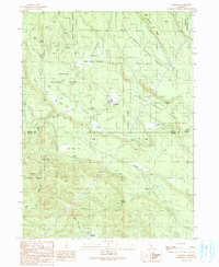
- 1990 Map of Ash Valley
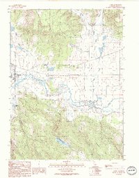
 1990 Ash Valley1990 Print · USGSThe high ranchlands of Lassen County are shown here as they appeared in the 1990s. Trace old family sites and water sources like Fleming Sheep Camp, Oxendine Spring, and the small Cem on the valley floor.
 - 1990 Map of Canby
 1990 Canby1990 Print · USGSUpper Modoc County in the early 1990s was a landscape where high-desert ranching met mountain timberlands. Researchers can trace the layout of Canby, locate the Arlington Sch, and find the geothermal activity at Kelley Hot Spring.
 - 1990 Map of Minnesota Mountain
 1990 Minnesota Mountain1990 Print · USGSShasta County in the 1990s is defined by the expansive waters of the National Recreation Area and its surrounding peaks. Researchers can locate the Bully Hill (Site), trace the McClure Gulch drainage, or find the Museum near Squaw Creek.
 - 1990 Map of Surprise Station
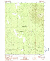
 1990 Surprise Station1990 Print · USGSNortheastern California's high plateau comes into focus here in the late twentieth century, showing a landscape shaped by the river and the reservation. You can locate the Chimney Rock Historical Mon, trace the North Fork Pit River, and find remote outposts like Surprise Station.
 - 1990 Map of Tioga Pass
 1990 Tioga Pass1990 Print · USGSThe high Sierra crest at the close of the twentieth century shows a landscape of alpine research, recreation, and mining history. Trace the trails leading to the Great Sierra Mine, explore the waters of Saddlebag Lake, or locate the Carnegie Institute Experimental Station.
 - 1990 Map of Leonards Hot Springs
 1990 Leonards Hot Springs1990 Print · USGSSurprise Valley at the start of the nineties reveals a remote landscape of geothermal activity and seasonal lakebeds. Researchers can trace the infrastructure of the basin through the Causeway, Leonards Hot Springs, and the Surprise Valley Mineral Wells.
 - 1990 Map of McGinty Point
 1990 McGinty Point1990 Print · USGSGoose Lake was a shifting landscape of mud and water at the start of the 1990s. Researchers can trace the boundaries of the X L Ranch Indian Reservation, locate remote operations at Lakeshore Ranch, and follow the Causeway to McGinty Point.
 - 1990 Map of Kinyon
 1990 Kinyon1990 Print · USGSSiskiyou County's timberlands are captured here in the late twentieth century as the region balanced forestry with high-country recreation. Trace the route of the Old Railroad Grade and locate old mountain outposts like Nitwit Camp and Kinyon.
 - 1990 Map of Burney Mountain East
 1990 Burney Mountain East1990 Print · USGSThe volcanic highlands of Shasta County are captured here in the 1990s, revealing a landscape of cinder cones and lava flows within the Lassen National Forest. Local history researchers can trace the roads into Hat Creek Valley or locate features like Cornaz Lake and the Hat Creek FS Station.
 - 1990 Map of Burney
 1990 Burney1990 Print · USGSShasta County life in the early nineties is centered on the growing community of Burney and its neighboring Johnson Park. Researchers can trace local landmarks like the Cem, the Goose Valley Ranch, and the Pit 3 Powerhouse along the river.
 - 1990 Map of Alturas
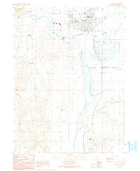 1990 Alturas1990 Print · USGSAlturas and the surrounding high desert wetlands are captured in detail during the late twentieth century. Researchers can trace the civic layout of the town, from the Alturas Rancheria to landmarks like Woods Place Dam and the Modoc High Sch.
 - 1990 Map of Hanland Peak
 1990 Hanland Peak1990 Print · USGSShasta County in the early nineties is shown here as a dense network of forest service lands and lakefront recreation. Researchers can trace the drainages of Indian Creek and Salt Creek or locate landmarks like Hanland Peak and Antlers Campground.
 - 1990 Map of Snag Hill
 1990 Snag Hill1990 Print · USGSNorthern California volcanic territory is documented in the 1990s, revealing a landscape of high-elevation peaks and caves. Researchers can trace the Old RR Grade and find remote sites like Lost Iron Well or Ice River Caves.
 - 1990 Map of Pondosa
 1990 Pondosa1990 Print · USGSThe timberlands of Siskiyou and Shasta counties are captured in the 1990s as a landscape of managed forests and old logging routes. Researchers can trace the Old Railroad Grade or locate family-named sites like Harlow Place and Bosworth Meadow.
 - 1990 Map of Timber Knob
 1990 Timber Knob1990 Print · USGSMadera County’s high Sierra backcountry is captured here during the 1980s, bridging the gap between national forest and wilderness lands. Trace the remote mining history at Strawberry Mine or locate early forest service outposts like Chetwood Cabin and the Clover Meadow Ranger Station.
 - 1990 Map of Montgomery Creek
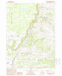
 1990 Montgomery Creek1990 Print · USGSUpper Shasta County comes into focus in the 1990s as a hub of hydroelectric power and forest management. Researchers can trace tribal lands at the Montgomery Creek Rancheria, locate the Halcumb Cemetery, and study the Cedar Powerhouse along the creek.2 unique versions available
 - 1990 Map of Skunk Ridge
 1990 Skunk Ridge1990 Print · USGSShasta National Forest is documented here in the early 1990s, showcasing a landscape of high ridges and critical water sources. You can trace the path of the Pacific Crest National Scenic Trail past Summit Lake and the Nelson Creek Slides.
 - 1990 Map of Letterbox Hill
 1990 Letterbox Hill1990 Print · USGSUpper Lassen County in the early 1990s was a landscape of high-country reservoirs and protected forest lands. Researchers can trace historic water routes and crossings like Stonebreaker Crossing or locate landmarks such as Hayden Hill and McClelland Reservoir.
 - 1990 Map of Cherry Lake South
 1990 Cherry Lake South1990 Print · USGSThe high Sierra backcountry in the 1990s reveals a unique intersection of heavy hydropower infrastructure and protected wilderness. Researchers can trace the Old RR Grade and find historic sites like Meyers Ranch and the Woods Ridge Lookout.
 - 1990 Map of Larkspur Hills
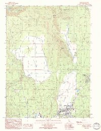
 1990 Larkspur Hills1990 Print · USGSSurprise Valley's arid landscape is captured here in the late twentieth century, showing a region defined by its high-desert hydrology and water management. Researchers can trace seasonal water patterns at Upper Lake, Fee Reservoir, and the remote Poison Springs.
 - 1990 Map of Sing Peak
 1990 Sing Peak1990 Print · USGSThe High Sierra backcountry at the boundary of Yosemite and Sierra National Forest is captured here in the late twentieth century. Backcountry travelers can trace routes through Merced Pass, visit the Buck Camp Ranger Station, or locate Gravelly Ford.
 - 1990 Map of Bass Lake
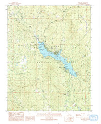 1990 Bass Lake1990 Print · USGSThe Sierra Nevada foothills near Madera County appear here at the start of the 1990s as a hub of mountain recreation and hydro-infrastructure. Researchers can trace local community roots at the Bass Lake Sch and Denver Church or locate the old Powerhouse No 3 and Nelder Grove.
 - 1990 Map of Crank Mountain
 1990 Crank Mountain1990 Print · USGSThe high plateau of Modoc County is captured here in the late twentieth century, showing a landscape of volcanic buttes and critical water reservoirs. Researchers can locate the Happy Camp FS Station and trace paths through Sand Flat or up to the summit of Crank Mountain.
 - 1990 Map of Sugar Hill
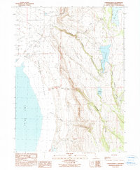
 1990 Sugar Hill1990 Print · USGSThe Modoc high country is surveyed here in the late twentieth century, showing the rugged intersection of the Warner Mountains and the Goose Lake shoreline. Historians can pinpoint the Site of Fandango Massacre or trace mountain water sources like Briles Reservoir and Gaston Spring.
 - 1990 Map of Fall River Mills
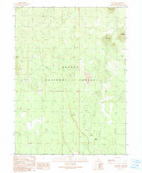
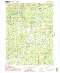
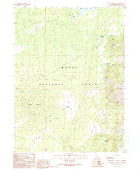
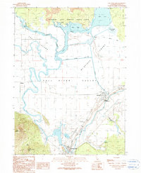 1990 Fall River Mills1990 Print · USGSFall River Valley was a thriving agricultural and hydraulic hub in the 1990s, where the Pit and Fall Rivers meet. Researchers can trace local landmarks like McArthur, the Pine Grove Cem, and the historic Rat Farm (Site) near the edge of the lava beds.
Showing maps 1-25
Top cities of California
- Los Angeles historical maps
- San Diego historical maps
- San Jose historical maps
- San Francisco historical maps
- Fresno historical maps
- Sacramento historical maps
See more
Top counties of California
- San Diego County historical maps
- Orange County historical maps
- San Bernardino County historical maps
- Santa Clara County historical maps
- Alameda County historical maps
- Sacramento County historical maps
See more
Frequently asked questions
- What are the different types of historical maps available for California?
- What is the oldest map of California?
- Where can I purchase historical maps of California for my home or office?
- Where can I download high-res historical maps of California?
- Are there historical topographic maps available for California?
- Is there historical aerial imagery available for California?
- Where are historical maps of California sourced from?