1950s Maps of California
Explore 5,438 historic maps of California from the 1950s. These maps offer a rare glimpse into what life looked like during the 1950s — showing old roads, neighborhoods, homes, and landmarks that have changed or disappeared over time.
Whether you're researching your family's past, planning a metal detecting trip, or studying how California's landscape evolved across the 1950s, these high-resolution maps are a powerful tool for exploring the history of this region.
- Focus on a specific era: All maps on this page are from the 1950s, giving you a focused view of this time period.
- See what’s changed: Compare century-old streets, trails, and buildings to today's modern landscape using overlays and satellite layers.
- Research with precision: Use these maps for genealogy, historical research, land use analysis, or educational projects.
- View, download, or print: Maps are fully viewable online in high resolution, and can be downloaded or printed for your own records.
Start exploring California's history through authentic maps from the 1950s. This is your window into the past.
California maps
- 1950 Map of Kettleman Plain
 1950 Kettleman Plain1950 Print · USGSThe oil fields of Kings County are captured here at mid-century, showcasing a landscape of industrial development and arid ridges. Researchers can trace the early petroleum infrastructure near North Dome and the remote Oil Pumping Sta.
 - 1950 Map of Las Plumas
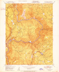 1950 Las Plumas1950 Print · USGSButte County was a hub of mining and railroad engineering in the years following World War II. Researchers can locate active lode claims like the Surcease Mine and trace the Western Pacific line as it serves Berry Creek Station and Las Plumas.2 unique versions available
 - 1950 Map of Burrel
 1950 Burrel1950 Print · USGSThe San Joaquin Valley landscape at mid-century reveals a complex irrigation network and rail-dependent economy. Genealogists and historians can trace old rural school districts like Elkhorn School and family-named landmarks such as Burrel Ranch.
 - 1950 Map of Reynolds Ranch
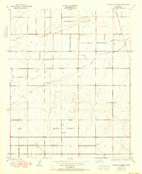
 1950 Reynolds Ranch1950 Print · USGSKern County ranching and water management are captured here during the mid-century, reflecting the landscape as it was surveyed in the 1930s. Genealogists and researchers can trace family-named sites such as Gilbert Ranch and Reynolds Ranch or follow the Goose Lake Canal.
 - 1950 Map of Placerville
 1950 Placerville1950 Print · USGSEl Dorado County in the late 1940s retains the clear footprint of its mining and railroad heritage. Researchers can trace the location of vanished settlements at Logtown (Site) and Cold Springs (Site), alongside active landmarks like the Crusader Mine and the Southern Pacific line.2 unique versions available
 - 1950 Map of Oregon House
 1950 Oregon House1950 Print · USGSYuba County ranching and timber lands are captured here just after the mid-century, before modern development altered the rural landscape. Local historians can trace the foundations of Oregon House and Virginia Ranch, or locate the sites of the Peoria School and sawmill.
 - 1950 Map of Greenwood
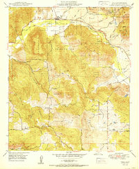
 1950 Greenwood1950 Print · USGSThe California Gold Country near the El Dorado and Placer county line was undergoing significant change in the mid-twentieth century. Trace the legacy of mining through sites like Spanish Dry Diggings, Grit Mine, and the early reservoir development at Applegate.
 - 1950 Map of Parker Dam Area
 1950 Parker Dam Area1950 Print · USGSThe California-Arizona borderlands come into focus at the mid-century mark, centered on the engineering of the Parker Dam. Trace the river economy through the Colorado River Indian Reservation and remote landmarks like Bandit Pass and Cienega Springs.2 unique versions available
 - 1950 Map of Waukena
 1950 Waukena1950 Print · USGSThe rural stretch between Kings and Tulare Counties comes into focus in this mid-century edition, based on earlier surveys of the valley's irrigation. Genealogists and historians can trace the foundations of the Waukena community and locate old landmarks like Lakeside School and Aurora School.
 - 1950 Map of San Clemente Island North
 1950 San Clemente Island North1950 Print · USGSSan Clemente Island is documented here in the mid-1940s, highlighting its role as a strategic maritime outpost. You can trace early navigational markers like the North Head Lighthouse and coastal landmarks from Wilson Cove to the Shifting Sands.
 - 1950 Map of Burris Park
 1950 Burris Park1950 Print · USGSMid-century Kings and Tulare counties come alive in this survey of the irrigated San Joaquin Valley. Researchers can trace ancestral property near River Bend School, follow the Southern Pacific Railroad, or locate the historic Burris Park.
 - 1950 Map of French Corral
 1950 French Corral1950 Print · USGSThe Sierra foothills around the Yuba and Nevada County line are shown here in the years following the Second World War. Researchers can trace historic gold-country sites like French Corral, the San Juan Mine, and the Rice Crossing townsite.
 - 1950 Map of Wahtoke
 1950 Wahtoke1950 Print · USGSMid-century Fresno County is captured here as a landscape of intensive irrigation and foothill farming. Genealogists and local historians can trace rural roots through the Frankwood School, Wahtoke settlement, and the Acres Cem.2 unique versions available
 - 1950 Map of Prado Dam
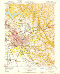
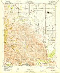 1950 Prado Dam1950 Print · USGSThe Prado Dam area at the start of the 1950s shows a unique mix of institutional expansion, aviation history, and flood control. Local researchers can trace the Cal-Aero Flight Academy, the California Institution for Men, and the Rancho Santa Ana Botanic Gardens.
 - 1950 Map of Pentland
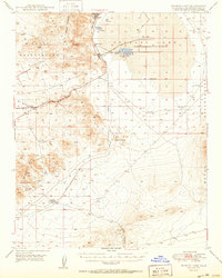
 1950 Pentland1950 Print · USGSKern County's petroleum landscape is captured here at mid-century, showing the dense industrial grid of the southern San Joaquin Valley. Researchers can locate specialized worker sites like General Petroleum Corp Essex Camp and major facilities such as the Lakeview Refining Co near Pentland.
 - 1950 Map of Pala
 1950 Pala1950 Print · USGSThe northern San Diego back country comes alive in this mid-century survey of the Pala Indian Reservation and its surrounding valleys. Genealogists and researchers can trace the historic Mission at Pala, find the Indian Cem, and locate the Katerina Mine tucked into the hills.
 - 1950 Map of Avenal Gap
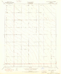
 1950 Avenal Gap1950 Print · USGSThe Kings and Kern County line crosses the southern San Joaquin Valley here at mid-century. Researchers can trace early road routes and locate the Devils Den settlement and Devils Den Sch near the Antelope Plain.
 - 1950 Map of Weed
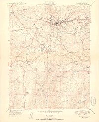
 1950 Weed1950 Print · USGSSiskiyou County and the surrounding Klamath mountains appear in the mid-century before extensive modern development. Genealogists and local historians can locate remote outposts like the Lee Brown Ranch and the specialized settlement of Darlingtonia.
 - 1950 Map of Searles Lake
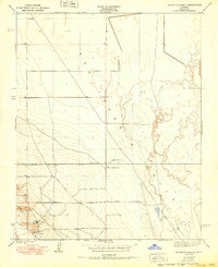
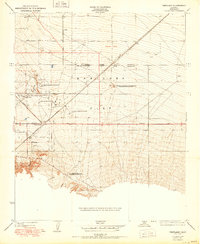
 1950 Searles Lake1950 Print · USGSMid-century San Bernardino County reveals an intensive desert industrial landscape along the western shore of Searles Lake. Researchers can trace the rail-linked settlements of South Trona, Westend, and Argus, or locate mineral prospects tucked into the Spangler Hills.
 - 1950 Map of Triunfo Pass
 1950 Triunfo Pass1950 Print · USGSThe coastal Santa Monica Mountains come into focus just after the war as new highways begin to carve through the canyons. Genealogists and hikers can trace the original locations of Yerba Buena Sch, Solromar, and the Triunfo Lookout.2 unique versions available
 - 1950 Map of Hayward
 1950 Hayward1950 Print · USGSHayward and the East Bay hills are captured during the postwar building boom. Genealogists and local historians can trace old family sites and institutions like the Holy Sepulchre Cemetery, Mt Eden, and the historic Oakland Speedway.
 - 1950 Map of Sausalito School
 1950 Sausalito School1950 Print · USGSTulare County's agricultural heartland is captured here at mid-century, showing the early infrastructure of the San Joaquin Valley. Genealogists and historians can trace the locations of rural schoolhouses like Sausalito Sch and Zion Sch near the Southern Pacific tracks.
 - 1950 Map of West of Lethent
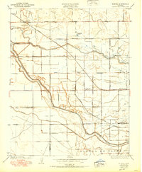
 1950 West of Lethent1950 Print · USGSMid-century Fresno County land use is defined by a unique automotive-themed grid system in the San Joaquin Valley. Researchers can trace land boundaries along Packard Avenue, Cadillac Avenue, and Ford Avenue.
 - 1950 Map of Gosford
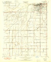 1950 Gosford1950 Print · USGSSouthwest Bakersfield and the surrounding Kern County ranch lands are caught in a moment of post-war expansion. Local researchers can trace the historic irrigation network of the Stine Canal and find old rural schools like Union Ave Sch and Fairview Sch.
 - 1950 Map of Visalia
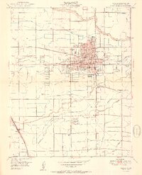 1950 Visalia1950 Print · USGSVisalia and the surrounding Tulare County farmland are shown here during a period of significant mid-century growth and agricultural development. Genealogists and local historians can trace the legacy of Tagus Ranch, locate dozens of local schools like Veva Blunt School, and follow the complex irrigation system of Mill Creek.2 unique versions available
Showing maps 1-25
Top cities of California
- Los Angeles historical maps
- San Diego historical maps
- San Jose historical maps
- San Francisco historical maps
- Fresno historical maps
- Sacramento historical maps
See more
Top counties of California
- San Diego County historical maps
- Orange County historical maps
- San Bernardino County historical maps
- Santa Clara County historical maps
- Alameda County historical maps
- Sacramento County historical maps
See more
Frequently asked questions
- What are the different types of historical maps available for California?
- What is the oldest map of California?
- Where can I purchase historical maps of California for my home or office?
- Where can I download high-res historical maps of California?
- Are there historical topographic maps available for California?
- Is there historical aerial imagery available for California?
- Where are historical maps of California sourced from?