1960s Maps of California
Explore 2,080 historic maps of California from the 1960s. These maps offer a rare glimpse into what life looked like during the 1960s — showing old roads, neighborhoods, homes, and landmarks that have changed or disappeared over time.
Whether you're researching your family's past, planning a metal detecting trip, or studying how California's landscape evolved across the 1960s, these high-resolution maps are a powerful tool for exploring the history of this region.
- Focus on a specific era: All maps on this page are from the 1960s, giving you a focused view of this time period.
- See what’s changed: Compare century-old streets, trails, and buildings to today's modern landscape using overlays and satellite layers.
- Research with precision: Use these maps for genealogy, historical research, land use analysis, or educational projects.
- View, download, or print: Maps are fully viewable online in high resolution, and can be downloaded or printed for your own records.
Start exploring California's history through authentic maps from the 1960s. This is your window into the past.
California maps
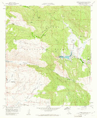
- 1960 Map of Fresno
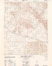
 1960 Fresno1960 Print · USGSThe San Joaquin Valley's mid-century agricultural boom meets the high peaks of the Sierra Nevada in this detailed survey. Genealogists and historians can trace the rail-driven growth of Fresno, Tulare, and Visalia or locate family roots in smaller towns like Raisin City and Calwa City.2 unique versions available
 - 1960 Map of Trona
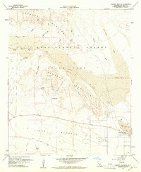
 1960 Trona1960 Print · USGSThe Mojave Desert at mid-century reveals a landscape of massive military installations and industrial mineral works. Researchers can trace the heritage of mining and ranching at Ashford Mill, Randsburg, and Paxton Ranch while following the Old Spanish Trail.2 unique versions available
 - 1960 Map of Reno
 1960 Reno1960 Print · USGSThe high desert of western Nevada comes alive in this mid-century survey of the Reno-Tahoe region. Genealogists and historians can trace rail lines like the Southern Pacific RR and locate remote outposts such as Olinghouse, Nixon, and the Olinghouse Mine.2 unique versions available
 - 1960 Map of Bagdad
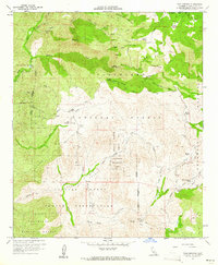
 1960 Bagdad1960 Print · USGSThe Mojave Desert interior in the late fifties is captured here through its remote rail stops and volcanic landmarks. Researchers can trace the Atchison Topeka and Santa Fe line to find Bagdad, the Orange Blossom Mine, and the Amboy Crater cinder cone.
 - 1960 Map of San Francisco
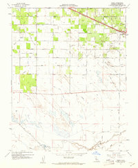
 1960 San Francisco1960 Print · USGSThe San Francisco Bay Area at the start of the sixties reveals a landscape of rapid expansion and critical infrastructure. Researchers can trace the development of East Bay communities like Russell City and Mt Eden or locate early rural landmarks like Alpine School.
 - 1960 Map of Ukiah
 1960 Ukiah1960 Print · USGSNorthern California during the late fifties reveals a landscape of deep timber forests and valley agriculture before modern expansion. Trace the historic rail lines of the California Western RR and the Northwestern Pacific RR through settlements like Fort Bragg and Ukiah.2 unique versions available
 - 1960 Map of Long Beach
 1960 Long Beach1960 Print · USGSCoastal California at the height of post-war expansion reveals a dense network of suburban growth and maritime industry. Trace the development of the South Bay and inland neighborhoods like Lakewood Village, or explore the topography of Santa Catalina Island and Los Angeles Harbor.2 unique versions available
 - 1960 Map of Santa Ana
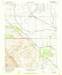
 1960 Santa Ana1960 Print · USGSSouthern California's coastal plains and inland deserts meet in this mid-century survey of the burgeoning Orange and Riverside county corridors. Researchers can trace the layout of early freeway systems, find tribal lands like the Soboba Indian Reservation, and locate military landmarks such as March Field.2 unique versions available
 - 1960 Map of Kingman
 1960 Kingman1960 Print · USGSThe high desert landscape of the Arizona-Nevada border comes alive in the mid-twentieth century, showcasing the rise of recreation alongside deep-rooted mining history. Genealogists and historians can trace the roots of towns like Kingman and Oatman, or locate remote sites like the Lucky Dutchman Mine and Santa Claus.3 unique versions available
 - 1960 Map of Chico
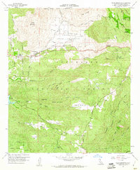
 1960 Chico1960 Print · USGSThe Northern California high country and Sacramento Valley meet in this 1960s-era landscape of mining towns and river settlements. Trace the rail-and-water economy of the gold country through the Empire Mine, Beale Air Force Base, and the Western Pacific Railroad.
 - 1960 Map of Bakersfield
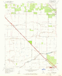
 1960 Bakersfield1960 Print · USGSThe Southern San Joaquin Valley at mid-century reveals a complex landscape of petroleum development and massive irrigation projects. Researchers can trace the rail lines of the Southern Pacific, explore oil-era landmarks like Oil City, and locate early settlements including Allensworth and Pixley.2 unique versions available
 - 1960 Map of Arena, 1961 Print
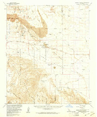
 1960 Arena1961 Print · USGSMerced County at the start of the 1960s showcases a landscape transformed by intensive irrigation and the Southern Pacific rail line. Researchers can trace the layout of Arena and early Atwater, alongside specialized features like the Tin Flume and Airstrip.3 unique versions available
 - 1960 Map of St. Helena, 1961 Print
 1960 St. Helena1961 Print · USGSNapa Valley's vineyard and college life are captured here in the early sixties, showing the region before modern development. Genealogists and historians can trace the rail stops of Krug and Barro, or locate family sites near Pacific Union College and the Sanitarium.6 unique versions available
 - 1960 Map of Potrero, 1961 Print
 1960 Potrero1961 Print · USGSThe San Diego backcountry at the dawn of the 1960s reveals a sparse landscape of mountain valleys and border settlements. Trace the winding San Diego and Arizona Eastern Railway through Canyon City or locate the old Cem in Potrero.4 unique versions available
 - 1960 Map of Viejas Mountain, 1961 Print
 1960 Viejas Mountain1961 Print · USGSThe Viejas Valley and surrounding San Diego County highlands are documented here during the early sixties, showing a landscape of tribal lands and national forest. Genealogists and local historians can trace family locations at The Willows, Lyster Ranch, and Kearchoffer Flat.5 unique versions available
 - 1960 Map of Beauty Mountain, 1961 Print
 1960 Beauty Mountain1961 Print · USGSThe high desert border between Riverside and San Diego Counties is captured here in the early sixties, showing a landscape of remote valleys and high peaks. Genealogists and historians can locate legacy outposts like Mitchell Camp, the Pawnee Mine, and trails through Chihuahua Valley.4 unique versions available
 - 1960 Map of Mint Canyon, 1961 Print
 1960 Mint Canyon1961 Print · USGSLos Angeles County's northern canyons and river valleys are captured here during the early sixties, showing the rail and road network along the Santa Clara River. Genealogists and local historians can trace old settlements like Solemint, Lang, and the Sulphur Spring Sch.5 unique versions available
 - 1960 Map of Volta, 1961 Print
 1960 Volta1961 Print · USGSMerced County agriculture and irrigation are at their mid-century peak in this survey of the San Joaquin Valley. Genealogists and researchers can trace the Southern Pacific rail line through Volta, locate the Labor Camp, and identify the grounds of the Los Banos Odd Fellows Grove.4 unique versions available
 - 1960 Map of Tule Springs, 1961 Print
 1960 Tule Springs1961 Print · USGSSan Diego County's high country is captured here in the early sixties, showing the intersection of tribal lands and national forest. Researchers can locate remote family holdings like Sherilton Valley Ranch and landmarks like Cedar Creek Falls.5 unique versions available
 - 1960 Map of Plainsburg, 1961 Print
 1960 Plainsburg1961 Print · USGSThe San Joaquin Valley's agricultural heartland is captured here at the start of the 1960s, showing a landscape defined by orchards and vital rail corridors. Genealogists and local historians can trace family-named roads and landmarks like Plainsburg, the Savana Sch, and the junction of the Southern Pacific railroad.3 unique versions available
 - 1960 Map of Borrego Mountain, 1961 Print
 1960 Borrego Mountain1961 Print · USGSThe Colorado Desert during the early sixties reveals a landscape of remote outposts and shifting sands within the Anza-Borrego Desert State Park. Traces of local history are preserved at the Little Borrego (Site), the USN Railroad, and the Elephant Tree Area.2 unique versions available
 - 1960 Map of Morena Reservoir, 1961 Print
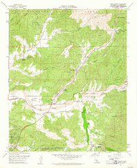
 1960 Morena Reservoir1961 Print · USGSSan Diego County's high-country wilderness is documented here just as the post-war era of water management and forest service oversight was firmly established. Researchers can trace the rugged backcountry infrastructure of Morena Village, the Marine Memorial, and the Los Pinos Mtn fire lookout.5 unique versions available
 - 1960 Map of Borrego Mountain, 1961 Print
 1960 Borrego Mountain1961 Print · USGSSan Diego County's desert interior is captured in the early sixties as a playground for geology and exploration. Trace the early layout of Ocotillo Wells and navigate the primitive routes of Old Kane Spring Road and The Slot.4 unique versions available
 - 1960 Map of Bliss Ranch, 1961 Print
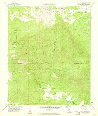
 1960 Bliss Ranch1961 Print · USGSMadera County ranching and irrigation systems are in full focus during the early sixties. Researchers can trace the boundaries of historic estates like Bliss Ranch and Red Top Ranch while locating community landmarks such as Alamo School and the Labor Camp.3 unique versions available
 - 1960 Map of El Nido, 1961 Print
 1960 El Nido1961 Print · USGSMerced County agriculture and irrigation are in full focus at the start of the 1960s. Researchers can trace the Southern Pacific rail line through Lingard, locate the Duck Club, and follow the complex water routes of Deadman Creek and Duck Slough.2 unique versions available
Showing maps 1-25
Top cities of California
- Los Angeles historical maps
- San Diego historical maps
- San Jose historical maps
- San Francisco historical maps
- Fresno historical maps
- Sacramento historical maps
See more
Top counties of California
- San Diego County historical maps
- Orange County historical maps
- San Bernardino County historical maps
- Santa Clara County historical maps
- Alameda County historical maps
- Sacramento County historical maps
See more
Frequently asked questions
- What are the different types of historical maps available for California?
- What is the oldest map of California?
- Where can I purchase historical maps of California for my home or office?
- Where can I download high-res historical maps of California?
- Are there historical topographic maps available for California?
- Is there historical aerial imagery available for California?
- Where are historical maps of California sourced from?