1900s (20th Century) Maps of Mendocino County, California
Explore 195 historic maps of Mendocino County from the 1900s (20th Century). These maps offer a rare glimpse into what life looked like during the 1900s — showing old roads, neighborhoods, homes, and landmarks that have changed or disappeared over time.
Whether you're researching your family's past, planning a metal detecting trip, or studying how Mendocino County's landscape evolved across the 1900s, these high-resolution maps are a powerful tool for exploring the history of this region.
- Focus on a specific era: All maps on this page are from the 1900s, giving you a focused view of this time period.
- See what’s changed: Compare century-old streets, trails, and buildings to today's modern landscape using overlays and satellite layers.
- Research with precision: Use these maps for genealogy, historical research, land use analysis, or educational projects.
- View, download, or print: Maps are fully viewable online in high resolution, and can be downloaded or printed for your own records.
Start exploring Mendocino County's history through authentic maps from the 1900s. This is your window into the past.
Mendocino County, CA maps
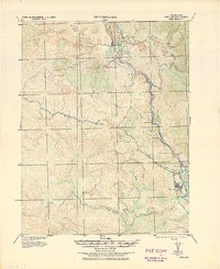
(195)- 1920 Map of Glenblair
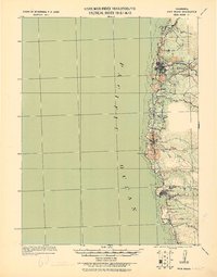
 1920 Glenblair1920 Print · USGSCoastal Mendocino County is seen here during the height of the early twentieth-century timber boom, where private rail lines carved through the redwood canyons. Researchers can trace the old logging camps and industrial spurs of the Albion Lumber Company and the California Western Railroad & Navigation Co through Irmulco and Northspur.
 - 1920 Map of Pt. Delagda
 1920 Pt. Delagda1920 Print · USGSThe Humboldt County coast in the years following the Great War remained a remote landscape of family-run operations and steep shorelines. Researchers can trace early ranching sites and coastal landmarks like Shelter Cove, Etters Ranch, and Honey Dew.
 - 1920 Map of Cummings
 1920 Cummings1920 Print · USGSMendocino County ranching and transit corridors are captured in the years following the Great War as the modern highway began to take shape. Genealogists and historians can locate family holdings like Buckhorn Ranch and Spittler Ranch alongside early settlements at Bell Springs and Cummings.
 - 1920 Map of Ukiah
 1920 Ukiah1920 Print · USGSMendocino County life centers on the Russian River valley during the years following the first World War. Family historians can locate specific homesteads like Roderis Ranch and trace rail operations at El Roble Siding or Clemhurst Spur.
 - 1920 Map of Covelo
 1920 Covelo1920 Print · USGSTracing the Eel River in the early twentieth century, this military survey reveals the remote homesteads and rail infrastructure of Mendocino County. Genealogists can locate family-named sites like Fred Simmerly Sr and Nash along the Northwestern Pacific Railroad.
 - 1920 Map of Harris
 1920 Harris1920 Print · USGSHumboldt County ranching and rail life are recorded here during the early twentieth century as the railroad carved its path through the Eel River canyon. Researchers can trace historic family holdings like Carey Ranch or locate early industrial sites such as the Steelhead US Fish Hatchery and Fort Seward.
 - 1920 Map of Fort Bragg, 1928 Print
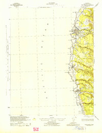
 1920 Fort Bragg1928 Print · USGSThe Mendocino coast in the early twentieth century reveals a rugged network of timber ports and pioneer rail lines. Genealogists and historians can trace the early footprints of Fort Bragg, the Cal Western R R & Nav Co railroad, and the historic lighthouse area at Pt. Cabrillo.
 - 1921 Map of Kelseyville
 1921 Kelseyville1921 Print · USGSNorthern California's thermal springs and mining districts are in full view in this early twentieth-century survey of Lake and Sonoma counties. Researchers can trace historic ranch boundaries like Moulton Ranch or locate vanished operations at the Cloverdale Quicksilver Mine and the Geyser Hotel.
 - 1921 Map of Westport
 1921 Westport1921 Print · USGSThe Mendocino coast comes alive in the early twentieth century as a hub for timber and coastal shipping. Genealogists and historians can trace the foundations of Westport and Rockport, or follow the path of the Ten Mile River Logging RR.2 unique versions available
 - 1921 Map of Briceland
 1921 Briceland1921 Print · USGSHumboldt County ranching and river life are captured here during the first World War, showing the early infrastructure of the redwood region. Researchers can locate numerous family holdings like the Ben Stoddard Ranch and settlements at Briceland and Garberville.2 unique versions available
 - 1921 Map of Branscomb
 1921 Branscomb1921 Print · USGSCoastal Mendocino County is documented during the height of early twentieth-century timber harvesting, focusing on the remote drainages of the Eel and Ten Mile Rivers. Local historians can trace logging infrastructure at N.W. Redwood Co. Camp No. 3 and early settlements like Branscomb and Wilderness Lodge.
 - 1922 Map of Willits
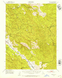
 1922 Willits1922 Print · USGSMendocino County's timber and rail corridor comes to life in the early twenties, centered on the growing hub of Willits. Researchers can trace the winding routes of the California Western Railroad and locate vanished stops like Shake City and Buckhorn.
 - 1922 Map of Hullville
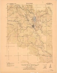
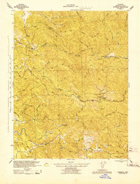
 1922 Hullville1922 Print · USGSThe pre-reservoir wilderness of Lake County is captured in this 1916 survey, shortly before the valley was flooded. Genealogists and historians can trace early homesteads and camps like Hullville, Boardman Camp, and Masons along the South Fork Eel River.
 - 1926 Map of Covelo
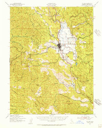
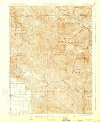 1926 Covelo1926 Print · USGSThe isolated high valley of Covelo is captured here in the mid-1920s, surrounded by the wilderness of the California National Forest. Local historians can locate the Indian School, early ranger outposts, and family landmarks like Browns Ranch.2 unique versions available
 - 1929 Map of Eden Valley
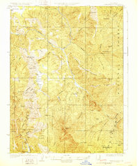 1929 Eden Valley1929 Print · USGSMendocino County’s interior wilderness is captured in the late 1920s, showing a landscape defined by the Eel River and remote mountain camps. Researchers can locate early family-named outposts like Crocker Place and trace the historic Mendenhall Trail through the high country.2 unique versions available
 - 1938 Map of Lakeport
 1938 Lakeport1938 Print · USGSLake County in the late thirties is captured here at a peak of lakeside development and rural industry. Genealogists and historians can trace family-named sites like Jones Ranch and Mission Rancheria, or locate old schoolhouses like Westlake Sch and Glen Eden Sch.3 unique versions available
 - 1938 Map of Hopland
 1938 Hopland1938 Print · USGSNorthern California’s Russian River valley is captured here in the 1920s, showing the early rail-and-road network between Hopland and Cloverdale. Trace old rail stops like Thorn Siding and historic locations such as Duncan Springs and Preston.
 - 1942 Map of Willits, 1956 Print
 1942 Willits1956 Print · USGSWillits and the surrounding Mendocino County ranchlands are captured here during the early 1940s as the railroad fueled local growth. Genealogists and historians can trace family landholdings and rural landmarks from Ridgewood Ranch to the Hearst Sch and Sylvandale.
 - 1943 Map of Point Arena
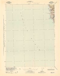
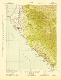 1943 Point Arena1943 Print · USGSThe Mendocino coast in the early 1940s reveals a landscape of isolated ranching and seafaring communities. Genealogists and local historians can trace family holdings from the Iverson Indian Rancheria to the Bourns Family Cem and the Seaside School.2 unique versions available
 - 1943 Map of Glenblair
 1943 Glenblair1943 Print · USGSCoastal Mendocino County timberlands and rail corridors are captured here during the 1940s, highlighting the region's logging legacy. Researchers can trace family ranch sites and remote camps like Irmulco, Northspur, and the Mendocino Lumber Co Ranch along the rail lines.2 unique versions available
 - 1943 Map of Fort Bragg
 1943 Fort Bragg1943 Print · USGSMendocino County's coastal timber and fishing hubs are captured here during the early 1940s. Researchers can trace the Caspar South Fork Railroad and explore early layouts of Fort Bragg, Mendocino, and the Heeser Addition.2 unique versions available
 - 1943 Map of Albion
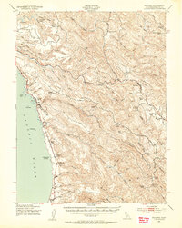
 1943 Albion1943 Print · USGSCoastal Mendocino County is mapped during the early 1940s, showing the intersection of the timber-rich hills and the rocky shoreline. Trace early settlements like Albion and Handley, and locate landmarks along the Navarro River and Navarro Ridge Road.2 unique versions available
 - 1943 Map of Pomo, 1954 Print
 1943 Pomo1954 Print · USGSMendocino County's ranching and irrigation landscapes are captured here during the 1940s, showcasing the development of Potter Valley. Genealogists and historians can locate family lands like Mewhinney Ranch alongside the Pomo Indian Reservation and the Emandale Resort.
 - 1943 Map of Boonville, 1954 Print
 1943 Boonville1954 Print · USGSMendocino County's ranching and timber heartland is captured here during the 1940s, focused on the Anderson Valley settlements. Genealogists and researchers can trace family-named sites like Whipple Ranch and Hagemann Ranch, along with several rural schoolhouses such as Con Creek Sch.
 - 1943 Map of Navarro, 1954 Print
 1943 Navarro1954 Print · USGSCoastal Mendocino County during the early war years reveals a rugged timber and ranching economy along the Pacific shore. Genealogists and local historians can trace family landmarks like the Galletti Ranch, small rural school sites such as Signal Sch, and maritime history at Bridgeport Landing.3 unique versions available
Showing maps 1-25 of 195
Top cities of Mendocino County
- Ukiah historical maps
- Fort Bragg historical maps
- Willits historical maps
- Redwood Valley historical maps
- Talmage historical maps
- Talmage historical maps
See more
Frequently asked questions
- What are the different types of historical maps available for Mendocino County?
- What is the oldest map of Mendocino County?
- Where can I purchase historical maps of Mendocino County for my home or office?
- Where can I download high-res historical maps of Mendocino County?
- Are there historical topographic maps available for Mendocino County?
- Is there historical aerial imagery available for Mendocino County?
- Where are historical maps of Mendocino County sourced from?