1990s Maps of Mendocino County, California
Explore 48 historic maps of Mendocino County from the 1990s. These maps offer a rare glimpse into what life looked like during the 1990s — showing old roads, neighborhoods, homes, and landmarks that have changed or disappeared over time.
Whether you're researching your family's past, planning a metal detecting trip, or studying how Mendocino County's landscape evolved across the 1990s, these high-resolution maps are a powerful tool for exploring the history of this region.
- Focus on a specific era: All maps on this page are from the 1990s, giving you a focused view of this time period.
- See what’s changed: Compare century-old streets, trails, and buildings to today's modern landscape using overlays and satellite layers.
- Research with precision: Use these maps for genealogy, historical research, land use analysis, or educational projects.
- View, download, or print: Maps are fully viewable online in high resolution, and can be downloaded or printed for your own records.
Start exploring Mendocino County's history through authentic maps from the 1990s. This is your window into the past.
Mendocino County, CA maps
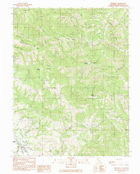
(48)- 1991 Map of Mathison Peak
 1991 Mathison Peak1991 Print · USGSCoastal Mendocino County is shown here in the early 1990s, characterized by the expansive timberlands of the Jackson State Forest. Researchers can trace old logging era remnants like Woodlands Station or find family landmarks such as Tom Bell Flat and Caspar Orchard.
 - 1991 Map of Van Arsdale Reservoir
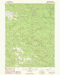
 1991 Van Arsdale Reservoir1991 Print · USGSThe Mendocino National Forest in the early 1990s is captured here, centered on the Eel River and the Lake County line. Genealogists and researchers can trace local landmarks like Hartstone Camp, Van Arsdale Reservoir, and Deadmans Flat.
 - 1991 Map of Boonville
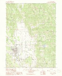
 1991 Boonville1991 Print · USGSBoonville and the southern reaches of the Anderson Valley are documented here in the early nineties, showing a landscape of deep canyons and family-named ridges. Genealogists and researchers can trace local landmarks like Fairground, Soda Spring, and Casabonne Peak.
 - 1991 Map of Ornbaun Valley
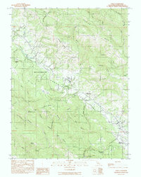
 1991 Ornbaun Valley1991 Print · USGSMendocino County’s rugged interior is captured here in the early nineties, showing a landscape shaped by deep timber reserves and ranching history. Researchers can locate the Ornbaun Cem, the protected groves of Mailliard Redwoods State Reserve, and the waters of the Garcia River.
 - 1991 Map of Navarro
 1991 Navarro1991 Print · USGSMendocino County's timber and river country is meticulously detailed in the early nineties, showing the area's intricate ridge-and-gulch topography. Researchers can trace historical routes like the Tramway, find the settlement of Navarro, and locate family landmarks such as John Smith Creek.
 - 1991 Map of Cold Spring
 1991 Cold Spring1991 Print · USGSCoastal Mendocino County in the early nineties is revealed here as a landscape of deep timbered ridges and river valleys. Researchers can trace family-named landmarks like McAllister Ridge or find remote landmarks such as Reilly Heights and Soda Spring.
 - 1991 Map of Bailey Ridge
 1991 Bailey Ridge1991 Print · USGSCoastal Mendocino County comes into focus in the early nineties, revealing the steep canyons between the Big and Navarro rivers. Researchers can trace historical homesteads like the Old Bailey Place and the grove at Montgomery Woods State Reserve.
 - 1991 Map of Comptche
 1991 Comptche1991 Print · USGSThe Mendocino coastal range comes into focus in the early nineties, centered on the forestry hub of Comptche. Researchers can trace old timber access points and remote outposts like the Chamberlain Creek Conservation Camp and McDuffy Opening.
 - 1991 Map of Gube Mountain
 1991 Gube Mountain1991 Print · USGSThe Mendocino-Sonoma county line runs through this high-country landscape during the 1990s. Researchers can trace remote homesteading and natural landmarks from Billings down to Howlett Ranch and the heights of Gube Mtn.
 - 1991 Map of Foster Mountain
 1991 Foster Mountain1991 Print · USGSMendocino County in the early 1990s reveals a landscape of high ridges and protected river corridors. Researchers can locate the Hearst (Site), the Emandal Resort, and the boundaries of the Potter Valley Rancheria Indian Reservation.
 - 1991 Map of Mc Guire Ridge
 1991 Mc Guire Ridge1991 Print · USGSThe Mendocino and Sonoma county line remains a landscape of isolated ranches and timbered ridges in the early nineties. Genealogists and historians can locate established holdings like Zeni Ranch and follow old tracks along McKenzie Grade or Johnny Woodin Ridge.
 - 1991 Map of Eureka Hill
 1991 Eureka Hill1991 Print · USGSMendocino County's coastal interior is captured in the early nineties, centered on the strategic presence of the Point Arena Air Force Station. Researchers can trace the rugged drainage of the Garcia River and name-specific landmarks like Jacks Opening and Zeni Ridge.
 - 1991 Map of Noyo Hill
 1991 Noyo Hill1991 Print · USGSThe Mendocino highlands are captured here in the early nineties, showing a landscape defined by the deep timber of the Jackson State Forest. Local researchers can trace the drainages around Glenblair or follow the paths leading toward Noyo Hill and the Redwood Lodge.
 - 1991 Map of Greenough Ridge
 1991 Greenough Ridge1991 Print · USGSMendocino County timberlands are charted here in the early 1990s, revealing a landscape of working forests and isolated clearings. Researchers can locate family-named landmarks like Hans Ottoson Opening and topographical features such as Greenough Ridge and Williams Peak.
 - 1991 Map of Laughlin Range
 1991 Laughlin Range1991 Print · USGSMendocino County’s interior ridges and watersheds are captured here during the early nineties, showing a landscape shaped by water management and fire service infrastructure. Researchers can trace the drainages of Laughlin Range and locate sites like Leonard Lake, Morris Dam, and the Mendocino Co CDF Headquarters.
 - 1991 Map of Willits
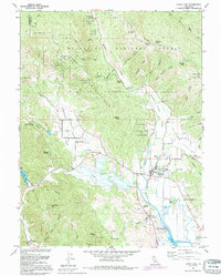
 1991 Willits1991 Print · USGSWillits and the surrounding Mendocino County highlands are shown here in the early nineties as the valley floor balanced aviation, industry, and agriculture. Genealogists and local historians can trace the Cem, the Fairground, and the small settlement of Muir.2 unique versions available
 - 1991 Map of Yorkville
 1991 Yorkville1991 Print · USGSMendocino County's high country is documented here in the early nineties, centered on the mountain settlement of Yorkville. Researchers can trace the remote water sources and peaks of the Coast Ranges, from Duncan Springs to Big Foot Mtn.
 - 1991 Map of Burbeck
 1991 Burbeck1991 Print · USGSMendocino County’s interior timberlands are captured here in the early nineties, showing a landscape defined by the Noyo River and the Jackson State Forest. Researchers can trace remote settlements like Shake City and Burbeck or find landmarks along Three Chop Ridge.
 - 1991 Map of Philo
 1991 Philo1991 Print · USGSMendocino County's Anderson Valley is documented in the early nineties, showing a landscape defined by the Navarro River and local timber history. Genealogists can trace family landmarks like Hagemann Ranch, Shields Cem, and Philbrick Mill.
 - 1991 Map of Zeni Ridge
 1991 Zeni Ridge1991 Print · USGSCoastal Mendocino County in the early nineties remains a landscape of high ridges and remote clearings. Researchers can locate the Habersan Gun Club or trace early mountain routes through German Gap and Saddle Opening.
 - 1991 Map of Orrs Springs
 1991 Orrs Springs1991 Print · USGSThe Mendocino highlands are captured here in the early nineties, centered on the remote outpost of Orrs Springs. Researchers can trace the boundary of the Montgomery Woods State Reserve and locate historic family properties like Mann Ranch and Greenfield Ranch.
 - 1991 Map of Big Foot Mountain
 1991 Big Foot Mountain1991 Print · USGSThe Mendocino and Sonoma County line was still defined by large rural holdings and complex river systems in the early nineties. Genealogists and local historians can trace family-named sites like Diamond D Ranch, Rockpile Ranch, and Mt Tom.
 - 1991 Map of Northspur
 1991 Northspur1991 Print · USGSMendocino County timberlands and river forks are documented here during the early 1990s as the regional landscape balanced industry and recreation. Researchers can trace the layout of Jackson State Forest and locate historical sites like Northspur and Old Camp Seven.
 - 1991 Map of Upper Lake, 1995 Print
 1991 Upper Lake1995 Print · USGSUpper Lake and the surrounding rancherias are shown here during the late twentieth century, before major changes to the valley drainage. You can trace local history through the Bloody Island Massacre Historical Marker, the Witter Springs P O, and several area schools like Union High Sch.
 - 1993 Map of Highland Springs
 1993 Highland Springs1993 Print · USGSLake County high country meets the fertile Big Valley in the early nineties, revealing a landscape of mountain peaks and water reservoirs. Trace the winding Hopland Grade Road across the county line or locate local landmarks like Lampson Field and Highland Springs.
Showing maps 1-25 of 48
Top cities of Mendocino County
- Ukiah historical maps
- Fort Bragg historical maps
- Willits historical maps
- Redwood Valley historical maps
- Talmage historical maps
- Talmage historical maps
See more
Frequently asked questions
- What are the different types of historical maps available for Mendocino County?
- What is the oldest map of Mendocino County?
- Where can I purchase historical maps of Mendocino County for my home or office?
- Where can I download high-res historical maps of Mendocino County?
- Are there historical topographic maps available for Mendocino County?
- Is there historical aerial imagery available for Mendocino County?
- Where are historical maps of Mendocino County sourced from?