1950s Maps of Mendocino County, California
Explore 33 historic maps of Mendocino County from the 1950s. These maps offer a rare glimpse into what life looked like during the 1950s — showing old roads, neighborhoods, homes, and landmarks that have changed or disappeared over time.
Whether you're researching your family's past, planning a metal detecting trip, or studying how Mendocino County's landscape evolved across the 1950s, these high-resolution maps are a powerful tool for exploring the history of this region.
- Focus on a specific era: All maps on this page are from the 1950s, giving you a focused view of this time period.
- See what’s changed: Compare century-old streets, trails, and buildings to today's modern landscape using overlays and satellite layers.
- Research with precision: Use these maps for genealogy, historical research, land use analysis, or educational projects.
- View, download, or print: Maps are fully viewable online in high resolution, and can be downloaded or printed for your own records.
Start exploring Mendocino County's history through authentic maps from the 1950s. This is your window into the past.
Mendocino County, CA maps
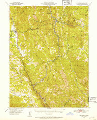
(33)- 1950 Map of Piercy, 1952 Print
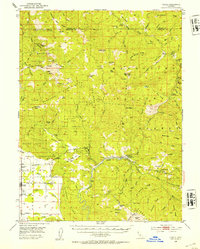
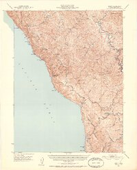 1950 Piercy1952 Print · USGSCoastal Mendocino County is shown here in the early fifties, documenting a landscape of isolated shore outposts and river settlements. Genealogists and historians can locate family ranches and sites like Hollow Tree (Hales Grove), Moody (Site), and the DeVilbiss Ranch.5 unique versions available
 - 1950 Map of Cape Vizcaino, 1960 Print
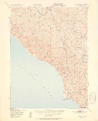
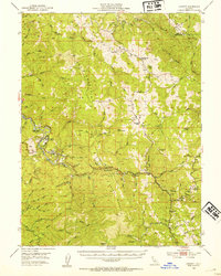
 1950 Cape Vizcaino1960 Print · USGSThe Mendocino coast at the middle of the twentieth century shows a landscape defined by timber and tide. Researchers can trace the legacy of coastal settlements like Westport, Rockport, and Newport alongside the extensive Logging Road networks of the era.2 unique versions available
 - 1951 Map of Alderpoint
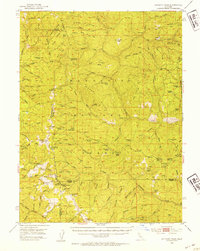
 1951 Alderpoint1951 Print · USGSSouthern Humboldt County is captured here at a time when the river-and-rail economy still shaped life along the Eel River. Researchers can trace old family holdings like Ware Ranch and Marr Ranch or locate the Harris PO and the Lumber Mill at Alderpoint.2 unique versions available
 - 1951 Map of Garberville
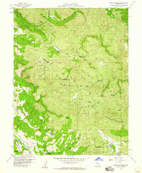
 1951 Garberville1951 Print · USGSSouthern Humboldt County is defined by the winding course of the river and the redwoods in the early fifties. Genealogists and historians can trace the development of river towns like Garberville or locate rural schools such as Oakdale Sch and South Fork Union H S.2 unique versions available
 - 1951 Map of Point Delgada
 1951 Point Delgada1951 Print · USGSThe Humboldt County coast in the early fifties remains a wilderness of steep ridges and isolated settlements. Researchers can trace the original Humboldt Road and locate mid-century landmarks like the Airstrip at Shelter Cove and the remote Honeydew post office.2 unique versions available
 - 1951 Map of Cape Vizcaino
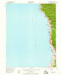
 1951 Cape Vizcaino1951 Print · USGSThe Mendocino coastline is captured here in the early fifties, featuring the isolated timber landings and seaside settlements north of Fort Bragg. You can trace early coastal roads and industry sites from Rockport and Union Landing to the Tenmile River and the Fort Bragg Grange.2 unique versions available
 - 1951 Map of Lake Pillsbury, 1953 Print
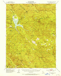 1951 Lake Pillsbury1953 Print · USGSLake County and the Mendocino National Forest are captured in the early fifties as a landscape of remote ranches and timber mills. Genealogists and historians can locate legacy sites like Fuller Ranch, Prather Mill, and the Snow Mtn House.5 unique versions available
 - 1951 Map of Lakeport, 1953 Print
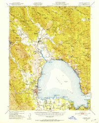 1951 Lakeport1953 Print · USGSNorthern California lake life and tribal history meet in the early fifties around the shores of Clear Lake. Trace the locations of the Upper Lake Rancheria, the Bloody Island Massacre Historic Marker, and the early layout of Lakeport.2 unique versions available
 - 1951 Map of Branscomb, 1953 Print
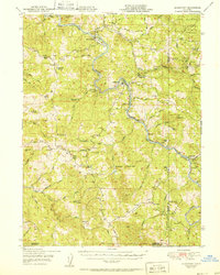
 1951 Branscomb1953 Print · USGSMendocino County's coastal ranges and timberlands are captured here in the early 1950s as remote ranching and logging hubs thrived. Genealogists and historians can trace the foundations of Branscomb, locate family-named sites like O'Conner Orchard, and identify early landmarks such as the Laytonville Rancheria.4 unique versions available
 - 1951 Map of Laytonville, 1953 Print
 1951 Laytonville1953 Print · USGSMendocino County's northern interior is captured here in the early fifties as a landscape of remote river canyons and scattered rancherias. Researchers can trace the path of the Northwestern Pacific RR through Dos Rios or find local landmarks like Laytonville Rancheria and Longvale.5 unique versions available
 - 1952 Map of Hull Mountain, 1954 Print
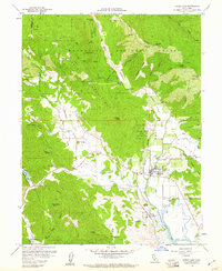
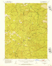 1952 Hull Mountain1954 Print · USGSThe high ridges of Mendocino National Forest are captured here in the early 1950s, showing a landscape shaped by forest service outposts and remote mountain camps. Researchers can find old backcountry locations like Plaskett Guard Sta, Millsap Cabin, and the high meadows of Black Butte.3 unique versions available
 - 1952 Map of Spyrock, 1954 Print
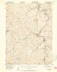
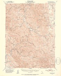
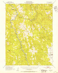 1952 Spyrock1954 Print · USGSMendocino County ranching and rail life are documented here in the early fifties, centered on the Round Valley Indian Reservation. Trace the Northwestern Pacific line past Spyrock and Nashmead or locate the Lake Mtn Sch and the streets of Covelo.4 unique versions available
 - 1952 Map of Eden Valley, 1954 Print
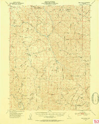 1952 Eden Valley1954 Print · USGSMendocino County's high ridges and river forks are captured here in the early fifties, documenting a landscape of remote ranching outposts and deep forest wilderness. Researchers can trace historic sites like Eden Valley Ranch, Elk Creek Ranch, and the high summit of Mt Sanhedrin.4 unique versions available
 - 1952 Map of Covelo, 1954 Print
 1952 Covelo1954 Print · USGSRound Valley in the early fifties remains a rugged hub of Mendocino ranching and indigenous life centered on the Covelo township. Genealogists and local historians can trace the foundations of the community at the Reservation School, Nomlackie Cem, and family landmarks like the Bauer Ranch.4 unique versions available
 - 1952 Map of Leggett, 1954 Print
 1952 Leggett1954 Print · USGSMendocino County’s mountain interior is mapped here in the early fifties, showing the logging and ranching country around the South Fork Eel River. Researchers can locate family landmarks like Drewry Ranch, the Linser Mine, and the historic Bell Springs Road.3 unique versions available
 - 1952 Map of Anthony Peak, 1954 Print
 1952 Anthony Peak1954 Print · USGSHigh mountain passes and forest service outposts define this corner of the California Coast Range during the early fifties. Local historians can locate specific mountain camps and former homesteads like Griffin Place, Howell Camp, and the Maxim Cabin (Site).4 unique versions available
 - 1957 Map of Ukiah, 1966 Print
 1957 Ukiah1966 Print · USGSNorthern California's diverse terrain comes into focus in the mid-1950s, from the rugged timberlands of the Jackson State Forest to the productive Sacramento Valley. Genealogists and historians can trace the rail lines of the Northwestern Pacific or locate early valley settlements like Arbuckle and Paskenta.3 unique versions available
 - 1958 Map of Redding
 1958 Redding1958 Print · USGSNorthern California's valley and mountain landscapes are captured in the late fifties, showing the region as new reservoirs reshaped the river systems. Genealogists and historians can trace rail-side towns like Cottonwood, the military presence at Red Bluff Air Force Station, and mountain outposts like Weaverville.5 unique versions available
 - 1958 Map of Purdys Gardens, 1960 Print
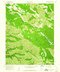
 1958 Purdys Gardens1960 Print · USGSThe Mendocino and Lake County line comes alive in the late fifties, showing a landscape of remote mountain ranches and seasonal camps. Genealogists and historians can trace family-named sites like Ruddick Ranch, Dorst Ranch, and James Cabin along the Russian River and high ridges.3 unique versions available
 - 1958 Map of Ukiah, 1960 Print
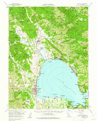
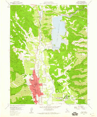 1958 Ukiah1960 Print · USGSMendocino County life in the late fifties centered around the thriving valley floor near Ukiah and the newly formed Lake Mendocino. Researchers can trace old property lines at Yokayo Ranch or locate historical institutional landmarks like the Mendocino State Hospital and Union High School.3 unique versions available
 - 1958 Map of Cow Mountain, 1960 Print
 1958 Cow Mountain1960 Print · USGSThe Mendocino and Lake County line follows the high ridges of the Northern Coast Ranges during the late fifties. Genealogists and historians can locate remote homesteads like Hemlock Ranch and Lona Loa Farm or trace the drainage of Sulphur Creek and Blue Lakes.2 unique versions available
 - 1958 Map of Elledge Peak, 1960 Print
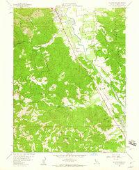 1958 Elledge Peak1960 Print · USGSThe Russian River valley south of Ukiah comes into focus in the late fifties, showing a landscape defined by orchards, vineyards, and early aviation. Genealogists and researchers can trace family holdings like McNab Ranch and Largo or locate the Indian Cemetery near the rail line.5 unique versions available
 - 1958 Map of Ukiah, 1961 Print
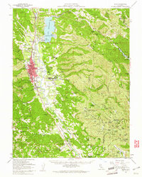 1958 Ukiah1961 Print · USGSMendocino County's interior valleys thrive in the late fifties as the regional hub of Ukiah grows alongside the Russian River. Genealogists and historians can trace family landholdings like W L Crawford Ranch and visit landmarks such as Vichy Springs or the Mendocino State Hospital.2 unique versions available
 - 1958 Map of Upper Lake, 1961 Print
 1958 Upper Lake1961 Print · USGSUpper Lake and the Bachelor Valley are shown here in the late fifties as agriculture and tribal lands met the forest edge. Local historians can find the Bloody Island Massacre Historical Marker, the Witter Springs P.O., and several rancheria tracts.3 unique versions available
 - 1958 Map of Lakeport, 1962 Print
 1958 Lakeport1962 Print · USGSClear Lake and its surrounding rancherias are shown in detail during the late fifties as the region's agricultural and resort communities thrived. Researchers can trace local landmarks like Saratoga Springs, the Bloody Island Massacre Historical Marker, and Robinson Rancheria.3 unique versions available
Showing maps 1-25 of 33
Top cities of Mendocino County
- Ukiah historical maps
- Fort Bragg historical maps
- Willits historical maps
- Redwood Valley historical maps
- Talmage historical maps
- Talmage historical maps
See more
Frequently asked questions
- What are the different types of historical maps available for Mendocino County?
- What is the oldest map of Mendocino County?
- Where can I purchase historical maps of Mendocino County for my home or office?
- Where can I download high-res historical maps of Mendocino County?
- Are there historical topographic maps available for Mendocino County?
- Is there historical aerial imagery available for Mendocino County?
- Where are historical maps of Mendocino County sourced from?