2020s Maps of Mendocino County, California
Explore 92 historic maps of Mendocino County from the 2020s. These maps offer a rare glimpse into what life looked like during the 2020s — showing old roads, neighborhoods, homes, and landmarks that have changed or disappeared over time.
Whether you're researching your family's past, planning a metal detecting trip, or studying how Mendocino County's landscape evolved across the 2020s, these high-resolution maps are a powerful tool for exploring the history of this region.
- Focus on a specific era: All maps on this page are from the 2020s, giving you a focused view of this time period.
- See what’s changed: Compare century-old streets, trails, and buildings to today's modern landscape using overlays and satellite layers.
- Research with precision: Use these maps for genealogy, historical research, land use analysis, or educational projects.
- View, download, or print: Maps are fully viewable online in high resolution, and can be downloaded or printed for your own records.
Start exploring Mendocino County's history through authentic maps from the 2020s. This is your window into the past.
Mendocino County, CA maps
(92)- 2021 Map of Bear Harbor OE W, 2021 Print
 2021 Bear Harbor OE W2021 Print · USGSThe Mendocino coast comes into sharp focus during this recent survey of the sea-facing wilderness. Map collectors and researchers can trace the steep coastal rise from the Pacific Ocean toward Chamisal Mtn and the offshore landmark of Small White Rock.
 - 2021 Map of Shelter Cove, 2021 Print
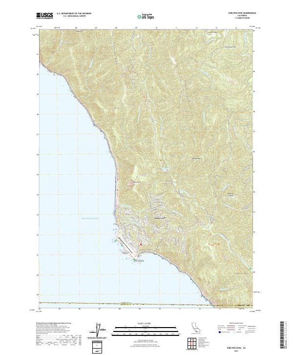 2021 Shelter Cove2021 Print · USGSThe Humboldt County coastline comes into sharp focus in the early 2020s, centering on the remote settlement at Shelter Cove. Researchers can trace local development around Point Delgada and the Shelter Cove Airport or explore the wilderness route of the Lost Coast Trl.
 - 2021 Map of Ornbaun Valley, 2021 Print
 2021 Ornbaun Valley2021 Print · USGSMendocino County ranching country is documented here in the early twenty-first century as the landscape remains defined by its deep creek valleys. Researchers can trace family history at Ornbaun Springs Cem or locate old landmarks like Rush Bottom and Fruit Lake.
 - 2021 Map of Big Foot Mountain, 2021 Print
 2021 Big Foot Mountain2021 Print · USGSThe Mendocino and Sonoma county line runs through this remote stretch of the California Coast Ranges in the early twenty-first century. Researchers can trace land patterns along Thompson Ridge or locate peaks like Big Foot Mtn and Crystal Peak.
 - 2021 Map of Hopland, 2021 Print
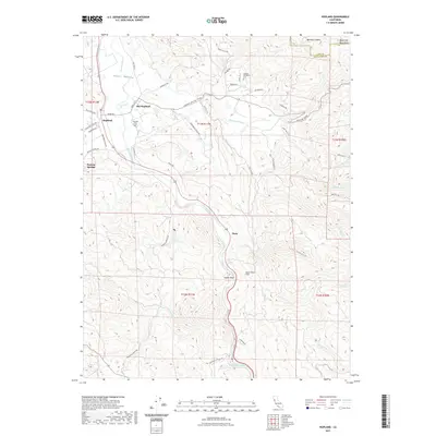 2021 Hopland2021 Print · USGSCovers Mendocino County, including Oasis, Nacomis Indian Rancheria, and other nearby areas
 - 2021 Map of Zeni Ridge, 2021 Print
 2021 Zeni Ridge2021 Print · USGSMendocino County's high country is documented here in the 2020s, showing a landscape shaped by the Garcia River and the timber-rich ridges of the coast range. Researchers can locate named clearings like Mule Opening and local landmarks like Buck Peak or Zeni Ridge.
 - 2021 Map of McGuire Ridge, 2021 Print
 2021 McGuire Ridge2021 Print · USGSCovers Mendocino County, including Old Red Rock Place, Sonoma County, and other nearby areas
 - 2021 Map of Gube Mountain, 2021 Print
 2021 Gube Mountain2021 Print · USGSThe Mendocino and Sonoma county line runs through this high-elevation landscape as it appeared in the early twenty-first century. Researchers can trace the drainage of Rockpile Cr or locate topographical landmarks like School Ridge, Gube Mtn, and Snook Mtn.
 - 2021 Map of Saunders Reef, 2021 Print
 2021 Saunders Reef2021 Print · USGSMendocino County's coastline comes into focus in this contemporary survey of the bluffs and gulches south of Point Arena. Researchers can trace the rugged geography of Saunders Reef, Iversen Point, and the famous geological formations at Bowling Ball Beach.
 - 2021 Map of Covelo West, 2021 Print
 2021 Covelo West2021 Print · USGSThe town of Covelo and the eastern edge of Round Valley appear here in the early twenty-first century. Genealogists can locate Valley View Cem and trace old routes like Mina Rd through Eberle Flat.
 - 2021 Map of Inglenook, 2021 Print
 2021 Inglenook2021 Print · USGSThe Mendocino coast at the start of the 2020s shows a landscape where industrial heritage meets protected wilderness. Genealogists and historians can trace old coastal settlements at Kibesillah and Newport while locating the Newport Cem and Inglenook Cem.
 - 2021 Map of Tan Oak Park, 2021 Print
 2021 Tan Oak Park2021 Print · USGSMendocino County's high country is captured here in the early twenty-first century, showing a landscape of deep canyons and isolated mountain ridges. Genealogists and local historians can trace family-named routes and summits like Bell Springs Rd, Rattlesnake Summit, and Burns Flat.
 - 2021 Map of Northspur, 2021 Print
 2021 Northspur2021 Print · USGSMendocino's deep river valleys and high timber ridges are meticulously documented here in the early twenty-first century. Researchers can trace historical transit routes and isolated settlements like Northspur, Irmulco, and Alpine along the winding Noyo River.
 - 2021 Map of Philo, 2021 Print
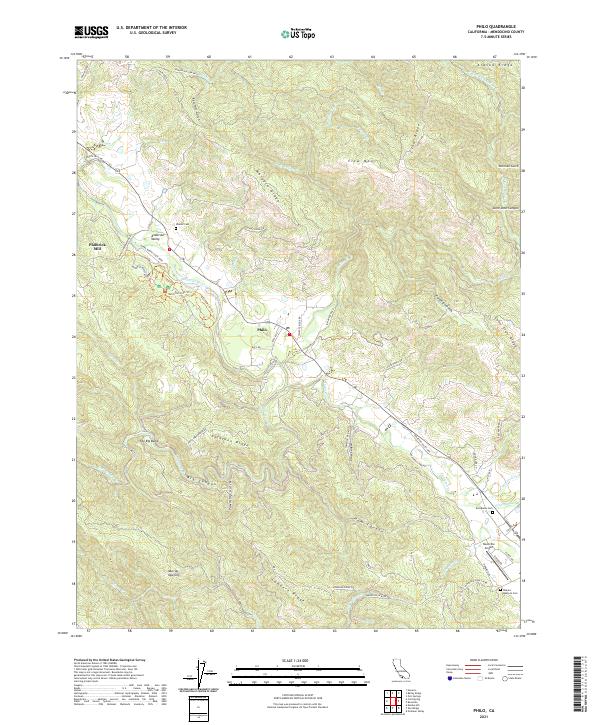 2021 Philo2021 Print · USGSAnderson Valley and the surrounding Mendocino ridges are captured here in a period of modern rural transition. Genealogists and local historians can trace family locations near Shields Cem, the historic Philbrick Mill, and the banks of the Navarro River.
 - 2021 Map of Leggett, 2021 Print
 2021 Leggett2021 Print · USGSCovers Mendocino County, including Leggett, Cummings, and other nearby areas
 - 2021 Map of Covelo East, 2021 Print
 2021 Covelo East2021 Print · USGSThe Round Valley floor meets the steep ridges of the Mendocino National Forest in this modern survey of eastern Covelo. Genealogists and local historians can trace legacy sites like the Round Valley Reservation Headquarters Cem and Nome Lackee Cem.
 - 2021 Map of Iron Peak, 2021 Print
 2021 Iron Peak2021 Print · USGSMendocino County's high country and river canyons are documented here in the early twenty-first century. Researchers can trace remote settlements and geological landmarks from Spyrock to Woodman, or locate specific features like Gas Mine Ridge and Grapevine Spring.
 - 2021 Map of Albion, 2021 Print
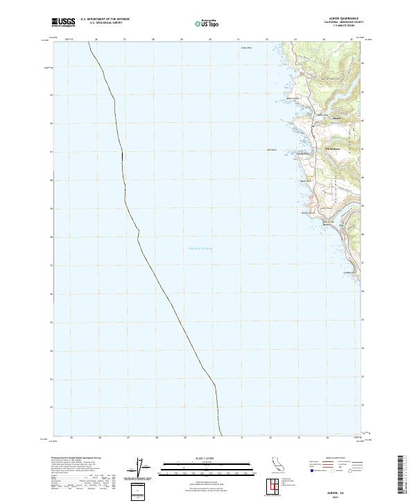 2021 Albion2021 Print · USGSThe Mendocino coast at the start of the 2020s shows a landscape of river-carved ridges and seaside settlements. Trace the coastal roads to reach Whitesboro, Albion Flat, and the distinct Arch of the Navarro at the mouth of the Navarro River.
 - 2021 Map of Bell Springs, 2021 Print
 2021 Bell Springs2021 Print · USGSMendocino and Trinity counties meet along these high ridges in the early 2020s, showing a landscape of isolated ranch roads and peaks. Researchers can trace the path of Bell Springs Rd past landmarks like Camel Rock and the settlement at Bell Springs.
 - 2021 Map of Boonville, 2021 Print
 2021 Boonville2021 Print · USGSBoonville and the surrounding Mendocino County ridges are documented here in the early twenty-first century as the local road network weaves through the high timber country. Researchers can trace land features like Shoemake Opening, the waters of Soda Spring, and family-named routes such as Rossi Rd.
 - 2021 Map of Comptche, 2021 Print
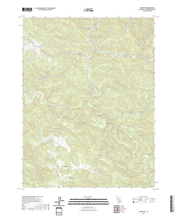 2021 Comptche2021 Print · USGSThe mountain settlement of Comptche and the surrounding Mendocino ridges are captured here in the early twenty-first century. Researchers can trace the drainage of the Albion River and locate historic forest clearings like Nathaniel Smith Opening and McDuffy Opening.
 - 2021 Map of Fort Bragg, 2021 Print
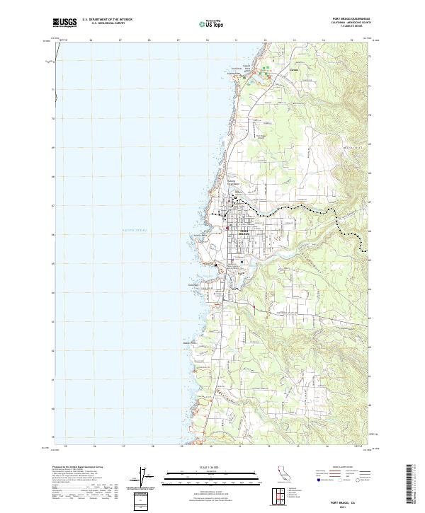 2021 Fort Bragg2021 Print · USGSFort Bragg and the Mendocino coast are documented here in the early twenty-first century as the region balances its industrial roots with parkland and education. Researchers can locate Rose Memorial Park Cem, the Fort Bragg Airport, and the historic fishing hub of Noyo.
 - 2021 Map of Sherwood Peak, 2021 Print
 2021 Sherwood Peak2021 Print · USGSMendocino County's high ridges and river headwaters are documented in this 2021 study of the Coast Range. Researchers can trace historical routes like Ft Bragg-Sherwood Rd and find landmarks such as Sherwood Peak and Case Opening.
 - 2021 Map of Updegraff Ridge, 2021 Print
 2021 Updegraff Ridge2021 Print · USGSThe Mendocino and Trinity county border comes alive in this survey of the river canyons and high ridgelines during the early 2020s. Trace the remote settlements of Island Mtn and Spyrock or follow the winding course of the Eel River.
 - 2021 Map of Brushy Mountain, 2021 Print
 2021 Brushy Mountain2021 Print · USGSMendocino County's high forest ridges and deep valleys are documented in this recent survey of the coastal range. Researchers can trace the winding Hearst Willits Rd through Low Gap and locate landmarks like Brushy Lake and the Eel Wild and Scenic River.
Showing maps 1-25 of 92
Top cities of Mendocino County
- Ukiah historical maps
- Fort Bragg historical maps
- Willits historical maps
- Redwood Valley historical maps
- Talmage historical maps
- Talmage historical maps
See more
Frequently asked questions
- What are the different types of historical maps available for Mendocino County?
- What is the oldest map of Mendocino County?
- Where can I purchase historical maps of Mendocino County for my home or office?
- Where can I download high-res historical maps of Mendocino County?
- Are there historical topographic maps available for Mendocino County?
- Is there historical aerial imagery available for Mendocino County?
- Where are historical maps of Mendocino County sourced from?