1940s Maps of Georgia
Explore 136 historic maps of Georgia from the 1940s. These maps offer a rare glimpse into what life looked like during the 1940s — showing old roads, neighborhoods, homes, and landmarks that have changed or disappeared over time.
Whether you're researching your family's past, planning a metal detecting trip, or studying how Georgia's landscape evolved across the 1940s, these high-resolution maps are a powerful tool for exploring the history of this region.
- Focus on a specific era: All maps on this page are from the 1940s, giving you a focused view of this time period.
- See what’s changed: Compare century-old streets, trails, and buildings to today's modern landscape using overlays and satellite layers.
- Research with precision: Use these maps for genealogy, historical research, land use analysis, or educational projects.
- View, download, or print: Maps are fully viewable online in high resolution, and can be downloaded or printed for your own records.
Start exploring Georgia's history through authentic maps from the 1940s. This is your window into the past.
Georgia maps
(136)- 1941 Map of Osborn
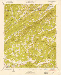
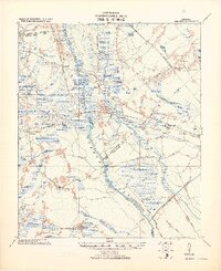
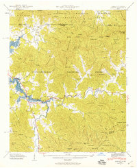 1941 Osborn1941 Print · USGSTowns County, Georgia, and Clay County, North Carolina, appear here during the creation of the Hiwassee River reservoir system. Genealogists and hikers can trace the Appalachian Trail through the mountains or find local landmarks like Osborn, Ivy Mount Cem, and Lower Hightower Sch.2 unique versions available
 - 1941 Map of Hiawassee
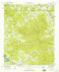
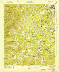
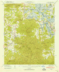 1941 Hiawassee1941 Print · USGSThe Georgia-North Carolina borderlands appear here in the early 1940s, just as the landscape was being reshaped by the Chatuge Lake reservoir. Researchers can trace ancestral locations at Wood Grove Cem, Ledford Chapel, and the now-submerged areas near Friendship.2 unique versions available
 - 1941 Map of Mineral Bluff, 1956 Print
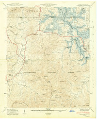
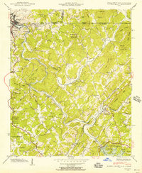 1941 Mineral Bluff1956 Print · USGSThe tri-state borderlands of Georgia, Tennessee, and North Carolina come alive in the early 1940s as the river-and-rail economy hums near Mineral Bluff. Genealogists and researchers can locate the Galloway Cem, trace the Louisville and Nashville Railroad, and find the CCC Camp 3467 TVA 29 site.4 unique versions available
 - 1941 Map of Epworth, 1957 Print
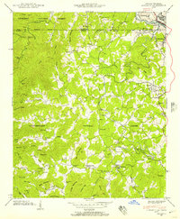 1941 Epworth1957 Print · USGSThe Tennessee-Georgia state line and the industrial copper basin are captured here in the early 1940s. Genealogists and historians can trace family landmarks like Hipp Chapel, Patterson Mill, and the small settlement of Madola along the Fightingtown Creek.3 unique versions available
 - 1941 Map of Clarks Hill, 1957 Print
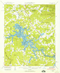
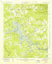
 1941 Clarks Hill1957 Print · USGSThe Savannah River valley remained a landscape of ferries and river-to-rail commerce just before the era of major dam construction. Genealogists and historians can trace family roots through numerous rural landmarks like Cary Hill Ch, Modoc, and Gilchrist Ferry.2 unique versions available
 - 1941 Map of Culberson, 1958 Print
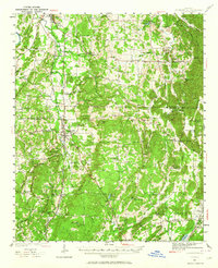
 1941 Culberson1958 Print · USGSThe borderlands of Georgia and North Carolina are captured here in the early 1940s, showing a landscape defined by mountain ridges and valley mills. Researchers can trace the Louisville and Nashville rail line through Culberson or locate family landmarks like Paris Cem and Loving Sch.4 unique versions available
 - 1941 Map of Gumlog, 1960 Print
 1941 Gumlog1960 Print · USGSThe mountain valleys of Union County appear here just as the landscape was changing with the creation of Nottely Lake. Genealogists and local historians can trace family-named sites like Many Forks Ch, Owenby Mill, and the Pleasant Hill Cem.2 unique versions available
 - 1941 Map of Ivylog, 1960 Print
 1941 Ivylog1960 Print · USGSThe Georgia and North Carolina borderlands appear here in the early 1940s as the Tennessee Valley Authority creates the new Nottely Lake. Genealogists can trace old homesteads and local institutions like the Ivylog Cem, Bethany Church, and Davenport Mill before the valley's landscape was forever changed.2 unique versions available
 - 1941 Map of Adairsville, 1964 Print
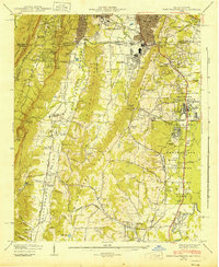
 1941 Adairsville1964 Print · USGSAdairsville and the rural borderlands of Gordon and Bartow counties are captured here just before the mid-century. Genealogists can trace family roots at Concord Cem, visit the Corra Harris Home, or locate old schoolhouses like Plainview Sch and Donaldson Sch.
 - 1942 Map of Meldrim
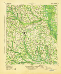
 1942 Meldrim1942 Print · USGSThe Ogeechee River corridor and its railway junctions are captured here in a series of surveys finalized just before the mid-century. Researchers can trace the layout of early settlements like Meldrim and Ellabel or locate ancestral sites at Miller Chapel and Zion Church.
 - 1942 Map of Epworth
 1942 Epworth1942 Print · USGSThe Georgia-Tennessee border comes alive in the early 1940s, showing the rugged mountain corridor between McCaysville and Epworth. Researchers can trace old mountain homesteads, country schools like Payne Sch, and historic local landmarks such as Higdon Store and Patterson Mill.
 - 1942 Map of Hiawassee
 1942 Hiawassee1942 Print · USGSTowns County and the North Carolina borderlands are captured during the 1940s transformation of the river valley. Genealogists and historians can locate family landmarks like Townsend Mill, Wood Grove Cem, and Lower Bell Creek Sch as the Chatuge Reservoir began to form.2 unique versions available
 - 1942 Map of Ivylog
 1942 Ivylog1942 Print · USGSUnion County, Georgia, was undergoing a massive transformation in the early 1940s as the Tennessee Valley Authority reshaped the landscape. Researchers can trace the original river course and emerging shoreline of the Nottely Reservoir while locating family landmarks like Ivylog Cem and Lance Mill.
 - 1942 Map of Clarks Hill
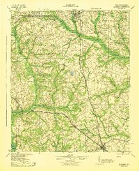
 1942 Clarks Hill1942 Print · USGSThe Savannah River valley along the South Carolina and Georgia border comes alive in this survey from the era of river ferries and local rail. Genealogists can trace family landmarks like Hosannah Church, Dents Ferry, and the Flat Rock School.
 - 1942 Map of Savannah
 1942 Savannah1942 Print · USGSCoastal Georgia and the South Carolina borderlands come alive in this wartime survey of the Savannah riverfront. Genealogists and historians can trace industrial housing at Port Wentworth Colored Village, river landmarks like Fort Jackson, and the footprint of the Ogeechee Canal.
 - 1942 Map of Moniac
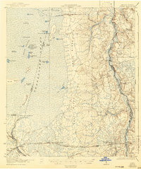 1942 Moniac1942 Print · USGSThe Georgia-Florida borderlands were defined by the wilderness of the Okefenokee Swamp and the tracks of the Georgia Southern and Florida railroad. Genealogists and historians can locate old landmarks like Olivers Mill, Deep Creek Church, and several rural schools including Chesser School and Dunn Creek School.2 unique versions available
 - 1942 Map of Culberson
 1942 Culberson1942 Print · USGSThe Georgia and North Carolina borderlands come alive in the early 1940s, revealing a landscape of mountain ridges and family-run mills. Genealogists can trace rural roots at Paris Cem or locate the numerous schoolhouses and churches like Hemp Sch and Zion Hill Ch.2 unique versions available
 - 1942 Map of Gumlog
 1942 Gumlog1942 Print · USGSThe Georgia and North Carolina borderlands are caught in detail during the early 1940s as the Nottely River valley began its transformation. Genealogists and local historians can trace family roots through Smyrna Sch, Caldwell Cem, and the milling history at Owenby Mill.2 unique versions available
 - 1942 Map of Fort Oglethorpe, 1946 Print
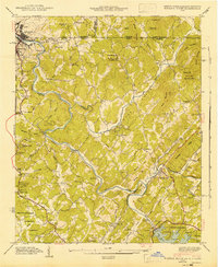
 1942 Fort Oglethorpe1946 Print · USGSThe Tennessee-Georgia borderlands are captured here during the early 1940s, highlighting the transition from historic battlefields to growing residential communities. Genealogists and historians can trace family-named sites like Snodgrass House, McCallie Lake, and Lee and Gordon Mill.3 unique versions available
 - 1943 Map of Pineland
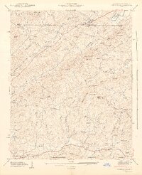
 1943 Pineland1943 Print · USGSCoastal South Carolina settlements between Hampton and Jasper counties are captured here in the early 1940s. Genealogists can trace family footprints through numerous rural landmarks like Highsmith Sawmill, Pineland Club, and Nixville Sch.2 unique versions available
 - 1943 Map of Brooklet
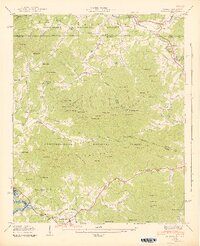
 1943 Brooklet1943 Print · USGSBulloch and Effingham Counties come alive in the early 1940s, showing a landscape of small farms and riverside landings. Genealogists can locate family landmarks like Knight Sch, Black Creek Ch, and the crossings along the Ogeechee River.
 - 1943 Map of Allendale
 1943 Allendale1943 Print · USGSCoastal plain settlements and timberlands thrive along the Salkehatchie River in the early 1940s as rail lines connect rural communities. Genealogists can trace family-named landmarks and institutions like Chaney Grove Mill, Hercules School, and Siloam Ch.
 - 1943 Map of Hardeeville
 1943 Hardeeville1943 Print · USGSCoastal South Carolina and Georgia meet along the river in the 1940s, showing a landscape shaped by tidewater swamps and early rail corridors. Researchers can trace historic river access at Becks Ferry or locate the Indian Mound near Purrysburg.
 - 1943 Map of Mineral Bluff
 1943 Mineral Bluff1943 Print · USGSFannin County and the tri-state border region are shown here in the early 1940s, just after the completion of the Blue Ridge Dam. Researchers can trace family history through sites like Galloway Cem or follow the Louisville and Nashville tracks through Mineral Bluff.
 - 1943 Map of Egypt
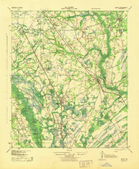 1943 Egypt1943 Print · USGSEffingham County during the mid-forties shows a landscape shaped by river landings and the timber-hauling rail lines. Genealogists and historians can trace the positions of family-named landmarks like St Peters Bluff and rural institutions such as Laurel Hill Ch or Midway Sch.
Showing maps 1-25 of 136
Top cities of Georgia
- Atlanta historical maps
- Augusta historical maps
- Columbus historical maps
- Macon historical maps
- Savannah historical maps
- Athens historical maps
See more
Top counties of Georgia
- Fulton County historical maps
- Gwinnett County historical maps
- Cobb County historical maps
- DeKalb County historical maps
- Chatham County historical maps
- Clayton County historical maps
See more
Frequently asked questions
- What are the different types of historical maps available for Georgia?
- What is the oldest map of Georgia?
- Where can I purchase historical maps of Georgia for my home or office?
- Where can I download high-res historical maps of Georgia?
- Are there historical topographic maps available for Georgia?
- Is there historical aerial imagery available for Georgia?
- Where are historical maps of Georgia sourced from?