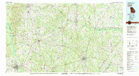
1980s Maps of Georgia
Explore 159 historic maps of Georgia from the 1980s. These maps offer a rare glimpse into what life looked like during the 1980s — showing old roads, neighborhoods, homes, and landmarks that have changed or disappeared over time.
Whether you're researching your family's past, planning a metal detecting trip, or studying how Georgia's landscape evolved across the 1980s, these high-resolution maps are a powerful tool for exploring the history of this region.
- Focus on a specific era: All maps on this page are from the 1980s, giving you a focused view of this time period.
- See what’s changed: Compare century-old streets, trails, and buildings to today's modern landscape using overlays and satellite layers.
- Research with precision: Use these maps for genealogy, historical research, land use analysis, or educational projects.
- View, download, or print: Maps are fully viewable online in high resolution, and can be downloaded or printed for your own records.
Start exploring Georgia's history through authentic maps from the 1980s. This is your window into the past.
Georgia maps
- 1980 Map of Eulonia
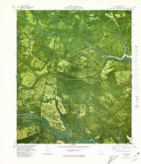
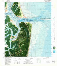
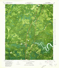 1980 Eulonia1980 Print · USGSMcIntosh County’s coastal wetlands and timber lands are captured here in the late twentieth century, showing the transition from rail-side hamlets to riverside communities. Researchers can trace family sites and local history at Mc Intosh Cem, Shorter Chapel, and the community at Bellville Point.
 - 1980 Map of Richmond Hill
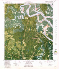
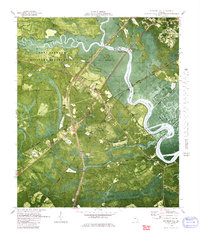 1980 Richmond Hill1980 Print · USGSThe Ogeechee River corridor is shown here as it transitioned into the 1980s, revealing a landscape of military reserves and old coastal canals. Trace family roots and local history at Byran Neck Ch, Strathy Hall Cem, and the old settlement at Burroughs.
 - 1980 Map of Garden City
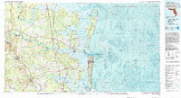
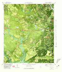 1980 Garden City1980 Print · USGSCoastal Georgia's industrial and rail hubs are in full view during the mid-seventies, from the Savannah River terminals to the edge of Pooler. Genealogists and local historians can trace family-named sites like Waldburgh Cem, Rossignol Hill, and Silk Hope.2 unique versions available
 - 1980 Map of Kingsland
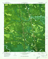 1980 Kingsland1980 Print · USGSCoastal Camden County is captured in the early 1970s through this detailed orthophotomap, showing the Georgia shoreline’s dense wetlands and timberlands. Researchers can locate small settlements like Seals and Kinlaw among the winding coastal marshes and creek beds.
 - 1980 Map of Ridgeville
 1980 Ridgeville1980 Print · USGSCoastal McIntosh County is documented here during the late seventies, showing the intricate tidal marshes and river islands surrounding Darien. Genealogists and historians can trace family roots through sites like Oglethorpe Academy, Ashantilly, and numerous country burial grounds like Powell Cem.
 - 1980 Map of Limehouse
 1980 Limehouse1980 Print · USGSJasper County tidelands and the edges of the Savannah riverfront appear here in the early eighties. Genealogists can trace local roots through sites like Chisolm Cem, Jonesville Ch, and the landings at Cook Landing.2 unique versions available
 - 1980 Map of Port Wentworth
 1980 Port Wentworth1980 Print · USGSCoastal Georgia in the late seventies is captured here at the intersection of heavy industry and wilderness. Trace the rail lines of the Central of Georgia or find family landmarks like Mt Marriah Ch and Cherokee Hill Cem.2 unique versions available
 - 1980 Map of Riceboro
 1980 Riceboro1980 Print · USGSThe Georgia coastal lowcountry near the Liberty and McIntosh county line comes into focus during the late seventies. Researchers can trace rural lineages through sites like First African Ch, the Panda Cem, and old rail stops at Brewsters Siding.
 - 1980 Map of Bladen
 1980 Bladen1980 Print · USGSThe coastal wetlands of Glynn and Camden Counties are captured here during the 1970s, showcasing a landscape of riverine trade and timber. Family historians can locate Magnolia Cemetery or trace the old paths of Shingle Mill Road and the Seaboard Coast Line.2 unique versions available
 - 1980 Map of Okefenokee Swamp, 1981 Print
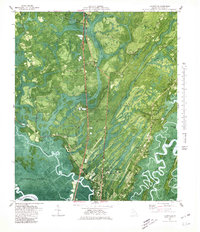
 1980 Okefenokee Swamp1981 Print · USGSThe Georgia-Florida borderlands come to life in the early 1980s, centered on the immense wilderness of the Okefenokee Swamp. Genealogists and historians can trace rail-stop settlements like Fargo and Fruitland or explore the interior geography of Billys Island and Trail Ridge.
 - 1980 Map of Athens, 1981 Print
 1980 Athens1981 Print · USGSNorth Georgia in the early eighties exhibits a landscape of growing university towns and deep-rooted rail hubs. Genealogists can trace family lands near Social Circle or Watkinsville while following the routes of the Central of Georgia and the Appalachee River.2 unique versions available
 - 1980 Map of Clark Hill Lake, 1981 Print
 1980 Clark Hill Lake1981 Print · USGSThe Georgia and South Carolina borderlands in the early eighties were defined by the expansive Clark Hill Lake and the winding Savannah River. Genealogists and historians can trace rail lines like the Georgia Railroad, find the De La Howe State School, and locate rural centers like Tignall and Appling.
 - 1980 Map of Harrietts Bluff, 1981 Print
 1980 Harrietts Bluff1981 Print · USGSCoastal Camden County is captured here during a period of significant military and recreational development in the early eighties. Genealogists and local historians can trace family-named sites like Simmons Bluff and Mush Bluff, or locate the John H McIntosh Sugar Mill Site Ruins.2 unique versions available
 - 1980 Map of Wassaw Sound, 1983 Print
 1980 Wassaw Sound1983 Print · USGSThe Georgia coast in the early eighties reveals a fascinating mix of strategic fortifications and preserved barrier islands. Trace the marshes around Wilmington Island or locate the grounds of Fort Pulaski National Monument and the Wassaw National Wildlife Refuge.2 unique versions available
 - 1980 Map of Columbia, 1984 Print
 1980 Columbia1984 Print · USGSShelby County's civic center and surrounding hill country are captured here just as the modern era began to reshape traditional landscapes. Local historians can trace family roots at Pine Lawn Gardens and Johnson Cem or follow the rail lines through Nelson.
 - 1981 Map of Fernandina Beach
 1981 Fernandina Beach1981 Print · USGSCoastal Florida and Georgia meet at this maritime crossroads in the early eighties, where river and ocean currents converge. Trace the historic fortifications of Fort Clinch and the layout of Old Fernandina alongside the Amelia Island Lighthouse.4 unique versions available
 - 1981 Map of Lake City
 1981 Lake City1981 Print · USGSNorth Florida and South Georgia are mapped in the early eighties as the region balanced forestry with growing infrastructure. Genealogists can trace family names and locations from Live Oak to Macclenny, or find cultural landmarks like the Stephen Foster State Folk Culture Center.2 unique versions available
 - 1981 Map of Valdosta
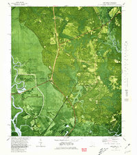
 1981 Valdosta1981 Print · USGSCrossing the Georgia and Florida border in the early eighties, this survey captures the agricultural and military landscape of the coastal plain. Genealogists and historians can trace the rail-linked growth of Valdosta and Quitman or find rural landmarks like New Hope Church and Lake Miccosukee.
 - 1981 Map of Milledgeville
 1981 Milledgeville1981 Print · USGSMiddle Georgia in the early eighties shows a landscape shaped by major reservoirs and deep forests. Genealogists and historians can trace the rail networks of the Southern and Central of Georgia through towns like Monticello and Eatonton.2 unique versions available
 - 1981 Map of Dublin
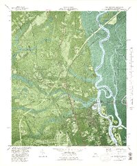
 1981 Dublin1981 Print · USGSEast Georgia in the early eighties shows a landscape defined by its river basins and a persistent rail network. Genealogists and historians can trace family roots through historic town centers like Sandersville, Swainsboro, and Louisville or follow the Old Railroad Grade.
 - 1981 Map of Chickamauga, 1982 Print
 1981 Chickamauga1982 Print · USGSThe tri-state border region of Georgia, Alabama, and Tennessee comes into focus during the early eighties, defined by the towering ridges of the Appalachians. Historians can trace the preserved grounds of Chickamauga and Chattanooga National Military Park and old rail stops like Rising Fawn or Sulphur Springs.2 unique versions available
 - 1981 Map of Fernandina Beach, 1982 Print
 1981 Fernandina Beach1982 Print · USGSThe coastal borderlands of Georgia and Florida are captured here in the early eighties, from the barrier islands to the rail towns of the interior. Genealogists and historians can trace family-named bluffs and sites like Franklintown, Dungeness Wharf, and St Marys Historical Park.3 unique versions available
 - 1981 Map of Dothan, 1982 Print
 1981 Dothan1982 Print · USGSSoutheast Alabama and the tri-state border region are shown here in the early 1980s as the area thrived on military and rail connectivity. Researchers can trace historic transit lines like the Hartford and Slocomb railroad or locate family roots in Ozark, Headland, and Geneva.
 - 1981 Map of Cartersville, 1982 Print
 1981 Cartersville1982 Print · USGSNorth Georgia at the start of the eighties shows a landscape defined by massive reservoirs and historic rail corridors. Researchers can trace the heritage of the Etowah Indian Mounds or locate old junctions along the Southern Railway and Seaboard Coast Line.2 unique versions available
 - 1981 Map of Camilla, 1982 Print
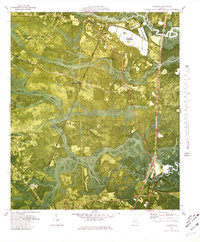
 1981 Camilla1982 Print · USGSSouthwest Georgia in the early 1980s is defined by the winding Flint River and the ancient legacy of Kolomoki Mounds State Park. Researchers can trace the agricultural and rail economy through junctions like Blakely, Pelham, and the rail lines of the Central of Georgia.2 unique versions available
Showing maps 1-25
Top cities of Georgia
- Atlanta historical maps
- Augusta historical maps
- Columbus historical maps
- Macon historical maps
- Savannah historical maps
- Athens historical maps
See more
Top counties of Georgia
- Fulton County historical maps
- Gwinnett County historical maps
- Cobb County historical maps
- DeKalb County historical maps
- Chatham County historical maps
- Clayton County historical maps
See more
Frequently asked questions
- What are the different types of historical maps available for Georgia?
- What is the oldest map of Georgia?
- Where can I purchase historical maps of Georgia for my home or office?
- Where can I download high-res historical maps of Georgia?
- Are there historical topographic maps available for Georgia?
- Is there historical aerial imagery available for Georgia?
- Where are historical maps of Georgia sourced from?