1970s Maps of Georgia
Explore 995 historic maps of Georgia from the 1970s. These maps offer a rare glimpse into what life looked like during the 1970s — showing old roads, neighborhoods, homes, and landmarks that have changed or disappeared over time.
Whether you're researching your family's past, planning a metal detecting trip, or studying how Georgia's landscape evolved across the 1970s, these high-resolution maps are a powerful tool for exploring the history of this region.
- Focus on a specific era: All maps on this page are from the 1970s, giving you a focused view of this time period.
- See what’s changed: Compare century-old streets, trails, and buildings to today's modern landscape using overlays and satellite layers.
- Research with precision: Use these maps for genealogy, historical research, land use analysis, or educational projects.
- View, download, or print: Maps are fully viewable online in high resolution, and can be downloaded or printed for your own records.
Start exploring Georgia's history through authentic maps from the 1970s. This is your window into the past.
Georgia maps
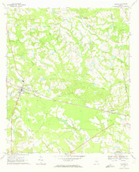
- 1970 Map of Hooker, 1972 Print
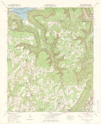
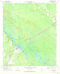
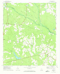
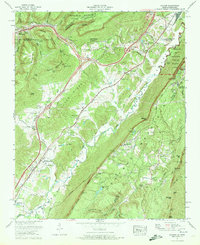 1970 Hooker1972 Print · USGSThe Tennessee-Georgia borderlands come to life in the early seventies, where the massive profiles of Lookout Mountain and Raccoon Mountain meet. Genealogists and local historians can trace family-named sites like Bates Cem, Sarah Chapel, and the small community of New England.
 - 1970 Map of Gordon, 1972 Print
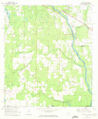
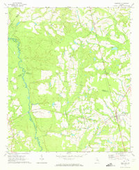
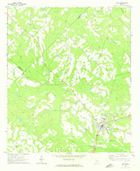
 1970 Gordon1972 Print · USGSIn the early 1970s, the river border between Alabama and Georgia balanced traditional river landings with emerging industrial infrastructure. Researchers can trace family roots through sites like St Pauls Ch and Carver Sch, or locate the Seaboard Coast Line rail corridor.3 unique versions available
 - 1970 Map of Columbia NE, 1972 Print
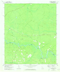
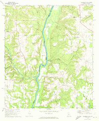 1970 Columbia NE1972 Print · USGSThe Chattahoochee River forms the border between Alabama and Georgia in this early 1970s view of the rural river valley. Researchers can trace historic river access at Gilbert Landing or locate local family landmarks like Bellevue Cem Ch and Haleburg.
 - 1970 Map of Saffold, 1972 Print
 1970 Saffold1972 Print · USGSThe tri-state border of Alabama, Georgia, and Florida comes alive in the early seventies as a landscape of riverine swamps and rural hamlets. Genealogists can locate family landmarks like Pilgrims Rest Ch or trace the old rail stops at Alaga and Saffold.2 unique versions available
 - 1970 Map of New Home, 1972 Print
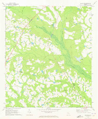
 1970 New Home1972 Print · USGSThe tri-state border of Georgia, Alabama, and Tennessee comes alive in the early seventies as the Tennessee River valley meets the coal-rich ridges. Genealogists and historians can trace family roots at Reeves Cem or Stephens Cem, and locate landmarks like Nickajack Cave and Cole City.2 unique versions available
 - 1970 Map of Columbia, 1972 Print
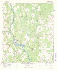
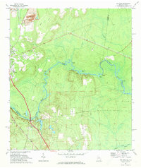
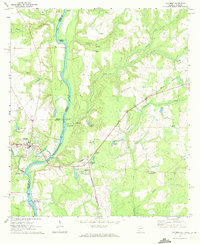 1970 Columbia1972 Print · USGSThe Chattahoochee River corridor at the start of the 1970s shows a landscape of river-based industry and rural community life. Genealogists and historians can locate family landmarks like Grier Cem, Freeman Chapel, and the George W Andrews Lock and Dam.2 unique versions available
 - 1970 Map of Cobbtown, 1973 Print
 1970 Cobbtown1973 Print · USGSSoutheast Georgia in the early seventies reveals a landscape of tight-knit rural communities and river-bottom lands. Genealogists can trace family roots at Sunlight Cem and Old Reedy Creek Cem, or locate landmarks like Aline and Cobbtown.2 unique versions available
 - 1970 Map of Kings Ferry, 1973 Print
 1970 Kings Ferry1973 Print · USGSThe Georgia-Florida borderlands along the St Marys River are documented here during the early 1970s. Local historians and genealogists can locate several riverfront landings and country churches, including Blood Landing, Kings Ferry, and Mt Olive Ch.3 unique versions available
 - 1970 Map of Collins, 1973 Print
 1970 Collins1973 Print · USGSThe Tattnall County countryside around Collins and Manassas appears here during the early 1970s, linked by the rail corridor. Genealogists and local historians can trace family roots through numerous sites like Old Tippins Cem and Rodgers Ch Cem.
 - 1970 Map of Johnson Corner, 1973 Print
 1970 Johnson Corner1973 Print · USGSToombs County in the early 1970s is a landscape of rural crossroads and family homesteads. Genealogists can trace local heritage through several burial sites and churches, including the St Matthew Ch Cem, Pittman Cem, and the central hub at Toombs Central.2 unique versions available
 - 1970 Map of Scotland, 1973 Print
 1970 Scotland1973 Print · USGSThe Georgia wiregrass country around the turn of the 1970s shows a landscape shaped by the Southern and Seaboard Coast Line railroads. Researchers can trace local lineages through Hinson and McDuffie cemeteries or locate the old Drive-in Theater near Scotland.2 unique versions available
 - 1970 Map of Glenwood, 1973 Print
 1970 Glenwood1973 Print · USGSWheeler County was a landscape of river-bend forests and rural rail junctions during the early seventies. Genealogists and local historians can trace the paths between Glenwood and Stuckey, identifying family sites like the Troop Grave and Boatwright Cem.
 - 1970 Map of Doctortown, 1973 Print
 1970 Doctortown1973 Print · USGSThe Altamaha River bottomlands in the early seventies reveal a world of interconnected swamps and river-dependent industry. Genealogists and historians can locate Doctortown and Ludowici, or trace landmarks like the Elem Ch and the Drive-in Theater.3 unique versions available
 - 1970 Map of Metter, 1973 Print
 1970 Metter1973 Print · USGSInland Georgia in the early seventies centers on the growing city of Metter and its connection to the Central of Georgia railroad. Researchers can trace rural lineages through family landmarks like Olliff Cem and Rosemary Ch, or locate local hubs like the Drive-in Theater.2 unique versions available
 - 1970 Map of Alston, 1973 Print
 1970 Alston1973 Print · USGSSoutheast Georgia's rural timber and farm country comes into focus in the 1970s, as the Central of Georgia rail line passes through Alston and Uvalda. Genealogists can trace family roots at Galbreath Cem, Mt Calvary Ch, and Old Cedar Crossing Cem.
 - 1970 Map of Oak Park SW, 1973 Print
 1970 Oak Park SW1973 Print · USGSSoutheast Georgia in the early 1970s reveals a patchwork of rural cemeteries and cross-county rail lines at the intersection of Montgomery and Toombs counties. Researchers can trace family history through sites like Mosleytown, Mc Leod Grave, and Blockers Chapel.
 - 1970 Map of Covena, 1973 Print
 1970 Covena1973 Print · USGSCoastal plain settlements and timberlands along the Ohoopee River define this Georgia landscape in the early seventies. Genealogists can trace family landmarks and rural communities through sites like Thigpen Chapel, Wilkes Cem, and the Old Railroad Grade.2 unique versions available
 - 1970 Map of Metter SE, 1973 Print
 1970 Metter SE1973 Print · USGSCandler County in the early seventies is a landscape of winding river bottoms and rural congregations. Genealogists and local historians can trace the foundations of the community through landmarks like Primitive Grove Ch, Everitt Cem, and Metter Airport.2 unique versions available
 - 1970 Map of Boulogne, 1973 Print
 1970 Boulogne1973 Print · USGSThe Georgia-Florida border comes alive in the early seventies as the St Marys River winds through the wetlands of Camden and Nassau counties. Genealogists and local historians can trace the rail-side growth of Folkston and Boulogne, or locate the Camp Pinckney Ch and Bethune Middle Sch.3 unique versions available
 - 1970 Map of Alamo, 1973 Print
 1970 Alamo1973 Print · USGSThe town of Alamo sits at a historical rail crossroads in the early seventies, surrounded by a landscape of creeks and rural congregations. Genealogists can locate numerous family-named burial sites and churches, including Mt Carmel Ch, Union Springs Cems, and McRae Cem.2 unique versions available
 - 1970 Map of Mount Vernon, 1973 Print
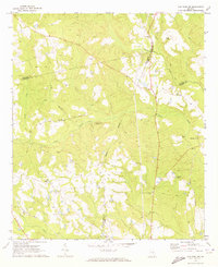
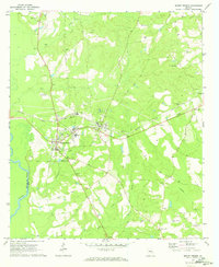 1970 Mount Vernon1973 Print · USGSThe Montgomery County seat and surrounding timberlands are documented here just as the new decade began. Researchers can trace family history through sites like Brewton Parker College, Peterson Cem, and the County Training Sch.2 unique versions available
 - 1970 Map of Nunez, 1973 Print
 1970 Nunez1973 Print · USGSEmanuel County in the early seventies shows a rural Georgia landscape shaped by the Ohoopee River and the Central of Georgia rail line. Genealogists can trace family roots at Slater Cem and Youmans Cem, or locate the old Lexsy Sch and Lombard settlement.3 unique versions available
 - 1970 Map of Jesup West, 1973 Print
 1970 Jesup West1973 Print · USGSWayne County, Georgia, underwent significant modernization in the 1970s as the rail hub of Jesup expanded westward. Genealogists and historians can trace community roots through numerous country churches like Satilla Church and rural landmarks such as the Jesup-Wayne County Airport.2 unique versions available
 - 1970 Map of Vidalia, 1973 Print
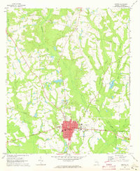
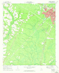
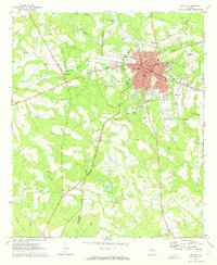 1970 Vidalia1973 Print · USGSIn the early 1970s, the rail crossroads at Vidalia remained the industrial and social heart of Toombs County. Researchers can trace the layout of small communities like Higgston and find many family-named landmarks including Johnson Cem and Allen Chapel.2 unique versions available
 - 1970 Map of Ohoopee, 1973 Print
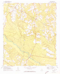
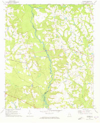 1970 Ohoopee1973 Print · USGSThe Toombs and Tatnall county line follows the winding river during the early 1970s. Genealogists can locate several family landmarks and community anchors like Saturday Cem, Little Flock Ch, and the rural settlement of Ohoopee.2 unique versions available
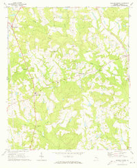
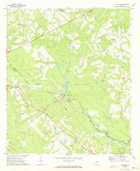
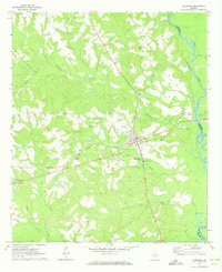
Showing maps 1-25
Top cities of Georgia
- Atlanta historical maps
- Augusta historical maps
- Columbus historical maps
- Macon historical maps
- Savannah historical maps
- Athens historical maps
See more
Top counties of Georgia
- Fulton County historical maps
- Gwinnett County historical maps
- Cobb County historical maps
- DeKalb County historical maps
- Chatham County historical maps
- Clayton County historical maps
See more
Frequently asked questions
- What are the different types of historical maps available for Georgia?
- What is the oldest map of Georgia?
- Where can I purchase historical maps of Georgia for my home or office?
- Where can I download high-res historical maps of Georgia?
- Are there historical topographic maps available for Georgia?
- Is there historical aerial imagery available for Georgia?
- Where are historical maps of Georgia sourced from?