1960s Maps of Georgia
Explore 250 historic maps of Georgia from the 1960s. These maps offer a rare glimpse into what life looked like during the 1960s — showing old roads, neighborhoods, homes, and landmarks that have changed or disappeared over time.
Whether you're researching your family's past, planning a metal detecting trip, or studying how Georgia's landscape evolved across the 1960s, these high-resolution maps are a powerful tool for exploring the history of this region.
- Focus on a specific era: All maps on this page are from the 1960s, giving you a focused view of this time period.
- See what’s changed: Compare century-old streets, trails, and buildings to today's modern landscape using overlays and satellite layers.
- Research with precision: Use these maps for genealogy, historical research, land use analysis, or educational projects.
- View, download, or print: Maps are fully viewable online in high resolution, and can be downloaded or printed for your own records.
Start exploring Georgia's history through authentic maps from the 1960s. This is your window into the past.
Georgia maps
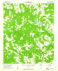
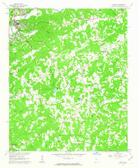
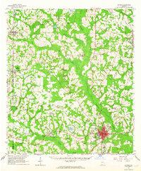
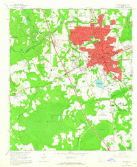
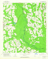
(250)- 1960 Map of Jacksonville
 1960 Jacksonville1960 Print · USGSCoastal Florida and Georgia meet in this mid-century portrait of a region shaped by naval power and the winding St Johns River. Researchers can trace the development of military sites like Cecil Field or locate historic rural landmarks such as Jerusalem Ch and Kings Ferry.
 - 1960 Map of Knoxville
 1960 Knoxville1960 Print · USGSThe Southern Appalachians come alive in the 1950s, showing the intersection of new national park tourism and deep-rooted mountain industry. Trace old rail lines like the Clinchfield RR and find high-altitude landmarks from Mt Le Conte to the Cherokee Indian Reservation.2 unique versions available
 - 1960 Map of Tallahassee
 1960 Tallahassee1960 Print · USGSThe Florida Panhandle and southern Georgia are captured here in the mid-twentieth century, showing a region defined by its rivers and military installations. Genealogists and historians can trace the growth of Tallahassee or locate coastal landmarks like the St Marks Lighthouse and Tyndall Air Force Base.
 - 1960 Map of Savannah
 1960 Savannah1960 Print · USGSCoastal Georgia and the South Carolina Lowcountry are captured in the late fifties, showcasing the intricate web of islands and tidal rivers before modern expansion. Researchers can trace the rail lines of the Atlantic Coast Line or locate sites like Parris Island, Beaufort, and the Tybee Lighthouse.
 - 1960 Map of Warthen NE, 1961 Print
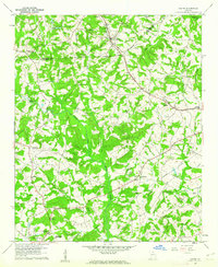
 1960 Warthen NE1961 Print · USGSThe rural borderlands of Washington and Hancock Counties are captured here in the early sixties, showing a landscape defined by millponds and country churches. Genealogists can trace family roots at Cummings Cem or locate community centers like Pine Hill Ch and Hamburgh Millpond.2 unique versions available
 - 1960 Map of Martin, 1962 Print
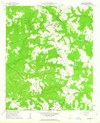
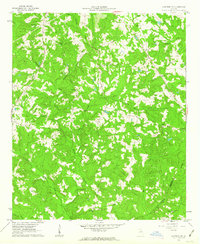
 1960 Martin1962 Print · USGSThe Georgia Piedmont in the early sixties remains a landscape of rail-side towns and rural churches connected by the Southern railroad. Genealogists can trace family footprints near Line Academy, the Carnesville Trade Sch, and Zion Hill Cem Ch.3 unique versions available
 - 1960 Map of Cohutta, 1962 Print
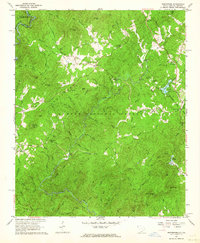
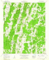 1960 Cohutta1962 Print · USGSWhitfield County and the Georgia-Tennessee border are detailed here in the early sixties, showing a landscape of forest ridges and rail-side towns. Genealogists can locate family landmarks like Prater Mill, South Cohutta Ch, and the Hoskins Cem.3 unique versions available
 - 1960 Map of Reed Creek, 1963 Print
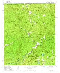
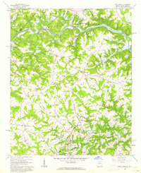 1960 Reed Creek1963 Print · USGSThe Georgia and South Carolina border is caught in a moment of transition during the 1960s as the Hartwell Reservoir fills the valley. Researchers can trace old family landmarks and rural congregations like Sharon Ch, Cleveland Cem, and the community of Maretts.3 unique versions available
 - 1961 Map of Augusta
 1961 Augusta1961 Print · USGSThe South Carolina lowcountry and CSRA appear here in the early sixties, during a period of massive military and industrial growth. Researchers can trace the development of the Savannah River Plant or locate legacy landmarks like Nelson Ferry and Magnolia Cemetery.2 unique versions available
 - 1961 Map of Savannah
 1961 Savannah1961 Print · USGSThe Georgia and South Carolina Lowcountry comes alive in this mid-century survey of coastal marshes, barrier islands, and river networks. Genealogists and historians can trace the paths of the Seaboard Air Line RR, locate family sites near Isle of Hope, or study the grounds of Fort Stewart Military Reservation.2 unique versions available
 - 1961 Map of Rome
 1961 Rome1961 Print · USGSNorthwest Georgia and neighboring Tennessee and Alabama are shown here at a moment of significant mid-century growth. Researchers can trace the rail networks of the Central of Georgia or locate landmarks within Chickamauga and Chattanooga Nat Military Park.
 - 1961 Map of Brunswick
 1961 Brunswick1961 Print · USGSThe Georgia coast at the start of the 1960s was a landscape of deep tidal marshes and growing military installations. Genealogists and historians can trace rail-linked towns like Limerick Station or explore coastal landmarks from Fort Frederica National Monument to Sapelo Island.
 - 1961 Map of South Canton, 1963 Print
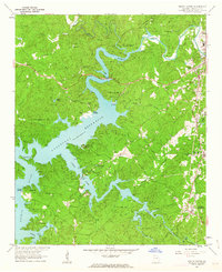 1961 South Canton1963 Print · USGSCherokee County enters a new era of recreation and industry in the early sixties as the reservoir waters reshape the local valleys. Researchers can trace the Louisville and Nashville rail line through Holly Springs or locate rural landmarks like Sutallee and Fields Chapel.4 unique versions available
 - 1961 Map of Dover Bluff, 1963 Print
 1961 Dover Bluff1963 Print · USGSCoastal Georgia in the early sixties reveals a landscape of tidal marshes and river-bend settlements. Genealogists and historians can trace the Old Spanish Mission, the Indian Mounds, and rural congregations at Mt Sinai Ch and Ella Park Ch.
 - 1961 Map of Deepstep, 1963 Print
 1961 Deepstep1963 Print · USGSWashington and Hancock counties in the early sixties reveal a landscape of rural communities and emerging industrial pits. Genealogists and historians can trace family locations near Linton, Goat Town, and numerous churches like Bold Spring Church.3 unique versions available
 - 1961 Map of Allatoona Dam, 1963 Print
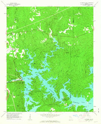 1961 Allatoona Dam1963 Print · USGSBartow and Cherokee counties are shown here just as the reservoir was becoming a regional recreation hub in the early sixties. Genealogists can trace old family burial grounds like Kay Cem and Goodson Cem, or locate rural landmarks like Stamp Creek Ch and Laffingal.4 unique versions available
 - 1961 Map of Warthen, 1963 Print
 1961 Warthen1963 Print · USGSWarthen and the surrounding Washington County countryside are captured here in the early sixties, showing a landscape of family farms and creek-side settlements. Researchers can locate many old burial sites and rural chapels, including Taylor Cem, Middle Hill Ch, and Base Spring Chapel.3 unique versions available
 - 1961 Map of Canton, 1963 Print
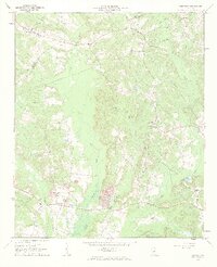
 1961 Canton1963 Print · USGSCherokee County in the early sixties centers on the industrial growth of Canton and the winding Etowah River. Local historians can trace family roots through numerous country landmarks like Pugh Cem, Carmichael Crossroads, and Indian Knoll Ch.4 unique versions available
 - 1961 Map of Warthen NW, 1963 Print
 1961 Warthen NW1963 Print · USGSThe rural landscape of Hancock and Washington Counties is captured here in the early sixties, showing a world of family farms and timber tracts. Researchers can locate numerous local landmarks including Knowles Chapel, Galilee Sch, and the Frasier Cem along the winding Buffalo Creek.2 unique versions available
 - 1961 Map of Hahira East, 1964 Print
 1961 Hahira East1964 Print · USGSIn the early sixties, this area north of Valdosta shows a landscape of traditional agriculture beginning to meet modern highway development. Genealogists can locate family landmarks like Passmore Cem, Jerusalem Ch, and the rural community at Mineola.4 unique versions available
 - 1961 Map of Whetstone, 1964 Print
 1961 Whetstone1964 Print · USGSOconee County's forested borderlands are captured here in the early sixties as the Blue Ridge foothills transition into the Chattooga River valley. Genealogists and historians can trace local landmarks like Long Creek Academy, the storied Stumphouse Tunnel, and the rural Mountain Rest community.4 unique versions available
 - 1961 Map of Satolah, 1964 Print
 1961 Satolah1964 Print · USGSThe Georgia and South Carolina borderlands meet in the early sixties within this detailed view of the Blue Ridge foothills. Researchers can locate remote family landmarks like Page Cem and Snyder Cem or trace the winding course of the Chattooga River.3 unique versions available
 - 1961 Map of Quitman, 1964 Print
 1961 Quitman1964 Print · USGSBrooks and Thomas counties are shown in the early sixties as a thriving rail-centered landscape. Genealogists can trace family names and local landmarks through sites like Robinson Cem, Simmon Hill Ch, and the mills at Bowen Millpond.
 - 1961 Map of Valdosta, 1965 Print
 1961 Valdosta1965 Print · USGSValdosta and its surrounding Lowndes County communities are captured in the early sixties as a thriving center of Georgia education and industry. Researchers can trace the footprints of Valdosta State College, locate family sites near Riverhill Cem, or follow the ATLANTIC COAST LINE through West Valdosta.4 unique versions available
 - 1961 Map of Hahira West, 1965 Print
 1961 Hahira West1965 Print · USGSBrooks and Lowndes counties in the early sixties reveal a landscape of rural schoolhouses and historic travel routes. Genealogists can locate family burial grounds and congregations like Miller Cem, Second Elizabeth Ch, and the Webb-Miller Sch along the Little River.2 unique versions available
Showing maps 1-25 of 250
Top cities of Georgia
- Atlanta historical maps
- Augusta historical maps
- Columbus historical maps
- Macon historical maps
- Savannah historical maps
- Athens historical maps
See more
Top counties of Georgia
- Fulton County historical maps
- Gwinnett County historical maps
- Cobb County historical maps
- DeKalb County historical maps
- Chatham County historical maps
- Clayton County historical maps
See more
Frequently asked questions
- What are the different types of historical maps available for Georgia?
- What is the oldest map of Georgia?
- Where can I purchase historical maps of Georgia for my home or office?
- Where can I download high-res historical maps of Georgia?
- Are there historical topographic maps available for Georgia?
- Is there historical aerial imagery available for Georgia?
- Where are historical maps of Georgia sourced from?