1920s Maps of Georgia
Explore 72 historic maps of Georgia from the 1920s. These maps offer a rare glimpse into what life looked like during the 1920s — showing old roads, neighborhoods, homes, and landmarks that have changed or disappeared over time.
Whether you're researching your family's past, planning a metal detecting trip, or studying how Georgia's landscape evolved across the 1920s, these high-resolution maps are a powerful tool for exploring the history of this region.
- Focus on a specific era: All maps on this page are from the 1920s, giving you a focused view of this time period.
- See what’s changed: Compare century-old streets, trails, and buildings to today's modern landscape using overlays and satellite layers.
- Research with precision: Use these maps for genealogy, historical research, land use analysis, or educational projects.
- View, download, or print: Maps are fully viewable online in high resolution, and can be downloaded or printed for your own records.
Start exploring Georgia's history through authentic maps from the 1920s. This is your window into the past.
Georgia maps
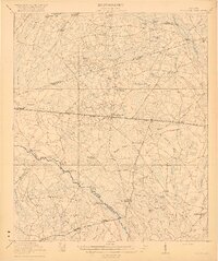
- 1920 Map of Hardeeville
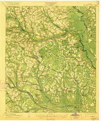
 1920 Hardeeville1920 Print · USGSThe Savannah River floodplain in the years following the Great War reveals a world of river landings and emerging rail towns. Genealogists and historians can trace the transition from water to rail through features like Becks Ferry, Hardeeville, and the Indian Mound.
 - 1920 Map of Ellenton
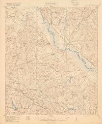
 1920 Ellenton1920 Print · USGSThe Savannah River valley in the years following the Great War reveals a landscape of river landings and small rail towns. Genealogists can trace family footprints through rural sites like Ellenton, St Marys Church, and the Burton and Myers Store.
 - 1920 Map of Pembroke
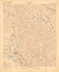
 1920 Pembroke1920 Print · USGSGeorgia's coastal plain emerges in the years after the Great War, showing a network of rail lines and river landings. Genealogists can trace old family roots through Stevens Grove School, Beulah Church, and the settlement at Pembroke.3 unique versions available
 - 1920 Map of Statesboro
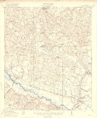
 1920 Statesboro1920 Print · USGSSoutheast Georgia was a bustling junction of regional railways just after the First World War. Researchers can trace family roots and land ownership across a network of rural schools like Smith Allen Deaf School, small settlements like Adabelle, and the prominent Central of Georgia Railway.4 unique versions available
 - 1920 Map of Hilltonia
 1920 Hilltonia1920 Print · USGSScreven County and the Savannah River valley are captured here at the end of the Great War, showing a landscape defined by ferries and rail. Genealogists can trace family footprints at Lovetts Cemetery, Bascom School, and the riverfront at Burtons Ferry.4 unique versions available
 - 1920 Map of Stapleton
 1920 Stapleton1920 Print · USGSEastern Georgia during the early twentieth century was a landscape of bustling cotton-belt rail towns and rural school districts. Genealogists and historians can trace family locations near landmarks like Harts Grove Church, Clarks Mill, and Wrens Sta.3 unique versions available
 - 1920 Map of Glennville
 1920 Glennville1920 Print · USGSSoutheast Georgia in the years after the Great War shows a landscape of rail-connected timber towns and dozens of country schools. Genealogists can locate family landmarks like Vance School, trace the winding Altamaha River past Beards Bluff, or find old crossings like Flat Ford Bridge.3 unique versions available
 - 1920 Map of Millen
 1920 Millen1920 Print · USGSJenkins County at the start of the twenties shows a landscape defined by the Ogeechee River and the busy rail junction at Millen. Genealogists can trace family footprints across dozens of rural landmarks like Old McCoy Church, Walker Academy, and Magnolia Spring.2 unique versions available
 - 1920 Map of Meldrim
 1920 Meldrim1920 Print · USGSCoastal Georgia during the early post-war period is defined here by the winding Ogeechee River and a busy intersection of rail lines. Genealogists and researchers can trace family roots near Clyde or locate rural landmarks like Zion Church and Miller Chapel.
 - 1920 Map of Greens Cut
 1920 Greens Cut1920 Print · USGSBurke County, Georgia, and the Savannah River valley are captured here just after the Great War during a period of peak rural density. Genealogists can locate dozens of country institutions like Daniel Grove Church, Red Hill School, and the Old Church Sta along the Central of Georgia line.3 unique versions available
 - 1920 Map of Oliver
 1920 Oliver1920 Print · USGSScreven County agriculture and river commerce thrived in the years following the Great War. Genealogists can locate family landmarks across the Ogeechee basin, from Double Head Church and Middle Ground School to the bustling rail stops at Halcyondale and Oliver.2 unique versions available
 - 1920 Map of Peeples
 1920 Peeples1920 Print · USGSThe Savannah River lowcountry during the years following the Great War reveals a landscape of river landings and new highways. Genealogists can trace family roots through numerous sites like Virgin Mary Church, Buddenville School, and Solomons Crossroads.3 unique versions available
 - 1920 Map of Wassaw Sound
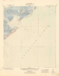 1920 Wassaw Sound1920 Print · USGSCoastal Georgia at the end of the Great War era reveals a landscape of tidal marshes and strategic barrier islands. Researchers can trace historic landmarks like the Great Wassaw Old Battery, the Cup of Hotel, and the winding Wilmington River.
 - 1920 Map of Irwinton
 1920 Irwinton1920 Print · USGSWilkinson County in the years following the Great War reveals a landscape of scattered rural hamlets and river-bottom agriculture. Researchers can trace the lineage of local landmarks like Goldens Mill, Myrtle Spring Church, and the winding Oconee River corridor.2 unique versions available
 - 1920 Map of Sapelo River
 1920 Sapelo River1920 Print · USGSCoastal McIntosh and Liberty counties were a network of tidal rivers and timber-line railroads during the early twentieth century. Genealogists and historians can trace rail stops like Brewsters Siding, the winding course of the Julienton River, and the landing at Sutherland Bluff.
 - 1920 Map of Clarks Hill
 1920 Clarks Hill1920 Print · USGSThe Savannah River border between South Carolina and Georgia comes alive in this survey, showing the region as it was before the creation of the massive Clarks Hill Lake. Genealogists can trace family landmarks like Gilchrist Ferry, Hosannah Church, and Flat Rock School during the heyday of the Charleston and Western Carolina railroad.
 - 1920 Map of Cabretta Island
 1920 Cabretta Island1920 Print · USGSCoastal Georgia's barrier islands appear in this post-World War I military survey, showing the intricate marsh and beach terrain. Researchers can locate early triangulation points like Palm 1902 and land features including Sand Hill and Art Well.
 - 1920 Map of Bluffton
 1920 Bluffton1920 Print · USGSThe Georgia and South Carolina coastlines meet here in the early twentieth century, showing a world defined by tidal rivers and island outposts. Researchers can trace historic maritime landmarks like Ft. Pulaski, the Long Island Ferry, and family settlements at Spanish Wells or Hickory Bluff.
 - 1920 Map of Limerick, 1928 Print
 1920 Limerick1928 Print · USGSThe Georgia coast at the end of the Great War reveals a landscape shaped by tidal rivers and burgeoning timber railroads. Genealogists and local historians can trace family roots through the settlements of Limerick, Sunbury, and Riceboro, or locate the historic Midway Ch. and the coastal defenses of Fort Morris.
 - 1920 Map of Everett City, 1944 Print
 1920 Everett City1944 Print · USGSCoastal Glynn County was a hub of railroad and river activity during the early twentieth century. Researchers can trace family-named landings and vanished rail stops like Thalmann, the Union Industrial School, and the historic Ft Barrington Ferry.
 - 1921 Map of Augusta
 1921 Augusta1921 Print · USGSThe riverfronts of South Carolina and Georgia met at a busy rail and water crossroads just after the Great War. Genealogists can trace family landmarks like the Downer Institute, Cottage Cem, and early rural schools including Freeborn School and Spiderweb School.5 unique versions available
 - 1921 Map of Brooklet
 1921 Brooklet1921 Print · USGSBulloch County's rural heartland is captured here during the 1920s, showing a landscape defined by small-town rail junctions and river fords. Genealogists can trace family footprints at vanished landmarks like Slabville School, Corinth Church, and Ebenezer Ford.2 unique versions available
 - 1921 Map of Rocky Ford
 1921 Rocky Ford1921 Print · USGSSoutheast Georgia in the early twenties reveals a landscape of river-bottom swamps and decentralized farming communities. Genealogists can trace local roots through numerous family-named landmarks like Bradwell School, Akins Mill Creek, and Finchs Store.2 unique versions available
 - 1921 Map of Clarks Hill
 1921 Clarks Hill1921 Print · USGSThe Savannah River valley in the early twenties was a landscape of ferries and railroad sidings before the creation of modern reservoirs. Genealogists can trace family footprints through dozens of rural landmarks like Hosannah Church, Dorn School, and Gilchrist Ferry.3 unique versions available
 - 1921 Map of Ellenton
 1921 Ellenton1921 Print · USGSThe Savannah River valley in the early 1920s reveals a lost network of riverside landings and agricultural rail stops. Genealogists can trace family footprints at Ellenton, Meyers Mill, and rural sites like Friendship Church or Bethesda School.2 unique versions available
Showing maps 1-25
Top cities of Georgia
- Atlanta historical maps
- Augusta historical maps
- Columbus historical maps
- Macon historical maps
- Savannah historical maps
- Athens historical maps
See more
Top counties of Georgia
- Fulton County historical maps
- Gwinnett County historical maps
- Cobb County historical maps
- DeKalb County historical maps
- Chatham County historical maps
- Clayton County historical maps
See more
Frequently asked questions
- What are the different types of historical maps available for Georgia?
- What is the oldest map of Georgia?
- Where can I purchase historical maps of Georgia for my home or office?
- Where can I download high-res historical maps of Georgia?
- Are there historical topographic maps available for Georgia?
- Is there historical aerial imagery available for Georgia?
- Where are historical maps of Georgia sourced from?