1990s Maps of Georgia
Explore 167 historic maps of Georgia from the 1990s. These maps offer a rare glimpse into what life looked like during the 1990s — showing old roads, neighborhoods, homes, and landmarks that have changed or disappeared over time.
Whether you're researching your family's past, planning a metal detecting trip, or studying how Georgia's landscape evolved across the 1990s, these high-resolution maps are a powerful tool for exploring the history of this region.
- Focus on a specific era: All maps on this page are from the 1990s, giving you a focused view of this time period.
- See what’s changed: Compare century-old streets, trails, and buildings to today's modern landscape using overlays and satellite layers.
- Research with precision: Use these maps for genealogy, historical research, land use analysis, or educational projects.
- View, download, or print: Maps are fully viewable online in high resolution, and can be downloaded or printed for your own records.
Start exploring Georgia's history through authentic maps from the 1990s. This is your window into the past.
Georgia maps
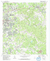
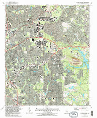
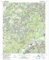
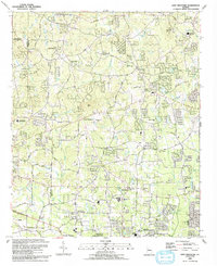
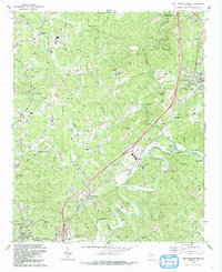
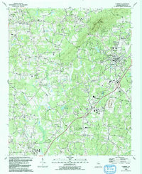
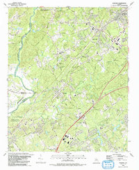
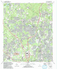
- 1992 Map of Marietta
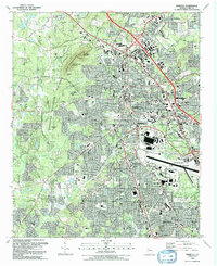 1992 Marietta1992 Print · USGSMarietta and Smyrna are shown during a period of rapid suburban growth in the early nineties, framed by significant military and civil war landmarks. Researchers can trace the sprawling grounds of Dobbins Air Force Base or locate local history at the Confederate Cem and Blackwells.2 unique versions available
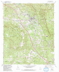
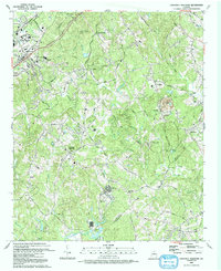
 - 1992 Map of Mountain Park
 1992 Mountain Park1992 Print · USGSCobb and Cherokee Counties are seen during a period of rapid suburban growth in the early nineties. Genealogists can trace family names and local landmarks through Arnold Mill, Crossroad Church, and the Arnold Cem near the Fulton County line.2 unique versions available
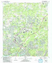
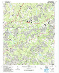
 - 1992 Map of Norcross
 1992 Norcross1992 Print · USGSGwinnett County’s rapid suburban transformation is on full display in the early nineties as residential neighborhoods spread between the Chattahoochee River and Lilburn. Researchers can trace local genealogy and land use through sites like Peachtree Mem Cem, the Southern rail line, and the massive Quarry near Beaver Ruin Creek.2 unique versions available
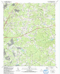
 - 1992 Map of Austell
 1992 Austell1992 Print · USGSThe western edges of the Atlanta metro area are captured here in the early nineties as Cobb and Douglas counties continued their suburban expansion. Genealogists and local historians can trace family roots through several rural burial sites like Coker-Elliott Cem and numerous local churches including Praise Tabernacle and County Line Ch.2 unique versions available
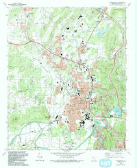
 - 1992 Map of Lawrenceville
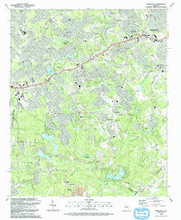
 1992 Lawrenceville1992 Print · USGSGwinnett County's rapid growth during the early nineties is documented here, showing the expansion of Lawrenceville and Dacula. Local historians can trace long-standing landmarks like the Lawrenceville Camp Ground and McMillan Cem alongside the modern Tribble Mill County Park.
 - 1992 Map of Stone Mountain
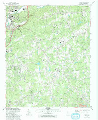
 1992 Stone Mountain1992 Print · USGSDeKalb County enters a period of intense suburban growth in the early nineties, centered around the iconic granite mass of Stone Mountain. Genealogists and local historians can trace community roots through numerous landmarks like Rehoboth Cem, Zion Ch, and the Atlanta Sch for the Deaf.2 unique versions available
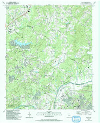
 - 1992 Map of Mableton
 1992 Mableton1992 Print · USGSMableton and Austell are shown in the early nineties as the suburban landscape of Cobb County expanded toward the river. Genealogists and researchers can locate numerous community landmarks, including Gann Cem, South Cobb High Sch, and the Southern Railway corridor.2 unique versions available
 - 1992 Map of Lost Mountain, 1993 Print
 1992 Lost Mountain1993 Print · USGSCobb and Paulding counties appear here in the early nineties as suburban growth began to surround landmarks like Lost Mtn. Genealogists and historians can locate family-named landmarks and institutions such as Bullard Cem, McEachern Ch, and the Picketts Mill State Historical Site.
 - 1992 Map of Ball Ground West, 1993 Print
 1992 Ball Ground West1993 Print · USGSCherokee County in the early 1990s reflects a landscape of river-valley settlements and growing infrastructure north of Canton. Genealogists and historians can trace several rural congregations and burial grounds, including Old Damascus Ch, McFarland Cem, and Dowda Cem.
 - 1992 Map of Roswell, 1993 Print
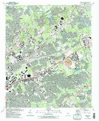
 1992 Roswell1993 Print · USGSThe North Fulton corridor was evolving rapidly in the early nineties as residential growth began to bridge the gap between Alpharetta and Roswell. Genealogists and local historians can trace legacy landmarks including Old Newton School, Greenlawn Cemetery, and the community of Crabapple.2 unique versions available
 - 1992 Map of Cartersville, 1993 Print
 1992 Cartersville1993 Print · USGSBartow County at the start of the nineties shows a landscape of deep history and industrial change, from the Etowah River to the peaks of Dobbins Mountain. Researchers can trace old community hubs like Atco, the ancient Etowah Mounds, and family sites at Oak Hill Cemetery.
 - 1992 Map of Duluth, 1993 Print
 1992 Duluth1993 Print · USGSGwinnett and Fulton counties were undergoing rapid transformation in the early nineties as suburban growth reached historic hamlets. Local historians can trace the foundations of Ocee and Shake Rag or locate family sites like Rogers Cem and Union Hill Ch.
 - 1992 Map of Cumming, 1993 Print
 1992 Cumming1993 Print · USGSCumming and southern Forsyth County were on the verge of significant growth in the early nineties as the Atlanta suburbs expanded north. Researchers can trace family sites and local landmarks like Sawnee Mountain, Ducktown, and historic congregations at Daves Creek Ch and Shiloh Ch.
 - 1992 Map of Snellville, 1993 Print
 1992 Snellville1993 Print · USGSGwinnett County during the early nineties shows a landscape of growing suburbs anchored by historic family landmarks and winding river bends. Researchers can trace local genealogy through numerous sites like Hannah Cem, Annistown Cem, and the old Rock Chapel Sch.
 - 1992 Map of Canton, 1993 Print
 1992 Canton1993 Print · USGSCherokee County enters a period of modern growth in the early nineties, centered on the Etowah River and the expanding town of Canton. Researchers can trace family sites at St Paul Cem, find old rural hubs like Hickory Flat, or locate landmarks such as the Dean Rusk Sch and Askew County Park.
 - 1992 Map of Acworth, 1993 Print
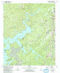
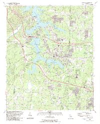 1992 Acworth1993 Print · USGSAcworth and the shores of Lake Allatoona are shown in the early nineties, a period of significant growth in Cobb County. Genealogists and local historians can locate established landmarks such as Liberty Hill Cem, Awtrey Middle Sch, and the CSX TRANSPORTATION line.2 unique versions available
 - 1992 Map of Suwanee, 1993 Print
 1992 Suwanee1993 Print · USGSGwinnett County's northern corridor comes into focus in the early nineties as suburban development expands near Suwanee and Sugar Hill. Genealogists and local historians can trace legacy sites like Old Peachtree Ch, Sudderth Cem, and the path of the SOUTHERN RAILWAY.
 - 1992 Map of Jasper, 1993 Print
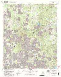
 1992 Jasper1993 Print · USGSThe northern Georgia piedmont around the early 1990s shows a landscape of industrial quarries and growing mountain communities. Genealogists can trace family roots through landmarks like Norton Cem, Philadelphia Ch, and the crossroads at Cagle.
 - 1992 Map of Luxomni, 1993 Print
 1992 Luxomni1993 Print · USGSGwinnett County's rapid suburbanization is documented here in the early nineties, showing how older crossroads communities adapted to new infrastructure. Genealogists and locals can trace family-named sites like McKendree Cem and Pharr School alongside the Seaboard System rail line.
 - 1992 Map of Hog Mountain, 1993 Print
 1992 Hog Mountain1993 Print · USGSGwinnett County in the early nineties shows a landscape of suburban growth reaching into its rural heritage near Hog Mountain. Researchers can trace genealogies through numerous sites like Ivy Creek Ch Cem and Old Ivy Ch Cem or locate the historic Harmony Sch.
 - 1992 Map of Kennesaw, 1993 Print
 1992 Kennesaw1993 Print · USGSThe northern Atlanta suburbs were undergoing significant growth in the early nineties, centered around the rail and campus hubs of Kennesaw and Woodstock. Researchers can trace local genealogy at Old Noonday Cem and Gresham Cem or locate the historic Louisville and Nashville line.2 unique versions available
 - 1992 Map of Chestnut Mountain, 1993 Print
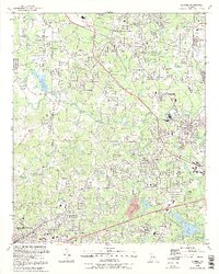
 1992 Chestnut Mountain1993 Print · USGSHall County and Jackson County meet in the early nineties as educational centers and motorsports venues began to reshape this Georgia landscape. Genealogists and historians can trace family ties through Tanner Mill, Hopewell Cem, and Cross Plains Cem.
 - 1993 Map of South Canton
 1993 South Canton1993 Print · USGSCherokee County enters a new era of growth in the early nineties as the suburban landscape expands around the shores of Allatoona Lake. Genealogists and historians can trace family ties at Lovingood Cem, old crossroads like Univeter, and the historical path of Bells Ferry.
 - 1993 Map of Auburn
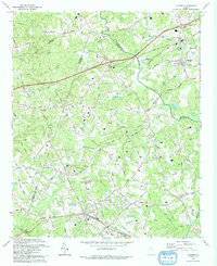 1993 Auburn1993 Print · USGSBarrow and Gwinnett counties were undergoing steady growth in the early nineties, centered on the Seaboard System rail towns. Genealogists can trace family names through numerous rural landmarks like Thompsons Mill, Hebron Cem, and Harmony Grove Ch.
 - 1993 Map of Cumberland Island North, 1995 Print
 1993 Cumberland Island North1995 Print · USGSThe northern reaches of Georgia's barrier islands appear in the early 1990s as a complex landscape of tidal rivers and maritime history. Researchers can trace landforms and heritage sites like the Little Cumberland Island Lighthouse, the First African Ch, and the Cumberland Cem.
Showing maps 1-25
Top cities of Georgia
- Atlanta historical maps
- Augusta historical maps
- Columbus historical maps
- Macon historical maps
- Savannah historical maps
- Athens historical maps
See more
Top counties of Georgia
- Fulton County historical maps
- Gwinnett County historical maps
- Cobb County historical maps
- DeKalb County historical maps
- Chatham County historical maps
- Clayton County historical maps
See more
Frequently asked questions
- What are the different types of historical maps available for Georgia?
- What is the oldest map of Georgia?
- Where can I purchase historical maps of Georgia for my home or office?
- Where can I download high-res historical maps of Georgia?
- Are there historical topographic maps available for Georgia?
- Is there historical aerial imagery available for Georgia?
- Where are historical maps of Georgia sourced from?