Old Maps of Logan County, Kansas for Metal Detecting
Plan your next treasure hunt with 195 historic maps of Logan County. Find old homesites, ghost towns, trails, and gathering spots that may be lost to time — perfect for identifying promising metal detecting locations.
- Locate forgotten sites: Uncover places like long-lost settlements, abandoned rail lines, or gathering spots.
- Plan better hunts: Use map overlays combined with LiDAR or satellite views to narrow in on historically rich areas.
- Made for detectorists: Thousands of hobbyists use these maps to discover relics, coins, and hidden history.
Use these historic maps to boost your research and find new opportunities beneath the surface of Logan County.
Logan County, KS maps
(195)- 1939 Map of Lake Mc Bride, 1958 Print
 1939 Lake Mc Bride1958 Print · USGSWestern Kansas at the end of the Depression reveals a landscape of remote schoolhouses and significant archaeological sites along the Ladder Creek breaks. Genealogists and historians can locate early landmarks like El Quartelejo Pueblo Ruins Monument, Glendale Sch, and the rugged Suicide Bluffs.5 unique versions available
 - 1939 Map of Sandon, 1959 Print
 1939 Sandon1959 Print · USGSWestern Kansas at the end of the 1930s reveals a landscape of remote schoolhouses and deep canyons along the Ladder Creek drainage. Genealogists and local historians can trace rural landmarks like Zanobia Sch, the Pueblo Ruins Monument, and the settlement of Sandon along the Missouri Pacific tracks.
 - 1939 Map of Pence, 1971 Print
 1939 Pence1971 Print · USGSWestern Kansas farm life is meticulously documented in this late 1930s survey of the Logan, Wichita, and Scott county lines. Researchers can trace the locations of numerous rural schoolhouses like Liberty Sch and Prairie View Sch, along with the Pence Cem.2 unique versions available
 - 1941 Map of Pence
 1941 Pence1941 Print · USGSWestern Kansas high plains life is preserved here during the late Depression era, showing the intersection of Logan, Wichita, and Scott counties. Genealogists can trace early 20th-century rural life through landmarks like Pence Cem and a network of schools including Lone Corner Sch and High Prairie Sch.2 unique versions available
 - 1942 Map of Sandon
 1942 Sandon1942 Print · USGSWestern Kansas at the end of the Depression era reveals a landscape shaped by both deep canyon drainages and the arrival of organized recreation and preservation. Genealogists can locate family-named landmarks and rural school sites like Goodluck Sch and Zanobia Sch, or trace the historical Pueblo Ruins Monument near McBride.
 - 1942 Map of Lake Mc Bride
 1942 Lake Mc Bride1942 Print · USGSWestern Kansas at the dawn of the 1940s reveals a unique intersection of ancient history and New Deal-era public works. Researchers can trace rural school locations like State Park Sch and explore landmarks like El Quartelejo Pueblo Ruins Monument.5 unique versions available
 - 1954 Map of Goodland, 1976 Print
 1954 Goodland1976 Print · USGSNorthwest Kansas comes into focus during the mid-1950s, showing a landscape defined by its vital river forks and thriving rail towns. Researchers can trace the path of the Union Pacific through Colby or locate historic parks like Sheridan Co State Park.
 - 1955 Map of Scott City, 1969 Print
 1955 Scott City1969 Print · USGSWestern Kansas in the mid-fifties is captured here as a landscape of rural schoolhouses and significant rail corridors. Family historians can trace the locations of Skyline and Beaver Creek Schools or follow the Union Pacific line through Oakley and Sharon Springs.4 unique versions available
 - 1956 Map of Goodland
 1956 Goodland1956 Print · USGSThe high plains of Northwest Kansas in the mid-fifties reveal a landscape of river-fed agriculture and expanding rail networks. Genealogists and historians can trace the development of county seats like Goodland and Atwood or locate landmarks such as the Arikaree Breaks.
 - 1957 Map of Goodland
 1957 Goodland1957 Print · USGSNorthwest Kansas in the mid-1950s shows a landscape of high plains agriculture and vital rail junctions. Researchers can trace the river-valley settlements from Goodland to Oberlin and follow the paths of the Union Pacific and Sappa Creek.2 unique versions available
 - 1958 Map of Scott City
 1958 Scott City1958 Print · USGSWestern Kansas at the peak of the post-war era reveals a landscape of high-plains agriculture and vital rail junctions. Genealogists and historians can trace old country school sites like Prairie Bell School, the landmark Chalk Pyramids, and small stops along the Union Pacific and Missouri Pacific.
 - 1968 Map of Russell Springs 3 NW, 1969 Print
 1968 Russell Springs 3 NW1969 Print · USGSWestern Kansas rangeland at the end of the 1960s is preserved here, showing the sparse infrastructure of the High Plains. Genealogists and historians can trace property boundaries across Harrison and Augustine or follow the course of Chalk Creek.2 unique versions available
 - 1968 Map of Russell Springs 3 NE, 1970 Print
 1968 Russell Springs 3 NE1970 Print · USGSHigh plains ranching and farming define this western Kansas landscape in the late sixties. Researchers can trace rural life through the Beulah Cem, High Plains Sch, and the isolated Church of the Nazarene.2 unique versions available
 - 1969 Map of Mc Allaster NW, 1971 Print
 1969 Mc Allaster NW1971 Print · USGSThe High Plains of western Kansas are captured here in the late sixties at the convergence of four counties. Genealogists and local researchers can trace the drainages of the South Fork Solomon River and Sand Creek near features like the spillway.
 - 1969 Map of Russell Springs 2 NW, 1971 Print
 1969 Russell Springs 2 NW1971 Print · USGSLogan County during the late sixties reveals a landscape shaped by historical westward travel and the transition to rail. Trace the legendary Butterfield Overland Trail past several Historical Markers along the Smoky Hill River.2 unique versions available
 - 1969 Map of Mc Allaster SE, 1971 Print
 1969 Mc Allaster SE1971 Print · USGSWestern Kansas rangeland and the river breaks are captured in the late sixties as the local economy balanced rail transport and ranching. Trace the path of the Union Pacific near the North Fork Smoky Hill River and locate landmarks like the Lowe Landing Strip.
 - 1969 Map of Russell Springs 2 SW, 1971 Print
 1969 Russell Springs 2 SW1971 Print · USGSLogan and Wallace counties in the late sixties reveal a landscape defined by ranching life and intricate prairie drainage. Researchers can trace the intersection of early townships and locate landmarks like Little Eagle Ch and the prominent Twin Butte.2 unique versions available
 - 1969 Map of Russell Springs 2 NE, 1971 Print
 1969 Russell Springs 2 NE1971 Print · USGSLogan County prairie land is captured here in the late sixties, highlighting the path of the legendary Butterfield Overland Trail. Local historians can trace the old trail past several Historical Markers and follow the winding Smoky Hill River.2 unique versions available
 - 1969 Map of Mc Allaster NE, 1971 Print
 1969 Mc Allaster NE1971 Print · USGSThe High Plains of Western Kansas are captured in the late sixties at the intersection of the Kingery and Winona townships. Researchers can trace the rural community at Brownville, locate the Brownville Cem, and see the early Landing Strip near the county line.
 - 1969 Map of Russell Springs 2 SE, 1971 Print
 1969 Russell Springs 2 SE1971 Print · USGSLogan County ranching and range land are captured here in the late sixties, showcasing the remote geography of western Kansas. Genealogists and historians can locate water sources like Nickel Mine Spring and industrial sites including a Gravel Pit and Quarry along Twin Butte Creek.2 unique versions available
 - 1969 Map of Mc Allaster, 1971 Print
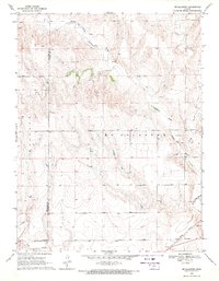 1969 Mc Allaster1971 Print · USGSThe High Plains of Logan County come to life in the late sixties, centered on the railroad siding of McAllaster. Researchers can trace the Union Pacific rail corridor and follow the winding North Fork Smoky Hill River past local Springs and a Marl Pit.2 unique versions available
 - 1972 Map of Russell Springs, 1974 Print
 1972 Russell Springs1974 Print · USGSRussell Springs sat at a historic Western crossroads in the early 1970s, where frontier trails met the river valley. Genealogists and historians can trace the Butterfield Overland Trail, the Russell Springs Cem, and remnants of an Old Railroad Grade.
 - 1972 Map of Monument, 1974 Print
 1972 Monument1974 Print · USGSMonument and the surrounding Logan County plains are captured in the early 1970s just as the rural landscape maintained its traditional rail-and-creek orientation. Local historians can trace the Union Pacific corridor, the town of Monument, and the nearby Monument Cem.
 - 1972 Map of Winona, 1974 Print
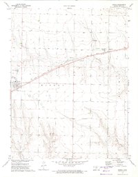 1972 Winona1974 Print · USGSLogan County, Kansas, was a landscape of high-plains agriculture and critical rail corridors in the early seventies. Researchers can trace the path of the Union Pacific through Winona and Page City or locate the Winona Cem and local airstrips.
 - 1972 Map of Winona NE, 1974 Print
 1972 Winona NE1974 Print · USGSWestern Kansas ranching and energy lands are captured here in the early 1970s, where the Saline River begins its eastward journey. Genealogists and local historians can locate the Township Cem and trace the paths of the North Fork Saline River and South Fork Saline River.
Showing maps 1-25 of 195
Top cities of Logan County
- Oakley historical maps
- Winona historical maps
- Monument historical maps
- McAllaster historical maps
- Russell Springs historical maps
- Elkader historical maps
Frequently asked questions
- What are the different types of historical maps available for Logan County?
- What is the oldest map of Logan County?
- Where can I purchase historical maps of Logan County for my home or office?
- Where can I download high-res historical maps of Logan County?
- Are there historical topographic maps available for Logan County?
- Is there historical aerial imagery available for Logan County?
- Where are historical maps of Logan County sourced from?