1900s (20th Century) Maps of Kentucky
Explore 1,977 historic maps of Kentucky from the 1900s (20th Century). These maps offer a rare glimpse into what life looked like during the 1900s — showing old roads, neighborhoods, homes, and landmarks that have changed or disappeared over time.
Whether you're researching your family's past, planning a metal detecting trip, or studying how Kentucky's landscape evolved across the 1900s, these high-resolution maps are a powerful tool for exploring the history of this region.
- Focus on a specific era: All maps on this page are from the 1900s, giving you a focused view of this time period.
- See what’s changed: Compare century-old streets, trails, and buildings to today's modern landscape using overlays and satellite layers.
- Research with precision: Use these maps for genealogy, historical research, land use analysis, or educational projects.
- View, download, or print: Maps are fully viewable online in high resolution, and can be downloaded or printed for your own records.
Start exploring Kentucky's history through authentic maps from the 1900s. This is your window into the past.
Kentucky maps
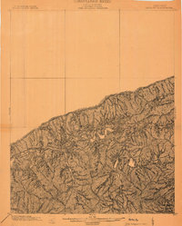
(1,977)- 1900 Map of Ironton, 1918 Print
 1900 Ironton1918 Print · USGSCovers Kentucky, including Ironton, Flatwoods, and other nearby areas2 unique versions available
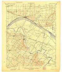
 - 1901 Map of Owensboro
 1901 Owensboro1901 Print · USGSCovers Kentucky, including Owensboro, Rockport, and other nearby areas5 unique versions available
 - 1901 Map of Ceredo, 1953 Print
 1901 Ceredo1953 Print · USGSCovers Kentucky, including Huntington, Ashland, and other nearby areas2 unique versions available
 - 1903 Map of Kenova
 1903 Kenova1903 Print · USGSCovers Kentucky, including Huntington, Ashland, and other nearby areas5 unique versions available
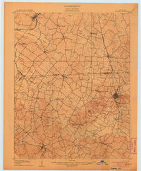
 - 1903 Map of Harlan
 1903 Harlan1903 Print · USGSCovers Kentucky, including Harlan, Loyall, and other nearby areas
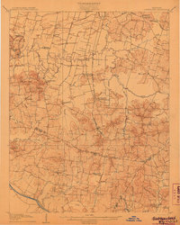
 - 1903 Map of Pineville
 1903 Pineville1903 Print · USGSCovers Kentucky, including Pineville, Balkan, and other nearby areas
 - 1903 Map of Tell City
 1903 Tell City1903 Print · USGSCovers Kentucky, including Tell City, Lewisport, and other nearby areas7 unique versions available
 - 1903 Map of Middlesboro
 1903 Middlesboro1903 Print · USGSCovers Kentucky, including Middlesboro, Harrogate, and other nearby areas
 - 1904 Map of Kenova
 1904 Kenova1904 Print · USGSCovers Kentucky, including Huntington, Ashland, and other nearby areas
 - 1905 Map of Harrodsburg
 1905 Harrodsburg1905 Print · USGSCovers Kentucky, including Lexington, Nicholasville, and other nearby areas3 unique versions available
 - 1905 Map of Newburg
 1905 Newburg1905 Print · USGSCovers Kentucky, including Evansville, Newburgh, and other nearby areas3 unique versions available
 - 1905 Map of Prospect, 1962 Print
 1905 Prospect1962 Print · USGSCovers Kentucky, including Louisville, Jeffersonville, and other nearby areas
 - 1905 Map of New Haven, 1966 Print
 1905 New Haven1966 Print · USGSCovers Kentucky, including Ridgway, Emma, and other nearby areas
 - 1906 Map of New Haven
 1906 New Haven1906 Print · USGSCovers Kentucky, including Ridgway, Emma, and other nearby areas4 unique versions available
 - 1906 Map of Sebree
 1906 Sebree1906 Print · USGSCovers Kentucky, including Sebree, Corydon, and other nearby areas3 unique versions available
 - 1906 Map of Lockport
 1906 Lockport1906 Print · USGSCovers Kentucky, including Monterey, Gratz, and other nearby areas2 unique versions available
 - 1906 Map of Sutherland
 1906 Sutherland1906 Print · USGSCovers Kentucky, including Owensboro, Livermore, and other nearby areas3 unique versions available
 - 1906 Map of Georgetown, 1954 Print
 1906 Georgetown1954 Print · USGSCovers Kentucky, including Lexington, Georgetown, and other nearby areas
 - 1907 Map of Louisville
 1907 Louisville1907 Print · USGSCovers Kentucky, including Louisville, Jeffersontown, and other nearby areas3 unique versions available
 - 1907 Map of Earlington
 1907 Earlington1907 Print · USGSCovers Kentucky, including Madisonville, Providence, and other nearby areas
 - 1907 Map of Morganfield
 1907 Morganfield1907 Print · USGSCovers Kentucky, including Morganfield, Sturgis, and other nearby areas3 unique versions available
 - 1907 Map of Whitesville, 1962 Print
 1907 Whitesville1962 Print · USGSCovers Kentucky, including Whitesville, Ralph, and other nearby areas
 - 1908 Map of Lockport
 1908 Lockport1908 Print · USGSCovers Kentucky, including Monterey, Gratz, and other nearby areas3 unique versions available
 - 1908 Map of Calhoun
 1908 Calhoun1908 Print · USGSCovers Kentucky, including Calhoun, Coraville, and other nearby areas2 unique versions available
 - 1908 Map of Georgetown
 1908 Georgetown1908 Print · USGSCovers Kentucky, including Lexington, Georgetown, and other nearby areas2 unique versions available
Showing maps 1-25 of 1,977
Top cities of Kentucky
- Louisville historical maps
- Lexington historical maps
- Owensboro historical maps
- Bowling Green historical maps
- Covington historical maps
- Georgetown historical maps
See more
Top counties of Kentucky
- Jefferson County historical maps
- Fayette County historical maps
- Kenton County historical maps
- Boone County historical maps
- Warren County historical maps
- Hardin County historical maps
See more
Frequently asked questions
- What are the different types of historical maps available for Kentucky?
- What is the oldest map of Kentucky?
- Where can I purchase historical maps of Kentucky for my home or office?
- Where can I download high-res historical maps of Kentucky?
- Are there historical topographic maps available for Kentucky?
- Is there historical aerial imagery available for Kentucky?
- Where are historical maps of Kentucky sourced from?