1920s Maps of Kentucky
Explore 54 historic maps of Kentucky from the 1920s. These maps offer a rare glimpse into what life looked like during the 1920s — showing old roads, neighborhoods, homes, and landmarks that have changed or disappeared over time.
Whether you're researching your family's past, planning a metal detecting trip, or studying how Kentucky's landscape evolved across the 1920s, these high-resolution maps are a powerful tool for exploring the history of this region.
- Focus on a specific era: All maps on this page are from the 1920s, giving you a focused view of this time period.
- See what’s changed: Compare century-old streets, trails, and buildings to today's modern landscape using overlays and satellite layers.
- Research with precision: Use these maps for genealogy, historical research, land use analysis, or educational projects.
- View, download, or print: Maps are fully viewable online in high resolution, and can be downloaded or printed for your own records.
Start exploring Kentucky's history through authentic maps from the 1920s. This is your window into the past.
Kentucky maps
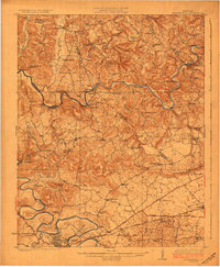
(54)- 1920 Map of Goloonda
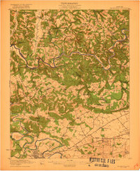
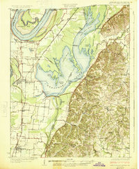
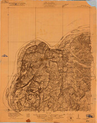 1920 Goloonda1920 Print · USGSThe Ohio River bottomlands of Livingston County are captured here just after the Great War, when river ferries and rural schoolhouses still anchored local life. Genealogists and researchers can trace family lands near Berry Ferry, Mt Pisgah Church, or the many district schools like Trimble School.
 - 1921 Map of Fords Ferry
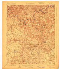
 1921 Fords Ferry1921 Print · USGSCrittenden County in the early twenties shows a landscape of river-dependent commerce and small rural hamlets connected by the Illinois Central. Genealogists can trace family footprints through dozens of local landmarks like Shelby Store, Hurricane Church, and the Seminary School.
 - 1921 Map of Big Stone Gap
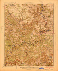
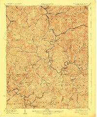
 1921 Big Stone Gap1921 Print · USGSIn the early 1920s, the coal and rail networks of Wise and Lee Counties were at their peak. Genealogists and historians can trace old settlements and rural hubs like Keokee, Johnsons Mill PO, and Stonega along the Southern RR and the Powell River.
 - 1921 Map of Golconda
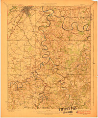
 1921 Golconda1921 Print · USGSThe Ohio River valley at the start of the 1920s reveals a bustling corridor of small river towns and rural school districts spanning Illinois and Kentucky. Genealogists and historians can trace family roots through dozens of local landmarks like Berrys Ferry, Cammens Store, and the Bethel Church.3 unique versions available
 - 1921 Map of Bowling Green, 1955 Print
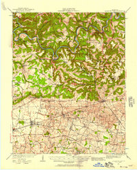
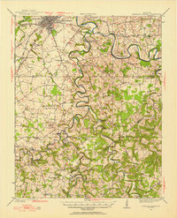 1921 Bowling Green1955 Print · USGSBowling Green and its surrounding counties are shown here just after the Great War, when the Louisville and Nashville railroad fueled regional growth. Genealogists can trace hundreds of family landmarks, from Mussey Mill to schools like Cave Mill School and the remote Antioch Chapel.
 - 1922 Map of Frankfort
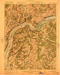
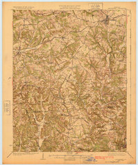
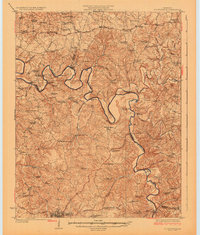
 1922 Frankfort1922 Print · USGSCentral Kentucky's river valleys and rolling uplands are captured here in the early twenties, showing a landscape defined by water and rail. Trace family history at Lanes Mill Fox Gap School or follow the river to Youngs High Bridge and Shryocks Ferry.
 - 1922 Map of Leitchfield
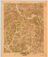
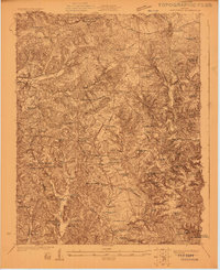 1922 Leitchfield1922 Print · USGSGrayson and Edmonson counties in the early twenties were defined by a robust network of small schools and local industry. Genealogists can trace family connections through landmarks like Duvall Cemetery, the Kentucky Rock Asphalt Co Mine, and the Rogers Springs School.
 - 1922 Map of Big Stone Gap
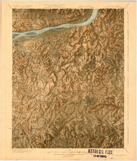
 1922 Big Stone Gap1922 Print · USGSSouthwest Virginia's coal and rail corridors are captured here in the early 1920s, showing the height of industrial development in the Cumberland Mountains. Trace family roots and vanished landmarks near Appalachia, Keokee, and the historic Seminary School along the Powell River.
 - 1922 Map of Brownsville
 1922 Brownsville1922 Print · USGSEdmonson and Warren Counties are mapped here in the early 1920s, showing a river-centered economy still reliant on ferries and landings. Genealogists can trace family footprints across dozens of country school sites like Poplar Spring School and historic crossings like Sadler Ford.
 - 1922 Map of Mammoth Cave, 1957 Print
 1922 Mammoth Cave1957 Print · USGSThe Green River valley and the Kentucky karst country are captured here in the early 1920s, before the full development of the national park. Researchers can trace family-named landmarks and long-established crossings like Fishtrap Ferry, Good Spring Church, and the world-renowned Mammoth Cave.7 unique versions available
 - 1923 Map of Bowling Green
 1923 Bowling Green1923 Print · USGSThe Bowling Green area in the early 1920s was a landscape defined by the winding Barren River and the busy Louisville and Nashville Railroad. Researchers can trace ancestral roots through dozens of rural sites like Cassadays Store, Massey Mill, and the Lost River.4 unique versions available
 - 1923 Map of Waddy
 1923 Waddy1923 Print · USGSShelby County and Anderson County are captured here in the early 1920s, showing a rural landscape organized around the Midland Trail and regional rail lines. Genealogists can trace family connections to numerous landmarks like Buffalo Lick Church, Jeptha Knob, and small settlements including Waddy and Glensboro.
 - 1923 Map of Mammoth Cave
 1923 Mammoth Cave1923 Print · USGSThe subterranean wonders of Edmonson County are mapped in the early 1920s alongside the river ferries and rail towns of the Kentucky karst. Family historians can trace ancestral roots through dozens of local landmarks like Good Spring Church, Ollie School, and Houchins Ferry.6 unique versions available
 - 1923 Map of Brownsville
 1923 Brownsville1923 Print · USGSThe river-driven economies of Edmonson and Warren counties are preserved here in the early twentieth century. Researchers can trace ancestral locations through dozens of named sites like Bethlehem Church, Dalton Ferry, and rural schoolhouses including Poplar Spring School.3 unique versions available
 - 1924 Map of Frankfort
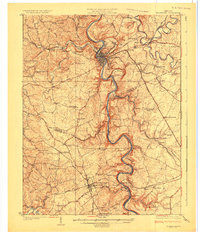 1924 Frankfort1924 Print · USGSThe Kentucky River valley and surrounding Bluegrass uplands are documented here during the mid-1920s. Genealogists and researchers can trace rural life through dozens of named district schools and river landmarks like Youngs High Bridge, Lanes Mill, and Shryocks Ferry.2 unique versions available
 - 1924 Map of Lillydale
 1924 Lillydale1924 Print · USGSThe Tennessee-Kentucky borderlands in the early twenties were defined by tight river bends and isolated ridge-top schools. Genealogists can trace the rural life of Lillydale through landmarks like Thompsons Store, Willow Grove, and the uniquely named Hongkong School.
 - 1925 Map of Spring Lick
 1925 Spring Lick1925 Print · USGSButler and Ohio counties are shown here in the mid-1920s, featuring a landscape of rural schoolhouses and river bends. Genealogists can trace family connections through sites like Flener Chapel, Whiteoak School, and the Illinois Central rail stops.2 unique versions available
 - 1925 Map of Cub Run
 1925 Cub Run1925 Print · USGSCentral Kentucky's rural landscape is captured here in the mid-1920s, dominated by the intricate loops of the Nolin River. Genealogists and historians can locate numerous family-named landmarks like Dickeys Mills, Sanders Store, and Hester School.3 unique versions available
 - 1925 Map of Mount Eden
 1925 Mount Eden1925 Print · USGSThe rolling hills between Shelbyville and the Salt River are captured here in the mid-twenties, showing a landscape tied to the rails and old turnpikes. Researchers can find dozens of rural landmarks, from Jeptha Knob to family-named sites like Martin School and Browns Store.
 - 1925 Map of Reelfoot Lake
 1925 Reelfoot Lake1925 Print · USGSNorthwestern Tennessee in the mid-twenties is defined here by the intricate waters of the Reelfoot basin and the shifting course of the Mississippi. Genealogists and historians can trace family-named sites like Rodgers School and Jones School, or locate old river landings including Cates and Whites Landing.3 unique versions available
 - 1925 Map of Gilbert
 1925 Gilbert1925 Print · USGSSouthern West Virginia in the mid-twenties shows a landscape defined by steep hollows and a burgeoning coal-and-rail economy. Researchers can trace ancestral footprints at several family-named institutions like Hatfield School or find old mining hubs such as Wharncliffe and Glenalum.
 - 1925 Map of Leitchfield
 1925 Leitchfield1925 Print · USGSGrayson and Edmonson counties are mapped in the mid-twenties as rural farming and coal communities. Genealogists can locate family landmarks like Rogers Springs School, the Meredith Coal Bank, and Beech Grove Church.2 unique versions available
 - 1925 Map of Cave In Rock
 1925 Cave In Rock1925 Print · USGSCrittenden County's river-and-rail landscape is captured here in the mid-1920s, during a time of thriving rural school districts and mining operations. Researchers can trace ancestral locations near Fords Ferry, the Franklin Mines, or Hurricane Church.3 unique versions available
 - 1926 Map of Greenup
 1926 Greenup1926 Print · USGSGreenup County in the mid-1920s is a landscape of riverfront rail towns and a high density of rural schoolhouses tucked into the Kentucky hollows. Genealogists and historians can trace family locations near Old Steam Furnace School, Nonchalanta, and Taylor Sta McCall PO.3 unique versions available
 - 1926 Map of Scottsville
 1926 Scottsville1926 Print · USGSThe Barren River valley in the mid-twenties was a landscape of ferries and fords connecting isolated rural schools and churches. Researchers can trace ancestral locations like Scottsville, find the Rocky Hill Game PO, or locate the Rough and Ready School.
Showing maps 1-25 of 54
Top cities of Kentucky
- Louisville historical maps
- Lexington historical maps
- Owensboro historical maps
- Bowling Green historical maps
- Covington historical maps
- Georgetown historical maps
See more
Top counties of Kentucky
- Jefferson County historical maps
- Fayette County historical maps
- Kenton County historical maps
- Boone County historical maps
- Warren County historical maps
- Hardin County historical maps
See more
Frequently asked questions
- What are the different types of historical maps available for Kentucky?
- What is the oldest map of Kentucky?
- Where can I purchase historical maps of Kentucky for my home or office?
- Where can I download high-res historical maps of Kentucky?
- Are there historical topographic maps available for Kentucky?
- Is there historical aerial imagery available for Kentucky?
- Where are historical maps of Kentucky sourced from?