1950s Maps of Kentucky
Explore 868 historic maps of Kentucky from the 1950s. These maps offer a rare glimpse into what life looked like during the 1950s — showing old roads, neighborhoods, homes, and landmarks that have changed or disappeared over time.
Whether you're researching your family's past, planning a metal detecting trip, or studying how Kentucky's landscape evolved across the 1950s, these high-resolution maps are a powerful tool for exploring the history of this region.
- Focus on a specific era: All maps on this page are from the 1950s, giving you a focused view of this time period.
- See what’s changed: Compare century-old streets, trails, and buildings to today's modern landscape using overlays and satellite layers.
- Research with precision: Use these maps for genealogy, historical research, land use analysis, or educational projects.
- View, download, or print: Maps are fully viewable online in high resolution, and can be downloaded or printed for your own records.
Start exploring Kentucky's history through authentic maps from the 1950s. This is your window into the past.
Kentucky maps
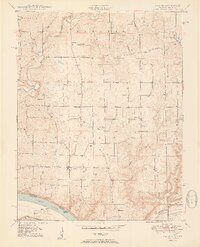
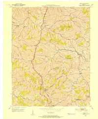
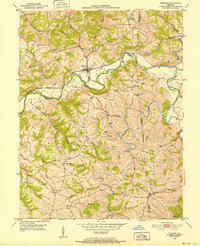
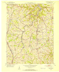
(868)- 1950 Map of Paducah
 1950 Paducah1950 Print · USGSThe confluence of the great midwestern rivers defines this mid-century landscape at the intersection of Illinois, Kentucky, and Missouri. Genealogists and historians can trace the rail-and-river economy through the hubs of Paducah, Cairo, and Metropolis or locate family roots near the Wildcat Hills.
 - 1950 Map of Mingo Mountains
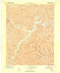
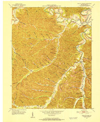
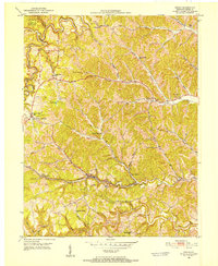
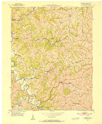
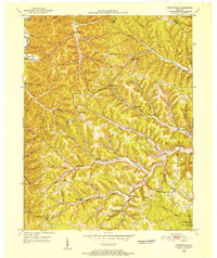
 1950 Mingo Mountains1950 Print · USGSThe Kentucky-Tennessee borderlands appear here at mid-century, capturing the coal-mining settlements and mountain hollows of the Appalachians. Researchers can trace family sites and local landmarks like Rising Spring Church, Manring, and Watson Cem.
 - 1950 Map of Fort Knox
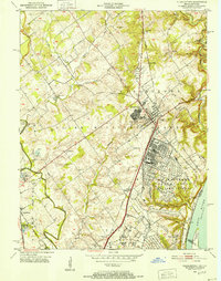
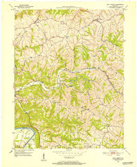
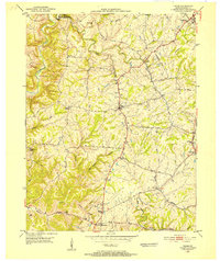
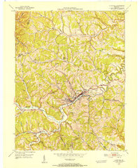
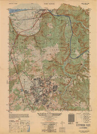 1950 Fort Knox1950 Print · USGSFort Knox and its surroundings in the years following the war show a landscape transformed by military necessity and river valley geography. Researchers can trace the layout of the US Bullion Depository and Godman Field alongside older communities like West Point and Goldville.
 - 1950 Map of Brushart
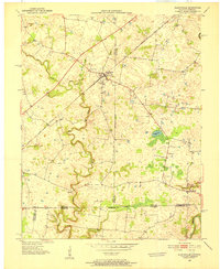
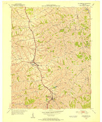
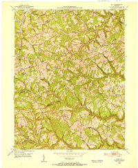
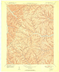 1950 Brushart1950 Print · USGSThe rural borderlands of Lewis and Greenup counties appear in the late 1940s as a landscape of isolated hollows and ridge-top crossings. Researchers can locate numerous local landmarks like Kenton-Furnace Sch, the Allen Cem, and the settlement of Whiteoak.
 - 1950 Map of Laconia
 1950 Laconia1950 Print · USGSHarrison County settlement patterns are preserved here in the mid-twentieth century, centered on the riverfront and the rural crossroads of Laconia. Researchers can trace dozens of family cemeteries like Ferree Cem and vanished landmarks like Rehoboth Sch or Tobacco Landing.2 unique versions available
 - 1950 Map of Charters
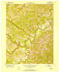
 1950 Charters1950 Print · USGSLewis County hills and hollows are captured here at the mid-century, centered on the communities of Charters and Clarksburg. Genealogists can trace family landmarks and rural institutions like Liberty Grove Ch, Heselton School, and McCoy Cem.
 - 1950 Map of Lexington East, 1952 Print
 1950 Lexington East1952 Print · USGSLexington and the surrounding Bluegrass estates are captured at mid-century as the city expanded along the historic pikes and rail lines. Genealogists and historians can locate family landmarks like the Home of Henry Clay, the Horse Cem, and the settlement of Cadentown.
 - 1950 Map of Head Of Grassy, 1952 Print
 1950 Head Of Grassy1952 Print · USGSLewis County's rugged ridge-and-hollow country is captured here at mid-century, showing the isolated communities of the Kentucky hills. Genealogists can trace family footprints through numerous rural landmarks like Blankenship Sch, Stone Cem, and the settlement of Head of Grassy.3 unique versions available
 - 1950 Map of Charlestown, 1952 Print
 1950 Charlestown1952 Print · USGSSouthern Indiana was undergoing a major industrial and military transformation at mid-century as the Cold War intensified. Local researchers can trace the massive Indiana Arsenal, the path of the Pennsylvania RR, and family history at St Michael Ch or Pleasant Grove Cem.
 - 1950 Map of Lexington West, 1952 Print
 1950 Lexington West1952 Print · USGSThe Bluegrass region around Lexington is captured here in the mid-century, showcasing the era's legendary horse farms and expanding urban footprint. Researchers can trace the grounds of Calumet Farm, locate the Kentucky House of Reform, and explore the 1950s layout of the University of Kentucky.
 - 1950 Map of Bruin, 1952 Print
 1950 Bruin1952 Print · USGSElliott and Carter counties in the early fifties show a landscape of deep hollows and winding creek-bottom settlements. Researchers can locate many family cemeteries and rural school sites such as Ibex Waddell Sch and Flannery Cem along the Little Sandy River.
 - 1950 Map of Beechwood, 1952 Print
 1950 Beechwood1952 Print · USGSThe Indiana-Kentucky borderlands along the Ohio River appear in high detail during the early fifties. Genealogists and hikers can trace remote landmarks like the Buzzard Roost Fire Tower, Old Union Ch, and the Wiseman Cem.3 unique versions available
 - 1950 Map of Mason, 1952 Print
 1950 Mason1952 Print · USGSThe Southern Railway and Dixie Highway corridor defines this mid-century look at Grant County. Genealogists can trace family names at Clark Cem and Morgan Cem or locate old community centers like Mason Sch and Mt Olivet Ch.
 - 1950 Map of Grahn, 1952 Print
 1950 Grahn1952 Print · USGSCarter County's rugged karst hills are captured here in the early fifties, showing a landscape defined by deep hollows and narrow creek bottoms. Researchers can trace the Chesapeake and Ohio rail line past the Aden Tunnel, find family roots at Littleton Cem, or locate the Clay Mines near Grahn.
 - 1950 Map of New Liberty, 1952 Print
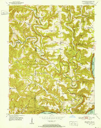
 1950 New Liberty1952 Print · USGSOwen County at mid-century shows a landscape of deep creek valleys and high ridges anchored by the Kentucky River. Genealogists can locate numerous family and lodge landmarks, including the I O O F Cem, White Chapel Sch, and Squiresville.4 unique versions available
 - 1950 Map of Allensville, 1952 Print
 1950 Allensville1952 Print · USGSSpanning the Kentucky and Tennessee border in the early 1950s, this area centers on the vital Louisville and Nashville rail line. Researchers can trace the rural communities of Allensville and Keysburg or locate the Belmont Cem near the winding Red River.2 unique versions available
 - 1950 Map of Glencoe, 1952 Print
 1950 Glencoe1952 Print · USGSThe rural borders of Gallatin, Owen, and Grant Counties come alive in the early fifties, centered on the railroad hub of Glencoe. Genealogists can trace family roots through numerous local sites like the I O O F Cem, Slab Lick Sch, and Pleasant Home Ch.2 unique versions available
 - 1950 Map of Elliston, 1952 Print
 1950 Elliston1952 Print · USGSGrant County is captured in the early fifties, a landscape of winding creek valleys and isolated northern Kentucky hamlets. Researchers can trace rural lineages through family-named sites like Sipple Cem, visit old church sites at Vine Run Ch, and locate fords like Eagle Mill Ford.2 unique versions available
 - 1950 Map of Union, 1952 Print
 1950 Union1952 Print · USGSBoone County's rolling landscape is captured here in the early fifties, showing a rural world of crossroads hamlets and family-named landmarks. You can trace the community life of the era through Sugartit, the New Haven Sch, and old burial grounds like Rice Cem.
 - 1950 Map of Williamstown, 1952 Print
 1950 Williamstown1952 Print · USGSGrant County is captured in the early fifties as the rural landscape began to transition around established transit hubs. Genealogists can trace family names through numerous hilltop burial sites like Dickerson Cem and McGuinnis Cem or explore the settlements of Dry Ridge and Sherman.
 - 1950 Map of Independence, 1952 Print
 1950 Independence1952 Print · USGSNorthern Kentucky in the early postwar years reveals a landscape of ridge-top farms and creek-bottom rail lines. Researchers can trace family sites near Independence or locate rural landmarks like New Banklick Ch and Independence Sta.
 - 1950 Map of Isonville, 1952 Print
 1950 Isonville1952 Print · USGSMid-century Elliott County is mapped here during a period of active rural life and early oil exploration. Researchers can trace ancestral locations through numerous schools like Fairview Sch and landmarks including Peters Hill Lookout Tower and Isonville.
 - 1950 Map of Wesleyville, 1952 Print
 1950 Wesleyville1952 Print · USGSNortheastern Kentucky hill country at the start of the fifties reveals a landscape of isolated hollows and tightly-knit rural communities. Genealogists and hikers can trace old family burial grounds like Jordan Cem or locate the historic Wesleyville Post Office and Smith Creek Sch.
 - 1950 Map of Olive Hill, 1952 Print
 1950 Olive Hill1952 Print · USGSMid-century Carter County comes alive in this survey of the Olive Hill area, where the river-and-rail economy of the Appalachians is on full display. Genealogists and historians can trace family-named ridges and hollows, locating old landmarks like Erie College, James Chapel, and the settlement of Soldier.
 - 1950 Map of Ault, 1952 Print
 1950 Ault1952 Print · USGSNortheastern Kentucky life in the early fifties revolves around winding creek-beds and ridge-top schools. Trace ancestral roots through localized landmarks like Gimlet (PO), Mocabee Ford, and the many rural schools including Rock Springs Sch and Bunker Hill Sch.
Showing maps 1-25 of 868
Top cities of Kentucky
- Louisville historical maps
- Lexington historical maps
- Owensboro historical maps
- Bowling Green historical maps
- Covington historical maps
- Georgetown historical maps
See more
Top counties of Kentucky
- Jefferson County historical maps
- Fayette County historical maps
- Kenton County historical maps
- Boone County historical maps
- Warren County historical maps
- Hardin County historical maps
See more
Frequently asked questions
- What are the different types of historical maps available for Kentucky?
- What is the oldest map of Kentucky?
- Where can I purchase historical maps of Kentucky for my home or office?
- Where can I download high-res historical maps of Kentucky?
- Are there historical topographic maps available for Kentucky?
- Is there historical aerial imagery available for Kentucky?
- Where are historical maps of Kentucky sourced from?