1910s Maps of Kentucky
Explore 74 historic maps of Kentucky from the 1910s. These maps offer a rare glimpse into what life looked like during the 1910s — showing old roads, neighborhoods, homes, and landmarks that have changed or disappeared over time.
Whether you're researching your family's past, planning a metal detecting trip, or studying how Kentucky's landscape evolved across the 1910s, these high-resolution maps are a powerful tool for exploring the history of this region.
- Focus on a specific era: All maps on this page are from the 1910s, giving you a focused view of this time period.
- See what’s changed: Compare century-old streets, trails, and buildings to today's modern landscape using overlays and satellite layers.
- Research with precision: Use these maps for genealogy, historical research, land use analysis, or educational projects.
- View, download, or print: Maps are fully viewable online in high resolution, and can be downloaded or printed for your own records.
Start exploring Kentucky's history through authentic maps from the 1910s. This is your window into the past.
Kentucky maps
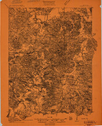
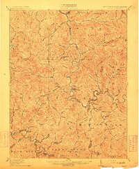
(74)- 1910 Map of Princeton
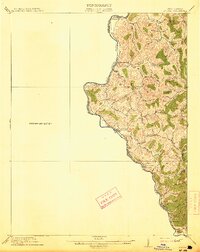
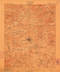 1910 Princeton1910 Print · USGSCaldwell County was a bustling rail hub at the turn of the century, centered on the strategic junction at Princeton. Genealogists can trace rural family roots through a dense network of country schools and churches like Heathen Hill School and Caldwell Chapel.5 unique versions available
 - 1910 Map of Naugatuck
 1910 Naugatuck1910 Print · USGSMingo and Wayne Counties come into focus in the early twentieth century as the coal and timber industry transformed these hollows. Genealogists and researchers can trace the Norfolk and Western rail line through early settlements like Kermit, Breeden, and Naugatuck.
 - 1911 Map of Dawson Springs
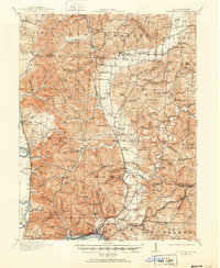
 1911 Dawson Springs1911 Print · USGSWestern Kentucky’s coal and rail corridors are captured here just after the turn of the century. Genealogists can trace family footprints through dozens of rural sites like the Daniel Boone School, Franklin's Store, and the Fox Run Mine.2 unique versions available
 - 1911 Map of Louisa
 1911 Louisa1911 Print · USGSThe West Virginia borderlands along the Big Sandy River come to life in this early twentieth-century study of Wayne County. Trace family roots and vanished rail stops like Fort Gay, Glenhayes, and Saltpeter along the Norfolk and Western Railway line.
 - 1911 Map of Drakesboro
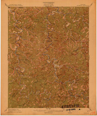
 1911 Drakesboro1911 Print · USGSMuhlenberg County was a landscape of dense rural school districts and emerging rail towns just before the Great War. Genealogists can trace family names through landmarks like Mays Store, Rhodes Chapel, and the uniquely named settlement of Lickskillet.
 - 1911 Map of Dunmor
 1911 Dunmor1911 Print · USGSMuhlenberg and Butler Counties are shown here just before the Great War, when river ferries and small rural schools anchored local life. Genealogists can trace family footprints at Mining City, Ebenezer Church, and the river landings near Skilesville.
 - 1911 Map of Sciotoville, 1952 Print
 1911 Sciotoville1952 Print · USGSThe industrial riverfronts and rural hollows of southern Ohio are shown here in the early twentieth century before modern development. Genealogists and historians can trace numerous rural landmarks like Davis Sta George PO, Harrison Furnace School, and the brickyards near New Boston.2 unique versions available
 - 1911 Map of Monticello, 1952 Print
 1911 Monticello1952 Print · USGSWayne County and the southern loops of the Cumberland River are captured here in the early twentieth century before modern reservoirs changed the valley. Genealogists can locate dozens of country schools and churches, from Old Glory School to Union Church, alongside river landings like Rankin Landing.2 unique versions available
 - 1912 Map of Prospect
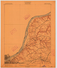 1912 Prospect1912 Print · USGSThe northeastern outskirts of Louisville and the riverbanks of the Ohio River appear here in the early twentieth century. Researchers can trace the development of suburban settlements like Anchorage and St Matthews or locate the sprawling grounds of the Lakeland Asylum.3 unique versions available
 - 1912 Map of Pound
 1912 Pound1912 Print · USGSThe borderlands of Wise County and Kentucky are captured in the early twentieth century before the coal industry fully reshaped the mountain hollows. Researchers can trace ancestral locations of schools and gaps, such as Upper Millstone School, Pound Gap, and the settlement of Jenkins.2 unique versions available
 - 1912 Map of Naugatuck
 1912 Naugatuck1912 Print · USGSMingo and Wayne County borderlands are shown here in the early twentieth century, as the river-and-rail economy transformed these Appalachian hollows. Genealogists and historians can trace family-named sites along the Tug Fork and Norfolk and Western Ry, including Kermit, Naugatuck, and Breeden.
 - 1912 Map of Gilbert
 1912 Gilbert1912 Print · USGSThe Guyandot River valley and the industrial Tug Fork corridor define this region in the early nineteen-hundreds. Researchers can trace rail-tied settlements like Wharncliffe and War Eagle or find rural landmarks such as Twisted Gun Gap and North Spring.2 unique versions available
 - 1912 Map of Kosmosdale
 1912 Kosmosdale1912 Print · USGSThe Ohio River valley and the Kentucky Knobs come alive in this pre-war survey, showing the expansion of southern Louisville and the rural hills of Jefferson and Bullitt counties. Researchers can locate vanished landmarks like Locust Point P.O. and the County Infirmary, or trace the old riverboat stops at Stewarts Landing.4 unique versions available
 - 1912 Map of Hindman
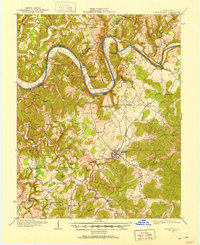
 1912 Hindman1912 Print · USGSThe Kentucky hills around Hindman appear in remarkable detail during the early twentieth century, showing a landscape defined by isolated hollows. Genealogists can trace early homesteads and communities like Elmrock, Kite, and Democrat, as well as numerous numbered schoolhouses along Troublesome Creek.
 - 1912 Map of Nortonville
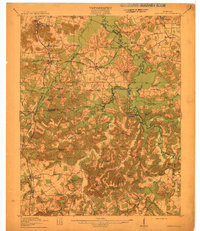 1912 Nortonville1912 Print · USGSWestern Kentucky at the start of the decade is defined here by its busy rail junctions and rural merchant economy. Genealogists and historians can trace family roots through numerous country schools and stores, including Clement School, Jordons Store, and Greens Chapel.3 unique versions available
 - 1913 Map of Ceredo
 1913 Ceredo1913 Print · USGSThe confluence of the Ohio and Big Sandy rivers comes alive in this pre-war survey of the West Virginia-Ohio borderlands. Genealogists and rail historians can trace the early footprints of Kenova, Ceredo, and the winding path of Twelvepole Creek.4 unique versions available
 - 1913 Map of Oven Fork
 1913 Oven Fork1913 Print · USGSLetcher County's steep ridges and narrow hollows are shown here in the early twentieth century, just as the Lexington and Eastern Ry arrived. Genealogists can trace family settlements from Whitesburg to Blackey, and locate early schools and landmarks like Campbranch Chapel or Pound Gap.
 - 1913 Map of Drakesboro
 1913 Drakesboro1913 Print · USGSMuhlenberg County in the early twentieth century was a bustling intersection of coal mining and major rail lines. Genealogists and historians can trace dozens of early rural schools and crossroads stores like Liberty Hill School, Belton Jost PO, and Dixon's Store.2 unique versions available
 - 1913 Map of Louisa
 1913 Louisa1913 Print · USGSThe river borders of West Virginia and Kentucky come alive in this pre-World War I survey of the Big Sandy valley. Genealogists can trace family footprints in Fort Gay, Saltpeter, and Glenhayes or locate the rural Buck Church.3 unique versions available
 - 1913 Map of Buckhorn
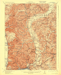
 1913 Buckhorn1913 Print · USGSThe North and Middle Forks of the Kentucky River dominate this pre-WWI landscape of steep ridges and deep valleys. Genealogists can locate family homesteads near Witherspoon College or trace ancestors along the Lexington and Eastern Ry through Chavies and Haddix.2 unique versions available
 - 1913 Map of Sciotoville, 1924 Print
 1913 Sciotoville1924 Print · USGSScioto County during the early twentieth century shows a landscape of river-front industry and deep-hollow settlements. Genealogists can trace family footprints across dozens of local school sites like Noel School and early industrial markers such as Scioto Furnace and Star Brickyard.2 unique versions available
 - 1913 Map of Clintwood, 1962 Print
 1913 Clintwood1962 Print · USGSVirginia's rugged coal country is captured here during the early twentieth century, showing a landscape of isolated ridge-top schools and river-valley settlements. Genealogists can trace family footprints across dozens of local sites like Hatchet Church, Smith Corners, and the Nichols Gap School.
 - 1914 Map of East Cincinnati
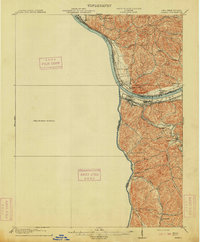
 1914 East Cincinnati1914 Print · USGSThe eastern Cincinnati suburbs and Northern Kentucky riverfront come alive in this pre-war survey of industrial and residential growth. Genealogists can trace family footprints near the St Aloysius Orphan Asylum, Alpine Bell School, or the Covington Reservoirs.4 unique versions available
 - 1914 Map of Laynesville
 1914 Laynesville1914 Print · USGSEastern Kentucky's river valleys and mountain hollows are meticulously mapped here in the years before the Great War. Genealogists can trace the locations of dozens of early schoolhouses, from School No 16 to the Sandy Valley Normal School, alongside river towns like Laynesville and Betsy Layne.
 - 1914 Map of Monticello
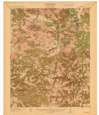
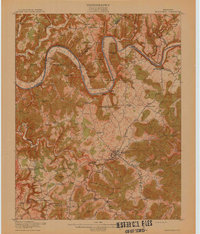 1914 Monticello1914 Print · USGSWayne County life in the early twentieth century centered on the Cumberland River and the crossroads at Monticello. Genealogists and historians can trace numerous rural institutions like Old Glory School, Union Church, and the Ramsey Branch Stop PO.4 unique versions available
Showing maps 1-25 of 74
Top cities of Kentucky
- Louisville historical maps
- Lexington historical maps
- Owensboro historical maps
- Bowling Green historical maps
- Covington historical maps
- Georgetown historical maps
See more
Top counties of Kentucky
- Jefferson County historical maps
- Fayette County historical maps
- Kenton County historical maps
- Boone County historical maps
- Warren County historical maps
- Hardin County historical maps
See more
Frequently asked questions
- What are the different types of historical maps available for Kentucky?
- What is the oldest map of Kentucky?
- Where can I purchase historical maps of Kentucky for my home or office?
- Where can I download high-res historical maps of Kentucky?
- Are there historical topographic maps available for Kentucky?
- Is there historical aerial imagery available for Kentucky?
- Where are historical maps of Kentucky sourced from?