1940s Maps of Kentucky
Explore 79 historic maps of Kentucky from the 1940s. These maps offer a rare glimpse into what life looked like during the 1940s — showing old roads, neighborhoods, homes, and landmarks that have changed or disappeared over time.
Whether you're researching your family's past, planning a metal detecting trip, or studying how Kentucky's landscape evolved across the 1940s, these high-resolution maps are a powerful tool for exploring the history of this region.
- Focus on a specific era: All maps on this page are from the 1940s, giving you a focused view of this time period.
- See what’s changed: Compare century-old streets, trails, and buildings to today's modern landscape using overlays and satellite layers.
- Research with precision: Use these maps for genealogy, historical research, land use analysis, or educational projects.
- View, download, or print: Maps are fully viewable online in high resolution, and can be downloaded or printed for your own records.
Start exploring Kentucky's history through authentic maps from the 1940s. This is your window into the past.
Kentucky maps
(79)- 1940 Map of Hiatt
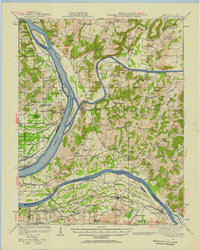
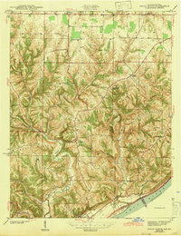
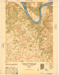
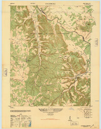
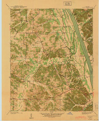 1940 Hiatt1940 Print · USGSThe Tennessee River valley is shown just before the landscape was transformed by damming. Genealogists can trace family landmarks like Faughn Cem, Inmans Store, and riverfront sites at Ironton Landing.
 - 1940 Map of Paducah, 1958 Print
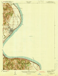
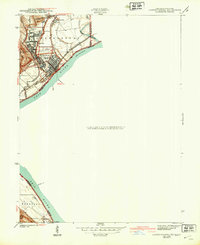
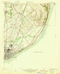
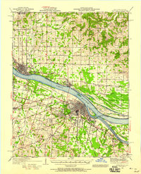 1940 Paducah1958 Print · USGSAcross the river from Illinois at the start of the 1940s, this area captures Paducah and Metropolis at a peak of rail and river activity. Researchers can trace the Illinois Central RR lines, locate family markers at Veyer Cemetery, and find rural landmarks like Klondike Sch and Palestine Ch.
 - 1941 Map of Ekron
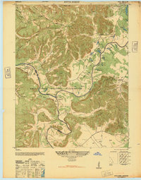
 1941 Ekron1941 Print · USGSNorthern Kentucky and the Ohio River shoreline are captured here in the early 1940s, showing the rural communities of Meade and Hardin Counties. Genealogists can trace family locations near Ekron, Shumate School, and the historic Sherman Landing.
 - 1942 Map of New Concord
 1942 New Concord1942 Print · USGSCalloway County is captured here in the early 1940s, showing a landscape of ridge-top farms and winding creek bottoms before major modern development. Genealogists can trace family roots through numerous small burial grounds like Outland Cem and country landmarks such as Sulphur Sprs Ch or Pottertown.
 - 1942 Map of Gallatin
 1942 Gallatin1942 Print · USGSThe Tennessee-Kentucky borderlands were a crossroads of river and rail during the early war years. Genealogists and historians can trace family roots through dozens of named settlements like Bethpage, Prices Mill, and Mitchellville, or locate historic river crossings such as Kirkpatricks Ferry.
 - 1942 Map of Hico
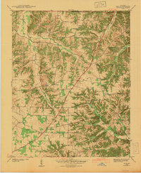 1942 Hico1942 Print · USGSCalloway and Marshall counties are shown here just before the war, capturing a rural landscape of ridge-top farms and creek-bottom timber. Researchers can locate family landmarks like Tatums Store, Shiloh Ch, and numerous burial sites including Curd Cem.
 - 1942 Map of Smithland, 1957 Print
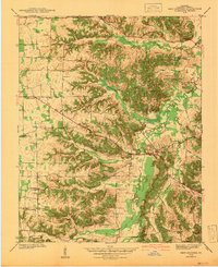
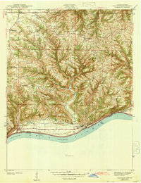
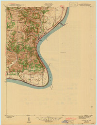
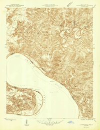
 1942 Smithland1957 Print · USGSWestern Kentucky's river-driven economy is on full display during the early 1940s as the Ohio, Cumberland, and Tennessee rivers converge. Researchers can trace historic river crossings like Haddox Ferry and find family landmarks at Kincaid Mounds or the Klondike Mine.
 - 1943 Map of Vine Grove
 1943 Vine Grove1943 Print · USGSHardin and Meade Counties appear here during a period of massive mid-century growth at Fort Knox. Genealogists can trace family homesteads near landmarks like Stovall Chapel, Red Hill, and the many rural schools including Hays Sch and Deckard Sch.
 - 1943 Map of Florence
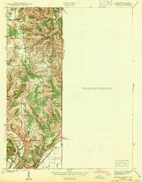
 1943 Florence1943 Print · USGSSwitzerland County's rugged riverfront is captured here in the early 1940s, showing the steep ridges and hollows overlooking the Ohio River. Genealogists can locate family landmarks like Bark Works Cem, the Warsaw Ferry crossing, and local schools such as Phillips Sch and West Union Sch.
 - 1943 Map of Aberdeen
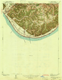
 1943 Aberdeen1943 Print · USGSSoutheastern Indiana's river hills are captured here just before mid-century, showing a landscape of ridge-top farms and creek-side settlements. Researchers can locate family landmarks like Gillespie Cem, Bascom Corner, and several schools including Fisher Sch.2 unique versions available
 - 1943 Map of Aurora
 1943 Aurora1943 Print · USGSDearborn County as it appeared in the early 1940s shows a landscape where river commerce and rail lines defined the growth of Aurora. Genealogists and local historians can trace rural schoolhouses like Worley Sch, country churches such as Mt Tabor Ch, and the original Baltimore and Ohio rail route.2 unique versions available
 - 1943 Map of Vevay North
 1943 Vevay North1943 Print · USGSSoutheast Indiana during the early years of the war shows a landscape of ridge-top farms and river valley settlements. Genealogists can trace family footprints through numerous rural landmarks like Mt Sterling, Stow Cem, and Jacksonville Sch.2 unique versions available
 - 1943 Map of Rising Sun
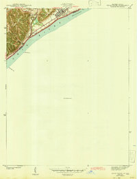
 1943 Rising Sun1943 Print · USGSThe Ohio River valley in the early 1940s was a landscape defined by riverside settlements and the steady work of river navigation. Genealogists can trace family histories through local landmarks like German Cem, North Landing, and the Laughery Club.
 - 1943 Map of Hooven
 1943 Hooven1943 Print · USGSThe Indiana-Ohio borderlands come into focus in the early 1940s, showing a landscape defined by the Whitewater R and the New York Central rail line. Researchers can locate early family sites near Sugar Ridge Cem, the Full Gospel Mission, and the State Line Monument.
 - 1943 Map of Brooksburg
 1943 Brooksburg1943 Print · USGSJefferson and Switzerland counties meet along the Ohio River in this early 1940s survey of the Indiana-Kentucky border. Trace the river-based economy and rural transit of the era through the Carrollton Ferry and family landmarks like Mc Kay Cem and McKay Sch.
 - 1943 Map of Lawrenceburg
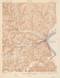
 1943 Lawrenceburg1943 Print · USGSThe Indiana-Kentucky-Ohio tri-state border comes alive in this wartime-era survey of the Ohio River valley. Researchers can trace the rail-side growth of Lawrenceburg and Greendale or locate family plots in the Greendale Cem.
 - 1943 Map of Patriot
 1943 Patriot1943 Print · USGSThe river town of Patriot and the winding Indiana shoreline appear here as they were in the early 1940s. Genealogists can trace family names through several rural landmarks, including Mc Nutt Cem, Wigal Cem, and Concord Ch.
 - 1943 Map of Vevay South
 1943 Vevay South1943 Print · USGSThe Indiana side of the Ohio River is captured in the early 1940s, showing the riverside town of Vevay and its surrounding hills. Genealogists can trace family landmarks like Potato Bug Hill, the Bridge Sch, and the County Infirmary.
 - 1944 Map of Clarksville, 1946 Print
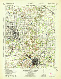 1944 Clarksville1946 Print · USGSThe Kentucky-Tennessee border during the mid-forties shows a landscape transformed by the massive expansion of Camp Campbell. Researchers can trace the early layout of the base and its Small Arms Ranges alongside historic sites like Dunbar Cave and the Sunnyside Church.
 - 1946 Map of Rock Haven
 1946 Rock Haven1946 Print · USGSMeade County, Kentucky, is shown here in the immediate post-war era, where the Ohio River valley meets the expanding military footprint of the time. Genealogists and historians can trace the foundations of Garnettsville, locate Doe Run Mill, and find family landmarks like Buck Grove Ch or Rockridge Sch.
 - 1946 Map of Pitts Point
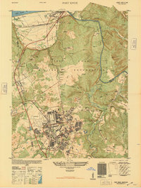
 1946 Pitts Point1946 Print · USGSIn the mid-1940s, this area of Bullitt and Hardin County was transforming into a vital military landscape. Genealogists can locate numerous community landmarks like Hays School, Stowers Branch Cem, and the river junction at Pitts Point.
 - 1946 Map of Leavenworth
 1946 Leavenworth1946 Print · USGSThe Indiana-Kentucky borderlands come into focus in the mid-1940s as the river economy of the Ohio Valley transitions toward modern infrastructure. Trace family homesteads and local history through rural anchors like Blue River Chapel, Sunshine Sch, and the riverside community of Leavenworth.
 - 1946 Map of Fort Knox
 1946 Fort Knox1946 Print · USGSFort Knox and the surrounding Kentucky riverlands are captured just after the war as the military installation reached its modern maturity. Researchers can trace the layout of Godman Field, locate the famous Bullion Depository, and find family landmarks like Montgomery Cem or the town of West Point.
 - 1946 Map of Colesburg
 1946 Colesburg1946 Print · USGSHardin and Bullitt Counties are shown at a transitional post-war moment when military activity and rural Kentucky life intersected. Researchers can locate the Fort Knox Military Reservation alongside older landmarks like Zion School and Mather Cem.
 - 1946 Map of Jeffersonville
 1946 Jeffersonville1946 Print · USGSSouthern Indiana sits at a crossroads of river and rail during the mid-1940s, as the industrial grid of Jeffersonville meets the rural Clark Military Grant. Researchers can trace family roots at Walnut Ridge Cem or locate vanished schoolhouses like Lane Sch and Middle Road Sch.2 unique versions available
Showing maps 1-25 of 79
Top cities of Kentucky
- Louisville historical maps
- Lexington historical maps
- Owensboro historical maps
- Bowling Green historical maps
- Covington historical maps
- Georgetown historical maps
See more
Top counties of Kentucky
- Jefferson County historical maps
- Fayette County historical maps
- Kenton County historical maps
- Boone County historical maps
- Warren County historical maps
- Hardin County historical maps
See more
Frequently asked questions
- What are the different types of historical maps available for Kentucky?
- What is the oldest map of Kentucky?
- Where can I purchase historical maps of Kentucky for my home or office?
- Where can I download high-res historical maps of Kentucky?
- Are there historical topographic maps available for Kentucky?
- Is there historical aerial imagery available for Kentucky?
- Where are historical maps of Kentucky sourced from?