1930s Maps of Kentucky
Explore 99 historic maps of Kentucky from the 1930s. These maps offer a rare glimpse into what life looked like during the 1930s — showing old roads, neighborhoods, homes, and landmarks that have changed or disappeared over time.
Whether you're researching your family's past, planning a metal detecting trip, or studying how Kentucky's landscape evolved across the 1930s, these high-resolution maps are a powerful tool for exploring the history of this region.
- Focus on a specific era: All maps on this page are from the 1930s, giving you a focused view of this time period.
- See what’s changed: Compare century-old streets, trails, and buildings to today's modern landscape using overlays and satellite layers.
- Research with precision: Use these maps for genealogy, historical research, land use analysis, or educational projects.
- View, download, or print: Maps are fully viewable online in high resolution, and can be downloaded or printed for your own records.
Start exploring Kentucky's history through authentic maps from the 1930s. This is your window into the past.
Kentucky maps
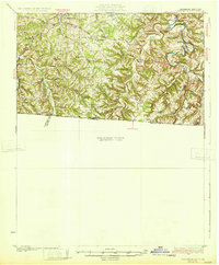
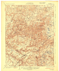
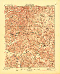
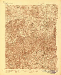
(99)- 1930 Map of Greenup
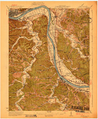 1930 Greenup1930 Print · USGSThe industrial corridor of the Ohio River valley is captured here in the early twentieth century, showing the borderlands of Greenup County and southern Ohio. Researchers can trace the legacy of iron production at Franklin Furnace or locate family roots near Tongs P O and Wurtland.3 unique versions available
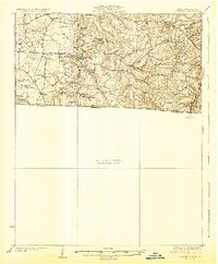
 - 1930 Map of Falmouth
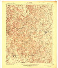
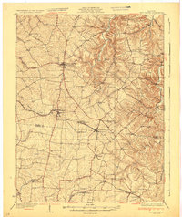
 1930 Falmouth1930 Print · USGSPendleton and Harrison counties are shown here in the early thirties, centered on the river-and-rail hub of Falmouth. Genealogists and historians can locate dozens of country institutions like Bunker Hill Sch, Mt Carmel Ch, and the riverside station at Catawba.
 - 1930 Map of Middlesboro
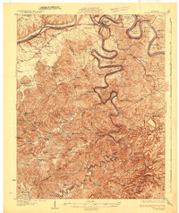
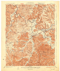
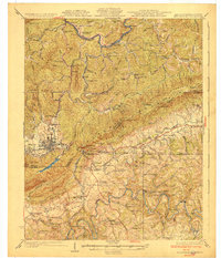 1930 Middlesboro1930 Print · USGSThe tri-state border region comes alive in the late 1920s, centered on the strategic mountain pass at Cumberland Gap. Genealogists and historians can trace family locations near Middlesboro, early campus sites at Lincoln Memorial University, and rural landmarks like Ellison Mill.4 unique versions available
 - 1931 Map of Hardinsburg
 1931 Hardinsburg1931 Print · USGSBreckinridge and Meade Counties are shown in meticulous detail during the late Prohibition era, before modern highways bypassed many rural communities. Researchers can trace dozens of country schools and churches like Giltedge Sch or the Gar Rook Mine along the Louisville and Nashville line.3 unique versions available
 - 1931 Map of Felicity
 1931 Felicity1931 Print · USGSClermont County's riverfront and rolling uplands are captured here in the early thirties as a network of small schoolhouses and rail lines defined rural life. Researchers can trace the path of the Cincinnati Georgetown and Portsmouth RR or locate family sites near Felicity, Utopia, and Lock 34.2 unique versions available
 - 1931 Map of Corydon
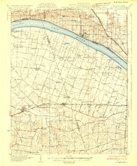
 1931 Corydon1931 Print · USGSThe Kentucky-Indiana borderlands along the Ohio River are captured here during the late Prohibition era. Local researchers can trace the riverbank settlement of Brandenburg or locate landmarks like the Oak Grove Sch and Hamilton Hill.4 unique versions available
 - 1931 Map of Lafayette
 1931 Lafayette1931 Print · USGSThe Kentucky and Tennessee borderlands in the late twenties were a network of tight-knit rural communities connected by winding river hollows. Genealogists and local historians can trace family roots through numerous small landmarks like Austin Sch, Mt Zion Ch, and the settlement of Holland.2 unique versions available
 - 1931 Map of Adolphus
 1931 Adolphus1931 Print · USGSThe Kentucky-Tennessee state line was a landscape of river fords and country schoolhouses during the late Prohibition era. Genealogists can trace family footprints through dozens of local landmarks like Old Mill Ford, McKendree Chapel, and Pinkle Cem.2 unique versions available
 - 1931 Map of Eddyville
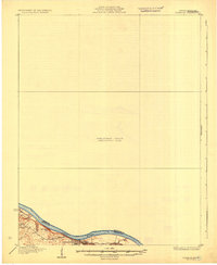
 1931 Eddyville1931 Print · USGSWestern Kentucky life along the winding Cumberland River is captured here in the late twenties, before the landscape was altered by massive dam projects. Genealogists and historians can trace family roots through dozens of rural landmarks like Shelby's Store, the Nancy Hanks Mine, and Williams Chapel Sch.
 - 1931 Map of Red Boiling Springs
 1931 Red Boiling Springs1931 Print · USGSCrossing the state line during the late twenties, this survey captures a landscape of ridge-top schools and creek-side settlements. Genealogists can trace family footprints through numerous rural landmarks like Sadlers Chapel, Akersville, and Hermitage Springs PO.3 unique versions available
 - 1931 Map of Higginsport, 1948 Print
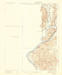
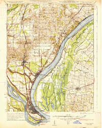
 1931 Higginsport1948 Print · USGSThe Ohio River corridor and Brown County hinterlands come alive in this early twentieth-century survey of the borderlands near Georgetown. Local historians can trace long-gone rural schoolhouses like McFadden School or locate the historic Brown County Infirmary and the Abandoned Columbus and Sardinia Road.
 - 1931 Map of Cairo, 1954 Print
 1931 Cairo1954 Print · USGSSouthern Illinois and western Kentucky meet at the great river confluence during the late 1920s and early 1930s. Genealogists can trace family footprints through numerous rural landmarks like Pleasant Hill Sch, the National Cem, and the riverfront at Mound City.2 unique versions available
 - 1932 Map of Big Clifty
 1932 Big Clifty1932 Print · USGSGrayson and Hardin Counties are captured here between the World Wars, showing a rural landscape defined by the Illinois Central Railroad and the Dixie Highway. Genealogists and historians can locate dozens of small community centers like Big Clifty, White Mills, and the Asphalt Mine.5 unique versions available
 - 1932 Map of Hagan
 1932 Hagan1932 Print · USGSThe rugged borderlands of Kentucky and Virginia come to life in this early 1930s survey of the high gaps and hollows. Researchers can locate remote mountain landmarks like Hensley Sch, Feepee Store, and the scattered cabins at Alva.3 unique versions available
 - 1932 Map of Burnside
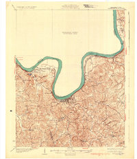
 1932 Burnside1932 Print · USGSThe Cumberland River and its South Fork are captured here in the early 1930s, showing the intricate river-and-rail topography of southern Kentucky. Researchers can locate dozens of country landmarks like Roberts Mill, Lovells Chapel, and Pole Bridge Sch.2 unique versions available
 - 1932 Map of New Castle
 1932 New Castle1932 Print · USGSHenry and Shelby Counties are captured here between the world wars as the rail and river economy thrived. Genealogists can trace family landmarks and rural schoolhouses like Hill Spring Sch, Burks Branch Sch, and the stop at Bellview Hill Spring Sta.
 - 1932 Map of Lawrenceburg
 1932 Lawrenceburg1932 Print · USGSThe tri-state confluence of Indiana, Ohio, and Kentucky comes alive in this early 1930s survey of the river valleys. Genealogists can trace family roots through rural landmarks like Eighteenmile House, Bullittsville Ch, and the Woolper Sch.3 unique versions available
 - 1932 Map of Fordsville
 1932 Fordsville1932 Print · USGSThe hill country of Ohio and Breckinridge Counties is captured here in the early thirties as the railroad age peaked. Researchers can trace family sites at Barretts Ferry PO Davidson Sta, Glen Dean, and the many schools like Fallen Rock Sch.
 - 1932 Map of La Center
 1932 La Center1932 Print · USGSWestern Kentucky and southern Illinois meet along the Ohio River in the early 1930s, showing a landscape of river landings and rail-side towns. Genealogists can trace family roots through numerous rural landmarks like Monkeys Eyebrow, Hinkleville, and Gum Corners Sch.
 - 1932 Map of La Grange
 1932 La Grange1932 Print · USGSThe Bluegrass region in the early thirties reveals a landscape defined by the Louisville and Nashville Railroad and the Ohio River. Genealogists can locate family landmarks like Henrysville Cemetery and several rural schoolhouses including Sweeney Sch.
 - 1933 Map of Cairo
 1933 Cairo1933 Print · USGSThe tri-state confluence of the Ohio and Mississippi rivers comes alive in the early 1930s, showing the vital rail and river hubs of Cairo and Mound City. Genealogists can pinpoint rural life through dozens of named sites like Bethlehem Ch, Rife Sch, and the National Cem.3 unique versions available
 - 1934 Map of Cannelton
 1934 Cannelton1934 Print · USGSThe Ohio River corridor between Indiana and Kentucky comes to life in this mid-1930s survey of the riverfront and its rugged hinterlands. Genealogists can trace family footprints through a dense network of country schools and churches, from St Johns Ch and New Bethel Ch to rural outposts like Mattingly PO.2 unique versions available
 - 1934 Map of Barthell
 1934 Barthell1934 Print · USGSMcCreary County during the late 1920s reveals a landscape of industrial outposts and river-bound settlements at the edge of the Tennessee line. Researchers can trace the Kentucky and Tennessee Railway corridor or find family roots at Kidds Crossing, Cooperative, and Laurel Hill Ch.
 - 1934 Map of Munfordville
 1934 Munfordville1934 Print · USGSHart County communities line the corridor of the Green River and the Nashville Road during the mid-1930s. Genealogists can trace family footprints through dozens of local landmarks like Poundstone Roller Mill, Big Springs Cem, and Priceville.
 - 1934 Map of Salt Lick
 1934 Salt Lick1934 Print · USGSNortheastern Kentucky’s river valleys and ridgelines are captured here in the 1930s, centered on the vital rail corridor through Salt Lick. Genealogists and historians can trace dozens of rural schoolhouses and churches, including Arnold Chapel Sch, Olympia Springs, and Moores Ferry on the Licking River.
Showing maps 1-25 of 99
Top cities of Kentucky
- Louisville historical maps
- Lexington historical maps
- Owensboro historical maps
- Bowling Green historical maps
- Covington historical maps
- Georgetown historical maps
See more
Top counties of Kentucky
- Jefferson County historical maps
- Fayette County historical maps
- Kenton County historical maps
- Boone County historical maps
- Warren County historical maps
- Hardin County historical maps
See more
Frequently asked questions
- What are the different types of historical maps available for Kentucky?
- What is the oldest map of Kentucky?
- Where can I purchase historical maps of Kentucky for my home or office?
- Where can I download high-res historical maps of Kentucky?
- Are there historical topographic maps available for Kentucky?
- Is there historical aerial imagery available for Kentucky?
- Where are historical maps of Kentucky sourced from?