1910s Maps of Maine
Explore 115 historic maps of Maine from the 1910s. These maps offer a rare glimpse into what life looked like during the 1910s — showing old roads, neighborhoods, homes, and landmarks that have changed or disappeared over time.
Whether you're researching your family's past, planning a metal detecting trip, or studying how Maine's landscape evolved across the 1910s, these high-resolution maps are a powerful tool for exploring the history of this region.
- Focus on a specific era: All maps on this page are from the 1910s, giving you a focused view of this time period.
- See what’s changed: Compare century-old streets, trails, and buildings to today's modern landscape using overlays and satellite layers.
- Research with precision: Use these maps for genealogy, historical research, land use analysis, or educational projects.
- View, download, or print: Maps are fully viewable online in high resolution, and can be downloaded or printed for your own records.
Start exploring Maine's history through authentic maps from the 1910s. This is your window into the past.
Maine maps
- 1910 Map of Kezar Falls
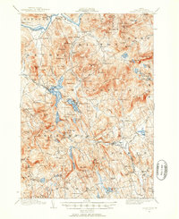
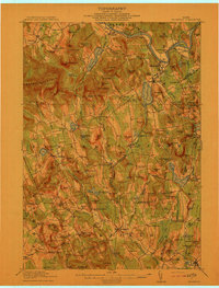
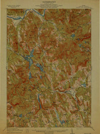
 1910 Kezar Falls1910 Print · USGSMaine and New Hampshire borderlands are captured here at the height of the railroad era, as the Maine Central linked river towns. Genealogists can trace family footprints through sites like the Parsonsfield Seminary, Merrill Corner, and the Haley School.5 unique versions available
 - 1910 Map of Livermore, 1959 Print
 1910 Livermore1959 Print · USGSMaine's river valleys and lake districts are captured here in the early twentieth century, showing a network of rail-reliant mill towns and rural crossroads. Genealogists can locate family landmarks like Howes Corner and Brettuns Mills, or trace local schools like Saunders School.
 - 1911 Map of Fryeburg
 1911 Fryeburg1911 Print · USGSOxford County at the start of the century shows a landscape of lake-fed valleys and the bustling rail corridor of the Maine Central RR. Genealogists and historians can trace old school districts like Foxboro School, local landmarks like the Battle Monument, and early settlements at Slab City and Lynchville.6 unique versions available
 - 1911 Map of Kezar Falls
 1911 Kezar Falls1911 Print · USGSThe Saco River valley at the turn of the century shows a landscape defined by riverside industry and mountain schools. Genealogists and historians can trace rail depots like Bridgton Junction and early landmarks such as Parsonsfield Seminary and Rankins Mill.5 unique versions available
 - 1911 Map of Ellsworth
 1911 Ellsworth1911 Print · USGSCoastal Hancock County at the turn of the century shows a landscape of busy rail junctions and remote plantation schools. Genealogists can trace family names at Washington Junction or locate the old Beechland School and Morrison School.5 unique versions available
 - 1911 Map of Bryant Pond, 1953 Print
 1911 Bryant Pond1953 Print · USGSOxford County at the start of the twentieth century shows a landscape of mountain ridges and valley mill towns. You can trace the rural school system and early transport lines through Bryant Pond, West Paris, and the waters of Mt Zircon Spring.3 unique versions available
 - 1911 Map of Buckfield, 1958 Print
 1911 Buckfield1958 Print · USGSOxford County at the dawn of the twentieth century was a landscape of high ridges and tight river valleys connected by new rail lines. Genealogists can locate dozens of district schoolhouses like Bonney School and rural hubs such as Buckfield and Brettuns Mills Livermore P O.
 - 1912 Map of Livermore
 1912 Livermore1912 Print · USGSMaine's lake district comes to life in this pre-war survey of the Androscoggin River valley. Genealogists and historians can trace old homesteads and landmarks like Brettuns Mills Livermore P O, Strickland Ferry, and Monmouth Academy.5 unique versions available
 - 1913 Map of Skowhegan
 1913 Skowhegan1913 Print · USGSSomerset County thrives as a hub of rail and river industry in this pre-war survey. Genealogists can trace family names through dozens of rural landmarks like Malbons Mills, the Union Church, and neighborhood schoolhouses from Athens to Canaan.4 unique versions available
 - 1913 Map of Buckfield
 1913 Buckfield1913 Print · USGSOxford County towns and mountain peaks are captured here in the early twentieth century. Researchers can trace rural family roots through numerous named schoolhouses like the Meadowview Academy, Jones School, and the Bear Mountain School.5 unique versions available
 - 1913 Map of Waldoboro
 1913 Waldoboro1913 Print · USGSCoastal Lincoln and Knox counties come alive in this pre-war survey, showing a landscape of tightly-knit villages and rural school districts connected by the river and rail. Researchers can trace ancestral footprints at the Old Dutch Church, Winslows Mills, and the Benners Corner Cem.2 unique versions available
 - 1914 Map of Portland
 1914 Portland1914 Print · USGSCoastal Maine at the start of the twentieth century shows a landscape tied together by industrial rivers and an expanding network of electric railroads. Genealogists can locate family names at Hillside Cemetery or trace old rural schoolhouses like the Babb School and Beech Ridge School.
 - 1914 Map of Casco Bay
 1914 Casco Bay1914 Print · USGSCumberland County's coastline and islands are shown in 1914, featuring a landscape of active coastal defenses and bustling maritime travel. Researchers can locate prominent landmarks such as Fort Mc Kinley, the Portland Head Light, and various steamer stops like Eastern Landing.
 - 1914 Map of Bethel
 1914 Bethel1914 Print · USGSOxford County mountain life and river valley commerce converge in this pre-World War I survey of the Bethel region. Genealogists and historians can trace old homestead paths to the Town House, several rural schoolhouses like Dresser School, and the path of the Grand Trunk R R.5 unique versions available
 - 1914 Map of Bryant Pond
 1914 Bryant Pond1914 Print · USGSOxford County at the dawn of the Great War was a land of valley mills and mountain schools connected by the iron rail. Genealogists can trace family footprints near Paris Hill, or locate long-standing landmarks like Abbotts Mill and the Patch Mountain School.4 unique versions available
 - 1915 Map of Waldoboro
 1915 Waldoboro1915 Print · USGSCoastal Lincoln County is surveyed here in the early twentieth century, showing a landscape defined by tidal rivers and small farming hamlets. Genealogists can locate family-named sites like Flanders Corner and rural institutions such as the Branch School and Broad Cove PO.5 unique versions available
 - 1915 Map of Belfast, 1962 Print
 1915 Belfast1962 Print · USGSMid-coast Maine at the start of the twentieth century shows a landscape of busy harbor towns and high-altitude farms. Genealogists can trace family names across dozens of rural landmarks, from Holmes Mill and Simpsons Corner to the numerous remote schoolhouses like Bartlett School.
 - 1916 Map of Portland
 1916 Portland1916 Print · USGSGreater Portland and the Cumberland County coast are documented here during the height of the trolley and rail era. Researchers can trace ancestral property near the Evergreen Cemetery, early industries at Cumberland Mills, and vanished local sites like the State Reform School.7 unique versions available
 - 1916 Map of Casco Bay
 1916 Casco Bay1916 Print · USGSCumberland County’s shoreline was a landscape of strategic military forts and busy steamboat landings in the years before the Great War. Genealogists and historians can trace coastal heritage through landmarks like Fort Williams, Pine Grove School, and the scattered piers of Falmouth Foreside.8 unique versions available
 - 1916 Map of Dover
 1916 Dover1916 Print · USGSCoastal New Hampshire and the Maine borderlands are captured here during the height of the rail era. Genealogists can locate dozens of district schools like Madbury School and trace the paths of the Boston and Maine Railroad through Portsmouth and Dover.2 unique versions available
 - 1916 Map of Portland And Vicinity
 1916 Portland And Vicinity1916 Print · USGSCoastal Maine at the start of the Great War reveals a landscape of heavy coastal fortifications and bustling rail terminals. Trace old neighborhood boundaries and family landmarks like Milliken Mills, Hillside Cemetery, and the Portland Head lighthouse.
 - 1916 Map of Liberty
 1916 Liberty1916 Print · USGSMid-coast Maine at the start of the Great War was a patchwork of small townships and family farmsteads connected by narrow-gauge rails. Researchers can locate dozens of country schools and named crossroads such as The Kingdom, Hibberts Gore, and Woodmans Mills.6 unique versions available
 - 1917 Map of Passadumkeag
 1917 Passadumkeag1917 Print · USGSIn the early twentieth century, the Penobscot River valley was a busy corridor of rail transit and small-town commerce. Genealogists can trace family footprints through numerous local schools like Hemlock School and the post office at West Enfield P.O.7 unique versions available
 - 1917 Map of Belfast
 1917 Belfast1917 Print · USGSCoastal Waldo County hummed with maritime trade and small-scale milling during the years before the Great War. Researchers can trace ancestral property near Head of the Tide, locate district schoolhouses like Woods School, or follow the Maine Central Railroad into Belfast.6 unique versions available
 - 1917 Map of Cutler, 1965 Print
 1917 Cutler1965 Print · USGSCoastal Washington County is shown here during the late First World War era as a landscape of isolated fishing villages and rocky peninsulas. Genealogists and researchers can trace local landmarks like Moose River School, the village of Cutler, and family-named spots such as Harmon Heath.
Showing maps 1-25
Top cities of Maine
- Portland historical maps
- Lewiston historical maps
- Bangor historical maps
- South Portland historical maps
- Auburn historical maps
- Biddeford historical maps
See more
Top counties of Maine
- Cumberland County historical maps
- York County historical maps
- Penobscot County historical maps
- Kennebec County historical maps
- Androscoggin County historical maps
- County historical maps
See more
Frequently asked questions
- What are the different types of historical maps available for Maine?
- What is the oldest map of Maine?
- Where can I purchase historical maps of Maine for my home or office?
- Where can I download high-res historical maps of Maine?
- Are there historical topographic maps available for Maine?
- Is there historical aerial imagery available for Maine?
- Where are historical maps of Maine sourced from?