1970s Maps of Maine
Explore 463 historic maps of Maine from the 1970s. These maps offer a rare glimpse into what life looked like during the 1970s — showing old roads, neighborhoods, homes, and landmarks that have changed or disappeared over time.
Whether you're researching your family's past, planning a metal detecting trip, or studying how Maine's landscape evolved across the 1970s, these high-resolution maps are a powerful tool for exploring the history of this region.
- Focus on a specific era: All maps on this page are from the 1970s, giving you a focused view of this time period.
- See what’s changed: Compare century-old streets, trails, and buildings to today's modern landscape using overlays and satellite layers.
- Research with precision: Use these maps for genealogy, historical research, land use analysis, or educational projects.
- View, download, or print: Maps are fully viewable online in high resolution, and can be downloaded or printed for your own records.
Start exploring Maine's history through authentic maps from the 1970s. This is your window into the past.
Maine maps
- 1970 Map of Gilead, 1972 Print
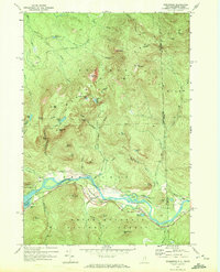
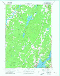
 1970 Gilead1972 Print · USGSThe confluence of the Androscoggin River and Wild River defines this Oxford County landscape in the early seventies. Genealogists and hikers can trace the Trunk Road past Gilead, find the Chapman Cem, or locate the Mine near the Bethel border.
 - 1970 Map of Speckled Mountain, 1972 Print
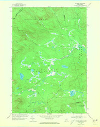
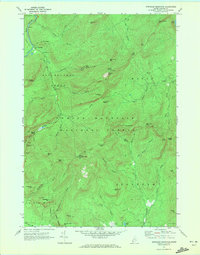 1970 Speckled Mountain1972 Print · USGSThe Maine backcountry in the early seventies reveals a landscape transition from timber extraction to forest recreation. Researchers can trace the layout of the Speckled Mtn Lookout Tower, the Hastings settlement, and several scenic Cold River Overlook sites.4 unique versions available
 - 1970 Map of East Stoneham, 1972 Print
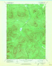
 1970 East Stoneham1972 Print · USGSOxford County in the early seventies shows a landscape of dense national forest and scattered mountain settlements. Genealogists and hikers can trace old family burial sites like Songo Cem or navigate the terrain near Albany Notch and East Stoneham.2 unique versions available
 - 1970 Map of Wild River, 1972 Print
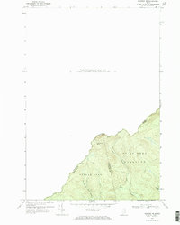
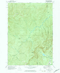 1970 Wild River1972 Print · USGSThe New Hampshire and Maine borderlands are shown here in the early 1970s, focused on the drainage of the Wild River. Trace the high-country Appalachian Trail and find backcountry landmarks like the Spruce Brook Shelter and Brickett Place.3 unique versions available
 - 1970 Map of Bethel, 1972 Print
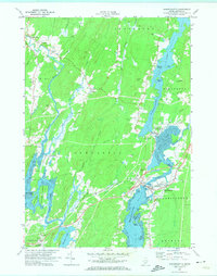
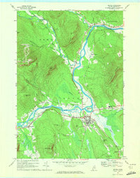 1970 Bethel1972 Print · USGSBethel and the surrounding Oxford County highlands are captured here during the 1970s as the rail and river economy shaped the valley. Genealogists and historians can trace family plots at Skillingston Cem, locate the historic Gould Academy, or follow the path of the Grand Trunk railroad through West Bethel.2 unique versions available
 - 1970 Map of Shelburne, 1972 Print
 1970 Shelburne1972 Print · USGSShelburne and the high Mahoosuc Range are documented in the early 1970s as the river valley served as a vital corridor for rail and energy transit. Trace the historic Appalachian Trail route past Gentian Pond or locate the Hazelton Cem and the Grand Trunk Railway line.3 unique versions available
 - 1970 Map of Skinner, 1973 Print
 1970 Skinner1973 Print · USGSThe international border and the high timberlands of Franklin County are captured here in the early 1970s. Researchers can trace the Canadian Pacific rail line as it passes the remote outposts of Skinner and Keough along the Moose River.2 unique versions available
 - 1970 Map of Merrill Mountain, 1973 Print
 1970 Merrill Mountain1973 Print · USGSThe international border between Maine and Quebec was surveyed here in the early 1970s, revealing a landscape of timberlands and isolated outposts. Researchers can trace historic township lines like the Merrill Strip and find remote sites such as Moose Mill Camp and Lower Nathan Bog.
 - 1970 Map of Kennebago Lake, 1973 Print
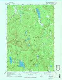
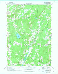
 1970 Kennebago Lake1973 Print · USGSNorthwestern Maine at the start of the 1970s remained a landscape of sporting camps and timber townships. Genealogists and researchers can trace the remote outposts of Grants Camps and Kennebago Lake Camps among the peaks of East Kennebago Mtn.
 - 1970 Map of Tim Mountain, 1973 Print
 1970 Tim Mountain1973 Print · USGSThe Franklin County highlands in the early 1970s show a remote landscape of timber townships and sporting camps. Researchers can locate remote outposts like Tim Pond Camp, trace the winding Tim Pond Lookout Road, and explore the high peaks of the Barnard Mountains.
 - 1970 Map of Kibby Mountain, 1973 Print
 1970 Kibby Mountain1973 Print · USGSThe Maine highlands and timberlands of Franklin County are shown here in the early seventies, centered on the heights of Kibby Mountain. Researchers can trace the mid-century logging roads and remote water bodies like Caribou Pond and Spencer Bog.2 unique versions available
 - 1970 Map of Skinner NE, 1973 Print
 1970 Skinner NE1973 Print · USGSThe international boundary between Maine and Quebec is documented in detail here during the early 1970s. Researchers can trace the remote drainage of the West Branch Gulf Stream and locate wilderness landmarks like Sixtynine Mtn and Turner Pond.2 unique versions available
 - 1970 Map of Boundary Pond, 1973 Print
 1970 Boundary Pond1973 Print · USGSThe Maine-Quebec borderlands in the early 1970s appear as a wild network of mountain peaks and isolated camps. Genealogists and historians can trace the remote settlement at Lowelltown or locate seasonal sites like the Dome Mtn Camps near Boundary Pond.
 - 1970 Map of Wiscasset, 1974 Print
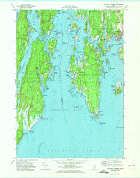
 1970 Wiscasset1974 Print · USGSCoastal Lincoln County is documented here during the early 1970s, showing the intricate relationship between the Sheepscot River and the village of Wiscasset. Genealogists can trace family landmarks across several townships, from Dresden Mills to ancestral burial sites like Herriman Cem and Marston Cem.2 unique versions available
 - 1970 Map of Damariscotta, 1974 Print
 1970 Damariscotta1974 Print · USGSThe mid-coast Maine landscape around the Damariscotta River is captured here in the 1970s, showing the vital link between the inland lake and the sea. Trace family history at St Patricks Ch or locate family plots in Alna Cem and Barstow Cem.2 unique versions available
 - 1970 Map of Westport, 1974 Print
 1970 Westport1974 Print · USGSCoastal Lincoln County is defined by its deep estuaries and island communities in the early seventies. Genealogists can locate family landmarks like the Bergen Ch, Doggett Castle, and the Ocean View Cem near Boothbay.2 unique versions available
 - 1970 Map of East Pittston, 1974 Print
 1970 East Pittston1974 Print · USGSCoastal Kennebec County as it appeared in the early seventies shows a landscape of tidal rivers and quiet crossroads. Genealogists can trace established family names and burial sites at Butman Cem, Goodspeed Cem, and Trainor Corner.2 unique versions available
 - 1970 Map of Boothbay Harbor, 1974 Print
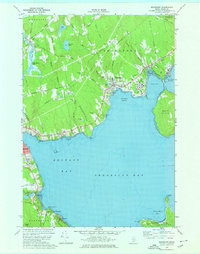
 1970 Boothbay Harbor1974 Print · USGSCoastal Maine's intricate network of harbors and islands is captured here during the 1970s, showcasing the region's enduring maritime character. Researchers can trace historic cemeteries and seasonal settlements from the bustling Boothbay Harbor to the quiet shores of Newagen and Reid State Park.2 unique versions available
 - 1970 Map of North Whitefield, 1974 Print
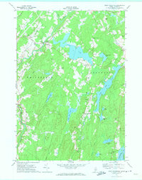 1970 North Whitefield1974 Print · USGSLincoln County in the early 1970s reveals a landscape of dense woodlands and interconnected waterways along the Sheepscot River. Genealogists can trace family roots through numerous local landmarks like St Denis Ch, Calvary Cem, and the settlement of South Jefferson.3 unique versions available
 - 1973 Map of New Harbor, 1974 Print
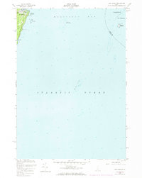 1973 New Harbor1974 Print · USGSCoastal Maine in the early 1970s is captured here, focusing on the maritime gateway of New Harbor and the eastern edge of Pemaquid Neck. Genealogists and maritime historians can trace landforms and seafaring markers like Lookout Hill, Pumpkin Cove, and the Daybeacon on Eastern Egg Rock.
 - 1973 Map of Cape Rosier, 1976 Print
 1973 Cape Rosier1976 Print · USGSCoastal Hancock County in the early seventies shows a landscape of granite heights and tidal reaches. Genealogists and historians can trace family-named sites like John B Mtn or find old burial grounds at Evergreen Cem and Bayview Cem.3 unique versions available
 - 1973 Map of Searsport, 1976 Print
 1973 Searsport1976 Print · USGSSearsport and the Waldo County coastline come alive in the 1970s as industrial rail lines meet the Atlantic. Researchers can trace family history through sites like Ford Chapel and Elmwood Cem, or explore the shoreline from Sears Island to Bayside.2 unique versions available
 - 1973 Map of Islesboro, 1976 Print
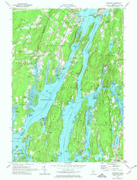
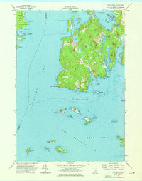
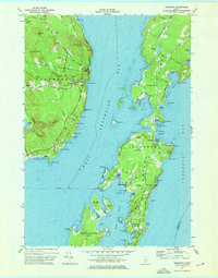 1973 Islesboro1976 Print · USGSThe islands of Penobscot Bay appear in the 1970s, showcasing the maritime connections of Islesboro and Dark Harbor. Trace local genealogy and landmarks across Seven Hundred Acre Island, the Saturday Cove Cem, and the Islesboro Ferry Toll.2 unique versions available
 - 1973 Map of Castine, 1977 Print
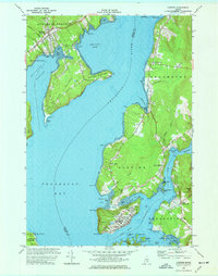 1973 Castine1977 Print · USGSThe Maine coast near the confluence of the Penobscot and Bagaduce Rivers is captured here in the early 1970s. Local historians can trace the foundations of Ft George, the route of the British Canal, and the grounds of the Maritime Academy in Castine.3 unique versions available
 - 1975 Map of The Traveler
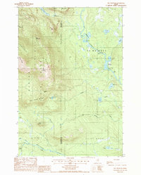 1975 The Traveler1975 Print · USGSBaxter State Park and the surrounding wildlands of the Maine North Woods appear in high detail during the mid-1980s. Trace the mountain geography from The Traveler to Old City, or follow the river system through Stair Falls and the Haskell Deadwater.2 unique versions available
Showing maps 1-25
Top cities of Maine
- Portland historical maps
- Lewiston historical maps
- Bangor historical maps
- South Portland historical maps
- Auburn historical maps
- Biddeford historical maps
See more
Top counties of Maine
- Cumberland County historical maps
- York County historical maps
- Penobscot County historical maps
- Kennebec County historical maps
- Androscoggin County historical maps
- County historical maps
See more
Frequently asked questions
- What are the different types of historical maps available for Maine?
- What is the oldest map of Maine?
- Where can I purchase historical maps of Maine for my home or office?
- Where can I download high-res historical maps of Maine?
- Are there historical topographic maps available for Maine?
- Is there historical aerial imagery available for Maine?
- Where are historical maps of Maine sourced from?