1960s Maps of Maine
Explore 81 historic maps of Maine from the 1960s. These maps offer a rare glimpse into what life looked like during the 1960s — showing old roads, neighborhoods, homes, and landmarks that have changed or disappeared over time.
Whether you're researching your family's past, planning a metal detecting trip, or studying how Maine's landscape evolved across the 1960s, these high-resolution maps are a powerful tool for exploring the history of this region.
- Focus on a specific era: All maps on this page are from the 1960s, giving you a focused view of this time period.
- See what’s changed: Compare century-old streets, trails, and buildings to today's modern landscape using overlays and satellite layers.
- Research with precision: Use these maps for genealogy, historical research, land use analysis, or educational projects.
- View, download, or print: Maps are fully viewable online in high resolution, and can be downloaded or printed for your own records.
Start exploring Maine's history through authentic maps from the 1960s. This is your window into the past.
Maine maps
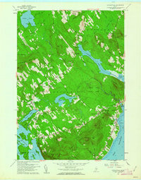
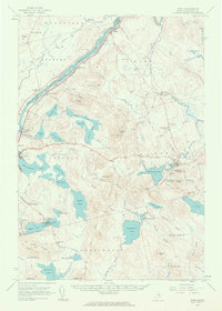
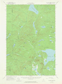
(81)- 1960 Map of Presque Isle
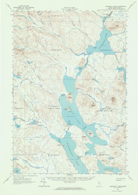
 1960 Presque Isle1960 Print · USGSNorthern Maine during the mid-century was a land of timber, rails, and strategic airfields. Genealogists and historians can trace the growth of Presque Isle and Ashland or explore the remote northern reaches of Baxter State Park and Presque Isle AFB.3 unique versions available
 - 1960 Map of Bangor
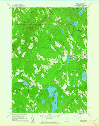
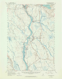
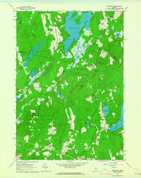
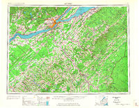
 1960 Bangor1960 Print · USGSCentral Maine in the sixties reveals a landscape of river-powered industry and sprawling coastal island chains. Researchers can trace the rail corridors of the Maine Central or locate mid-century aviation landmarks like Dow Air Force Base.
 - 1960 Map of Millinocket
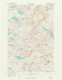
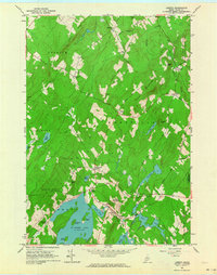
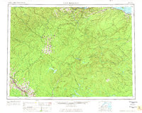
 1960 Millinocket1960 Print · USGSThe Maine North Woods and Penobscot River valley are captured at mid-century during the height of the paper milling era. Researchers can trace the Appalachian Trail near Mount Katardin or locate family roots in towns like Dover-Foxcroft and Milo.3 unique versions available
 - 1960 Map of Lincolnville, 1962 Print
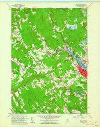
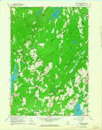
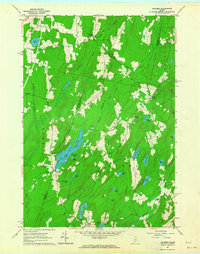
 1960 Lincolnville1962 Print · USGSThe mid-coast Waldo County shoreline and hills appear here just as the post-war era transitioned into the 1960s. Genealogists and local historians can trace family locations through numerous rural corners and burial sites like Grange Corner, Slab City, and the South Belmont Cem.3 unique versions available
 - 1960 Map of Morrill, 1962 Print
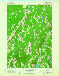
 1960 Morrill1962 Print · USGSMid-century Waldo County comes to life in this detailed survey of its lakes, ridge-top settlements, and game lands. Genealogists and researchers can trace family landmarks like Pauls Corner and Fosters Corner or locate old burial sites including Sunny Side Cemetery.4 unique versions available
 - 1960 Map of Belfast, 1962 Print
 1960 Belfast1962 Print · USGSBelfast and its tidal river valley appear here in the early sixties, showing the city's coastal layout and the Belfast & Moosehead Lake RR. Genealogists and local historians can trace family-named crossroads like Evans Corner and several rural schools, including the Van Poland Sch.4 unique versions available
 - 1960 Map of Searsmont, 1962 Print
 1960 Searsmont1962 Print · USGSCoastal Maine’s rural interior is captured here in the early sixties as a network of crossroad hamlets and ridges. Family historians can trace ancestral sites at Gushees Corner, Slab City, and numerous burial grounds like Oak Grove Cem.4 unique versions available
 - 1960 Map of Winn, 1963 Print
 1960 Winn1963 Print · USGSMid-century Penobscot County comes alive along the river and rail corridors of the 1960s. Genealogists and researchers can trace family landmarks like North Chester Cem, the Burr Sch, and the riverside tracks of the Maine Central railroad.3 unique versions available
 - 1960 Map of Passadumkeag, 1964 Print
 1960 Passadumkeag1964 Print · USGSPenobscot River life in the early sixties centers on riverside towns and rail hubs like Passadumkeag and Olamon. Genealogists can trace family names through rural landmarks like Cedarvale Cem, Edgecomb Sch, and the State Nursery.2 unique versions available
 - 1961 Map of Bangor
 1961 Bangor1961 Print · USGSMid-century Maine comes alive through its busy river ports and rocky archipelagoes during a period of steady maritime and rail commerce. Researchers can trace the path of the Maine Central railroad and locate coastal landmarks from Acadia National Park to Vinalhaven Island.
 - 1961 Map of Eastport
 1961 Eastport1961 Print · USGSThe maritime borderlands of Maine and New Brunswick are captured here in the early sixties, showing a world defined by the Bay of Fundy. Researchers can trace the Maine Central Railroad to Machiasport or explore remote island villages like Grand Harbour and Welchpool.
 - 1961 Map of Lewiston
 1961 Lewiston1961 Print · USGSWestern Maine and the White Mountains appear here during the early sixties, showing the industrial river towns and vast timberlands before the modern interstate era. Genealogists and historians can trace the Grand Trunk RR through Berlin or locate landmarks like Old Speck Mountain and Elephant Mountain.
 - 1961 Map of Boston
 1961 Boston1961 Print · USGSThe Massachusetts coastline and its industrial interior are detailed here in the mid-twentieth century, from the Monadnock highlands to Cape Cod. Researchers can trace the rail routes of the Boston and Maine or locate landmarks like Fort Devens and the Wachusett Reservoir.2 unique versions available
 - 1961 Map of Spider Lake, 1964 Print
 1961 Spider Lake1964 Print · USGSRemote Piscataquis County wilderness in the early 1960s reveals a landscape of fire watch towers and logging history. Trace old timber routes along the Tote Road or locate the State Forest Service Camp and Lookout Tower near Beetle Mtn.4 unique versions available
 - 1961 Map of Washington, 1964 Print
 1961 Washington1964 Print · USGSMid-coast Maine’s interior highlands in the early sixties reveal a landscape of interconnected small villages and deep-water ponds. Genealogists and local historians can locate several family burial grounds, including Weymouth Cem and Skidmore Cem, alongside landmarks like Woodmans Mills and Prescott Memorial Sch.3 unique versions available
 - 1961 Map of Allagash Lake, 1964 Print
 1961 Allagash Lake1964 Print · USGSThe Maine north woods in the early sixties remain a vast network of timberlands and interconnected waterways. Researchers can trace remote logging infrastructure and forestry outposts like the Lookout Tower on Allagash Mtn and the Forest Service Camp near Allagash Lake.3 unique versions available
 - 1961 Map of Razorville, 1964 Print
 1961 Razorville1964 Print · USGSCoastal Maine's interior comes into focus during the early sixties, showing a landscape of unincorporated gores and rural plantations. Genealogists can trace family names at Hannan Cem and Lenfest Cem or locate the Sandhill Sch near Sandhill Corner.3 unique versions available
 - 1961 Map of Liberty, 1964 Print
 1961 Liberty1964 Print · USGSCoastal Waldo County's inland hills and ponds are captured here in the early sixties, showing a landscape of family-named crossroads and state preserves. Genealogists can trace family footprints at Thurstons Corner, Smithton Cem, and Mt Repose Cem.4 unique versions available
 - 1961 Map of Palermo, 1964 Print
 1961 Palermo1964 Print · USGSThe Waldo County interior in the early sixties remains a landscape of rural settlements and glacial waters. Genealogists can locate family landmarks like Sennetts Corner, the Palermo Sch, and the Perkins Cem near the banks of Sheepscot Pond.3 unique versions available
 - 1962 Map of Lewiston
 1962 Lewiston1962 Print · USGSThe industrial river valleys and high peaks of Maine and New Hampshire define the region in the early sixties. Trace the rail-and-river network from Lewiston to the White Mountains, passing through mill towns like Berlin and Rumford.
 - 1962 Map of Churchill Lake, 1964 Print
 1962 Churchill Lake1964 Print · USGSMaine's North Woods in the early sixties remained a landscape of historic timber transport and remote lake systems. Researchers can trace the Old Railroad Grade and find the Tramway State Forest Service Camp and Churchill Depot.3 unique versions available
 - 1962 Map of Baker Lake, 1964 Print
 1962 Baker Lake1964 Print · USGSNorth Maine Woods townships were largely defined by timber and water during the early sixties. Researchers can trace remote logging infrastructure and river systems like the Baker Branch St John River, Baker Lake, and the Forest Service Camp.2 unique versions available
 - 1962 Map of Edmundston, 1966 Print
 1962 Edmundston1966 Print · USGSThe international borderlands of northern Maine and Canada come alive here during the early sixties, centered on the river-and-rail economies of the day. Genealogists and historians can trace the paths of the Bangor and Aroostook railroad through river towns like Fort Kent and St Agatha.2 unique versions available
 - 1962 Map of Quebec, 1966 Print
 1962 Quebec1966 Print · USGSThe cross-border region between Quebec and Northern Maine is captured here during the mid-1960s, showing the dense settlement of the St. Lawrence valley and the rugged timberlands of the frontier. Genealogists can trace family roots through numerous parishes like St-Joseph-de-Beauce or locate the industrial hubs of Thetford Mines and Levis.3 unique versions available
 - 1963 Map of Campbellton
 1963 Campbellton1963 Print · USGSThe international borderlands of New Brunswick and Maine come alive in the early sixties, showing a landscape of river-valley towns and timber outposts. Genealogists and historians can trace rail-side communities like Campbellton or remote camps such as Rapids Depot and Miller Line Cache.3 unique versions available
Showing maps 1-25 of 81
Top cities of Maine
- Portland historical maps
- Lewiston historical maps
- Bangor historical maps
- South Portland historical maps
- Auburn historical maps
- Biddeford historical maps
See more
Top counties of Maine
- Cumberland County historical maps
- York County historical maps
- Penobscot County historical maps
- Kennebec County historical maps
- Androscoggin County historical maps
- County historical maps
See more
Frequently asked questions
- What are the different types of historical maps available for Maine?
- What is the oldest map of Maine?
- Where can I purchase historical maps of Maine for my home or office?
- Where can I download high-res historical maps of Maine?
- Are there historical topographic maps available for Maine?
- Is there historical aerial imagery available for Maine?
- Where are historical maps of Maine sourced from?