1940s Maps of Maine
Explore 177 historic maps of Maine from the 1940s. These maps offer a rare glimpse into what life looked like during the 1940s — showing old roads, neighborhoods, homes, and landmarks that have changed or disappeared over time.
Whether you're researching your family's past, planning a metal detecting trip, or studying how Maine's landscape evolved across the 1940s, these high-resolution maps are a powerful tool for exploring the history of this region.
- Focus on a specific era: All maps on this page are from the 1940s, giving you a focused view of this time period.
- See what’s changed: Compare century-old streets, trails, and buildings to today's modern landscape using overlays and satellite layers.
- Research with precision: Use these maps for genealogy, historical research, land use analysis, or educational projects.
- View, download, or print: Maps are fully viewable online in high resolution, and can be downloaded or printed for your own records.
Start exploring Maine's history through authentic maps from the 1940s. This is your window into the past.
Maine maps
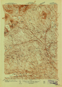
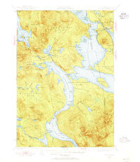
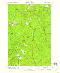
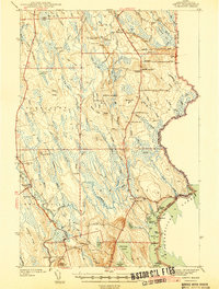
(177)- 1940 Map of Danforth
 1940 Danforth1940 Print · USGSUpper Washington and Aroostook counties come into focus just before the war, showing the vital rail junction at Danforth. Family historians can locate rural landmarks like Irish Settlement, the Trout Creek Cem, and schools such as Bonner Sch or Butterfield Sch.
 - 1940 Map of Sebec
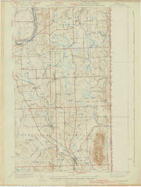
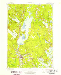
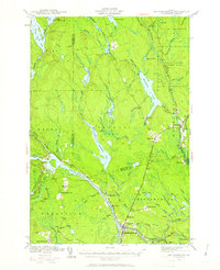
 1940 Sebec1940 Print · USGSPiscataquis County in the early 1940s is captured here at a crossroads of the iron and timber industries. Researchers can locate the Katahdin Iron Works, trace the rail yards at Brownville Junction, and find rural schools like Williamsburg Sch.4 unique versions available
 - 1940 Map of Mars Hill
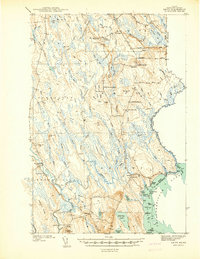
 1940 Mars Hill1940 Print · USGSAroostook County was a hub of rail and river commerce in the late 1930s, defined by its connection to the Canadian border. You can trace early schoolhouse locations like Maple Grove Sch and the industrial roots of Monson Mill and Easton Station.3 unique versions available
 - 1940 Map of Amity
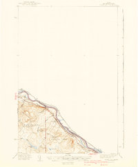
 1940 Amity1940 Print · USGSAroostook County was a landscape of remote border settlements and logging streams just before the Second World War. Researchers can trace family-named sites like Wilcox Settlement, find rural schoolhouses such as Estabrook Sch, and locate the Wilcox Cem near the Canadian line.
 - 1940 Map of Grand Isle
 1940 Grand Isle1940 Print · USGSThe northern boundary of Maine along the St John River is captured here during the 1940s, showing a landscape defined by riverside settlements and rail. Trace the family-named landmarks and rural hubs of the era, from St David and Lille to the isolated Doucotte Sch.3 unique versions available
 - 1940 Map of Poland, 1942 Print
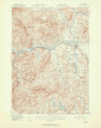
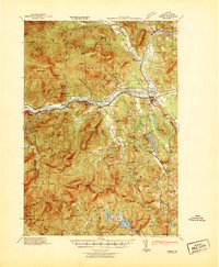
 1940 Poland1942 Print · USGSMaine's river valleys and rail junctions come to life in the 1940s as the region's industrial and rural networks are captured in detail. Genealogists can trace family landmarks like Hebron Sta P O, the Sanitarium, and the busy hub at Mechanic Falls.
 - 1940 Map of Oquossoc, 1955 Print
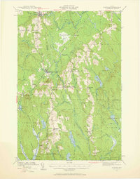
 1940 Oquossoc1955 Print · USGSOxford County at the dawn of the 1940s remained a landscape of timber and water, centered on the historic settlements of the Rangeley Lakes. Genealogists and researchers can trace early lakefront communities and the vital water-control sites at Upper Dam, Aziscohos Dam, and Oquossoc.4 unique versions available
 - 1940 Map of Ellsworth, 1957 Print
 1940 Ellsworth1957 Print · USGSHancock County at the start of the 1940s reveals a landscape of tidal bays and timbered ridges surrounding the hub of Ellsworth. Genealogists and local historians can trace rail lines at Washington Junction, find rural schoolhouses like Beechland Sch, and locate the old Franklin Road North Hancock Post Office.
 - 1940 Map of Island Falls, 1957 Print
 1940 Island Falls1957 Print · USGSThe river-and-rail landscape of southern Aroostook County is captured here in the years before the war. Researchers can trace the exact locations of numerous rural schoolhouses like Allsbury Sch and Myrick Sch or locate the Bangor and Aroostook RR through Island Falls.4 unique versions available
 - 1940 Map of Bethel, 1958 Print
 1940 Bethel1958 Print · USGSOxford County at the dawn of the 1940s reveals a landscape of river-valley farming and mountain timberlands. Genealogists and local historians can locate early district schools like Sunday River Sch, the Town House in Albany, and mountain notches like Tyler Notch.2 unique versions available
 - 1940 Map of Waite, 1959 Print
 1940 Waite1959 Print · USGSThe Maine-Canada borderlands near the St. Croix River were a patchwork of timber camps and family farms just before the war. Researchers can trace the heritage of remote sites like Keeley Farm, the Lamb Place, and camps such as Hamilton Camp.3 unique versions available
 - 1940 Map of Sherman, 1959 Print
 1940 Sherman1959 Print · USGSNorthern Maine's timber and rail landscape is captured here just before the mid-century, centered on the Bangor and Aroostook line. Genealogists can trace early homesteads near Sherman Mills, Golden Ridge, and the Stacyville Post Office.2 unique versions available
 - 1940 Map of Oxbow, 1960 Print
 1940 Oxbow1960 Print · USGSAroostook County was a remote timber and river frontier when this survey was conducted in the early 1940s. Genealogists and historians can trace old homesteads around Oxbow, locate the Oxbow East End School, and follow the Loghauler Road through the woods.
 - 1940 Map of Mattawamkeag, 1961 Print
 1940 Mattawamkeag1961 Print · USGSThe rail junction at Mattawamkeag and the timber-rich Penobscot valley are captured here just before the mid-century. Genealogists and historians can trace family locations at Jordan Mills, identify the Back Settlement, and locate the North Woodville School.2 unique versions available
 - 1940 Map of Forest, 1963 Print
 1940 Forest1963 Print · USGSThe Maine-Canada borderlands come alive in this mid-century survey of Washington County's lake country. Genealogists and historians can trace the Canadian Pacific rail line through Vanceboro or locate family homesteads near Todds Farm and Forest City.3 unique versions available
 - 1940 Map of Kellyland, 1963 Print
 1940 Kellyland1963 Print · USGSThe international border along the St Croix River comes into focus in this 1940s-era survey. Genealogists and historians can trace the industrial footprint of Kellyland or locate remote sites like Crocker Camp and Grand Falls.3 unique versions available
 - 1941 Map of Belfast
 1941 Belfast1941 Print · USGSCoastal Waldo County at the start of the 1940s reveals a landscape of tidal rivers and bustling rural crossroads. Genealogists and historians can trace family locations through numerous landmarks like Allens Hall, Holmes Mill, and the Belfast & Moosehead Lake RR corridor.
 - 1941 Map of Danforth
 1941 Danforth1941 Print · USGSThe Maine-New Brunswick borderlands come to life in this survey of the rail and timber country just before the war. Genealogists and historians can trace family-named sites like the Irish Settlement, Trout Brook Cem, and schools like Shaw Sch.2 unique versions available
 - 1941 Map of Rockland
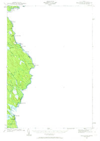
 1941 Rockland1941 Print · USGSThe Knox County shoreline during the early 1940s features a detailed look at maritime life and coastal industry. Genealogists and historians can trace the foundations of Rockland, locate the Rockland Breakwater Lighthouse, and explore villages like South Thomaston and Wattons Mill.
 - 1941 Map of Amity
 1941 Amity1941 Print · USGSAroostook County's borderlands are captured here just before the mid-century, detailing the rural life of eastern Maine along the New Brunswick line. Researchers can locate vanished schoolhouses like Estabrook Sch and family landmarks such as Wilcox Settlement or the Ferry Bridge.2 unique versions available
 - 1941 Map of Dover
 1941 Dover1941 Print · USGSCoastal New Hampshire and the Maine borderlands are captured here just before the mobilization of the early 1940s. Genealogists can trace family lands near Garrison Hill, old district schools like Witchtrot Sch, and the rail depots at Greenland Village Sta.
 - 1941 Map of Scraggly Lake
 1941 Scraggly Lake1941 Print · USGSBaskahegan Lake and the surrounding Maine timberlands are captured here in the early 1940s, showing a landscape defined by water and woods. Genealogists and researchers can trace remote landmarks like the FIRETOWER on Musquash Mountain or the old route of Gentner Road.6 unique versions available
 - 1941 Map of Casco Bay
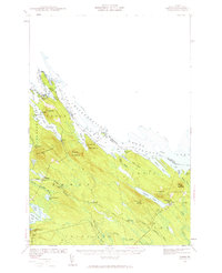
 1941 Casco Bay1941 Print · USGSCasco Bay and its vital harbor defenses are captured here just as the nation prepared for war. Military historians and genealogists can locate Fort McKinley and Fort Williams alongside local landmarks like Pine Grove Sch.
 - 1941 Map of Bethel
 1941 Bethel1941 Print · USGSOxford County was a landscape of mountain ridges and narrow river valleys just before the mid-century, centered on the Androscoggin River. Genealogists can trace family names and rural landmarks like the Bethel Cem, Mason School, and the village at Town House.
 - 1941 Map of Livermore
 1941 Livermore1941 Print · USGSAndroscoggin County at the start of the 1940s is a landscape defined by the river and rail economy between Livermore Falls and Wayne. Genealogists can trace family footprints across numerous rural districts, locating Brettuns Mills and the many schoolhouses like Young Sch and Pike Sch.
Showing maps 1-25 of 177
Top cities of Maine
- Portland historical maps
- Lewiston historical maps
- Bangor historical maps
- South Portland historical maps
- Auburn historical maps
- Biddeford historical maps
See more
Top counties of Maine
- Cumberland County historical maps
- York County historical maps
- Penobscot County historical maps
- Kennebec County historical maps
- Androscoggin County historical maps
- County historical maps
See more
Frequently asked questions
- What are the different types of historical maps available for Maine?
- What is the oldest map of Maine?
- Where can I purchase historical maps of Maine for my home or office?
- Where can I download high-res historical maps of Maine?
- Are there historical topographic maps available for Maine?
- Is there historical aerial imagery available for Maine?
- Where are historical maps of Maine sourced from?