1980s Maps of Maine
Explore 569 historic maps of Maine from the 1980s. These maps offer a rare glimpse into what life looked like during the 1980s — showing old roads, neighborhoods, homes, and landmarks that have changed or disappeared over time.
Whether you're researching your family's past, planning a metal detecting trip, or studying how Maine's landscape evolved across the 1980s, these high-resolution maps are a powerful tool for exploring the history of this region.
- Focus on a specific era: All maps on this page are from the 1980s, giving you a focused view of this time period.
- See what’s changed: Compare century-old streets, trails, and buildings to today's modern landscape using overlays and satellite layers.
- Research with precision: Use these maps for genealogy, historical research, land use analysis, or educational projects.
- View, download, or print: Maps are fully viewable online in high resolution, and can be downloaded or printed for your own records.
Start exploring Maine's history through authentic maps from the 1980s. This is your window into the past.
Maine maps
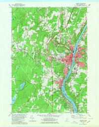
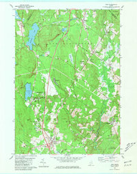
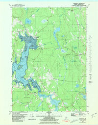
(569)- 1980 Map of Richmond
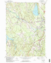
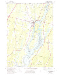 1980 Richmond1980 Print · USGSThe Kennebec River corridor comes alive in the early 1980s, documenting a landscape of tidal flats and riverfront settlements. Researchers can trace family lines through numerous burial grounds like Maple Grove Cem or locate the historic river crossings near Iceboro and Swan Island.2 unique versions available
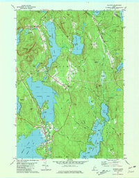
 - 1980 Map of Brunswick
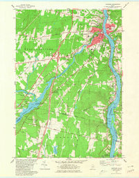
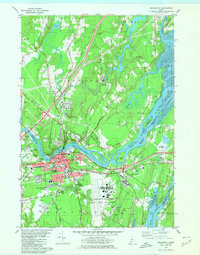 1980 Brunswick1980 Print · USGSCoastal Maine transitions from the academic halls of Brunswick to the tidal flats of Merrymeeting Bay in the early eighties. Genealogists and historians can trace family plots at Riverside Cem or locate the sprawling Brunswick Naval Air Station.3 unique versions available
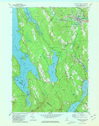
 - 1980 Map of Winthrop
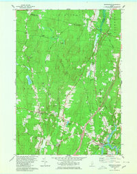
 1980 Winthrop1980 Print · USGSKennebec County's lake district is shown in detail during the late twentieth century, capturing the area's mix of village life and waterfront recreation. Researchers can locate family heritage sites like Lakeview Cem, the Jesse Lee Ch, and the Maine Central rail line.
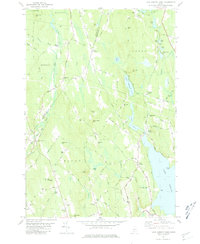
 - 1980 Map of Bath
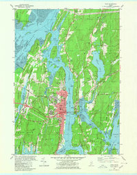 1980 Bath1980 Print · USGSMid-coast Maine’s maritime heritage is on full display here in the early eighties, centered on the historic shipbuilding hub of BATH. Researchers can trace old family names at Oak Grove Cem or locate former school sites like Dike Sch and Morse High Sch.3 unique versions available
 - 1980 Map of Belgrade
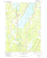 1980 Belgrade1980 Print · USGSThe Belgrade Lakes region in the late twentieth century reveals a landscape of summer camps, rail-side hamlets, and old farmsteads. Genealogists can trace family names at Pine Grove Cem, Steadman Cem, and the Tiffany Hill Chapel.2 unique versions available
 - 1980 Map of Augusta
 1980 Augusta1980 Print · USGSAugusta and the Kennebec River valley are captured in the early 1980s, showcasing the state capital's mix of government centers and rural hillsides. Genealogists and historians can locate numerous burial sites like Riverside Cem or trace institutional landmarks such as the State Capitol and University of Maine at Augusta.2 unique versions available
 - 1980 Map of Gardiner
 1980 Gardiner1980 Print · USGSGardiner and the Kennebec River valley are captured in the early 1980s as modern turnpike travel intersected with traditional riverfront industry. Genealogists can locate several burial grounds like St Josephs Cem and trace historical sites such as the Colburn House State Mem.3 unique versions available
 - 1980 Map of Purgatory
 1980 Purgatory1980 Print · USGSThe interconnected waters of Kennebec County are captured here in the early eighties, from the shores of Cobbosseecontee Lake to the rural hills of Litchfield. Researchers can trace family roots through landmarks like the Libby-Tozier Sch, Batchelders Crossing, and Plains Cem.
 - 1980 Map of Readfield
 1980 Readfield1980 Print · USGSThe Maine lakeside communities of Kennebec County are captured here during the 1970s, showing a landscape of family-named roads and rural settlements. Genealogists can trace property history through Robinson Cem and Potash Cem, or locate the old Readfield Depot along the Maine Central line.
 - 1980 Map of Bowdoinham
 1980 Bowdoinham1980 Print · USGSCoastal Sagadahoc County remains a network of tight-knit crossroads and river valleys as the 1980s began. Genealogists and local historians can trace the locations of family burial grounds like Coombs Cem and schools such as Bowdoin Sch alongside the active Maine Central Railroad.2 unique versions available
 - 1980 Map of Oxford, 1981 Print
 1980 Oxford1981 Print · USGSOxford and Hebron come alive in the 1970s, showcasing a landscape of upland academy life, family farms, and river industry. Genealogists and historians can trace Hebron Academy, the Canadian National rail line, and family landmarks like Sam Rowe Hill Cem.2 unique versions available
 - 1980 Map of Gray, 1981 Print
 1980 Gray1981 Print · USGSThe Gray and New Gloucester area in the early eighties shows a transition from rural landscape to modern thoroughfare. Researchers can trace the layout of Shaker Village, the Pineland Hospital and Training Center, and old rail stops at Intervale.3 unique versions available
 - 1980 Map of Gardiner, 1991 Print
 1980 Gardiner1991 Print · USGSMid-century Kennebec County comes alive in this 1940s survey of the river-and-rail corridor. Genealogists can trace family landmarks like Hathorn Hill, locate small rural schools such as Adams Sch, and find ancestors in Evergreen Cem.
 - 1981 Map of Brooklin
 1981 Brooklin1981 Print · USGSCoastal Hancock County is captured here in the early 1980s, showcasing the traditional maritime settlements between Blue Hill Bay and Eggemoggin Reach. Genealogists can trace family names at Pine Grove Cemetery and Freethy Cemetery or explore the docks at Center Harbor.
 - 1981 Map of Salsbury Cove
 1981 Salsbury Cove1981 Print · USGSHancock County's coastline meets the northern reaches of Mount Desert Island in the early 1980s. Local researchers can trace family landmarks and coastal hamlets like Salsbury Cove, Lamoine Corner, and the rural Mtn View Ch.2 unique versions available
 - 1981 Map of Penobscot
 1981 Penobscot1981 Print · USGSThe coastal waters of the Bagaduce River and Northern Bay define this corner of Maine in the early eighties. Researchers can trace historic family burial sites like Leach Cem or locate old settlements at South Penobscot and North Brooksville.2 unique versions available
 - 1981 Map of Raymond
 1981 Raymond1981 Print · USGSThe Lakes Region of Maine is captured here in the early 1980s as seasonal recreation and local heritage intersect. Researchers can trace family roots at Riverside Cemetery or locate landmarks like Union Chapel, Suckerville, and the Jordan-Small School.3 unique versions available
 - 1981 Map of Mechanic Falls
 1981 Mechanic Falls1981 Print · USGSAndroscoggin County comes to life in the early 1980s as a region of mills, rails, and recreational waters. Genealogists and local historians can trace the foundations of Mechanic Falls or locate the White Oak Hill Ch and Tenney Cem near the shores of Tripp Pond.
 - 1981 Map of Brooklin
 1981 Brooklin1981 Print · USGSThe Hancock County coast at the start of the 1980s reveals a landscape of tidal marshes and tight-knit maritime villages. Researchers can trace ancestral roots through sites like Mt Ephraim Cem and the older Rural Cem, or locate family landmarks at Flye Point and Haven.
 - 1981 Map of Lake Auburn West
 1981 Lake Auburn West1981 Print · USGSAndroscoggin County was a landscape of small hills and lakeside settlements in the early 1980s. You can trace the path of the Old Railroad Grade or locate local burial sites such as North Auburn Cem and Brookvale Cem.2 unique versions available
 - 1981 Map of Minot
 1981 Minot1981 Print · USGSIn the early eighties, the river valleys and hilltops of Androscoggin County show a landscape shaped by rail, water, and early aviation. Genealogists and historians can trace family locations through Mt Auburn Cem, locate the Moussam Sch, or follow the Maine Central railroad line through Danville.
 - 1981 Map of Blue Hill
 1981 Blue Hill1981 Print · USGSCoastal Maine's maritime and industrial character is preserved here in the early eighties. Researchers can trace family history through the Early Settlers Cemetery or locate landmarks like Stevens Academy and the old Blue Hill Airport.2 unique versions available
 - 1981 Map of Bartlett Island, 1982 Print
 1981 Bartlett Island1982 Print · USGSMount Desert Island's western coastline and the surrounding islands of Blue Hill Bay are captured here in the early eighties. Local historians can trace family names and early sites at Kelleytown, St Andrew by the Lake Ch, and the Murphy Cem.
 - 1981 Map of Ellsworth, 1982 Print
 1981 Ellsworth1982 Print · USGSThe riverfront and rail lines of this Hancock County hub were well-established by the early eighties. Genealogists and local historians can trace the foundations of Ellsworth through its community landmarks, from the Juniper Cem to the Maine Central RR tracks.
 - 1981 Map of Branch Lake, 1982 Print
 1981 Branch Lake1982 Print · USGSHancock County’s lakelands are captured here in the early 1980s, documenting the rural communities of North Ellsworth and West Surry. Researchers can trace the Maine Central rail line, locate small family plots like Gott Cem, and explore the shoreline of Branch Lake.2 unique versions available
Showing maps 1-25 of 569
Top cities of Maine
- Portland historical maps
- Lewiston historical maps
- Bangor historical maps
- South Portland historical maps
- Auburn historical maps
- Biddeford historical maps
See more
Top counties of Maine
- Cumberland County historical maps
- York County historical maps
- Penobscot County historical maps
- Kennebec County historical maps
- Androscoggin County historical maps
- County historical maps
See more
Frequently asked questions
- What are the different types of historical maps available for Maine?
- What is the oldest map of Maine?
- Where can I purchase historical maps of Maine for my home or office?
- Where can I download high-res historical maps of Maine?
- Are there historical topographic maps available for Maine?
- Is there historical aerial imagery available for Maine?
- Where are historical maps of Maine sourced from?