1950s Maps of Minnesota
Explore 357 historic maps of Minnesota from the 1950s. These maps offer a rare glimpse into what life looked like during the 1950s — showing old roads, neighborhoods, homes, and landmarks that have changed or disappeared over time.
Whether you're researching your family's past, planning a metal detecting trip, or studying how Minnesota's landscape evolved across the 1950s, these high-resolution maps are a powerful tool for exploring the history of this region.
- Focus on a specific era: All maps on this page are from the 1950s, giving you a focused view of this time period.
- See what’s changed: Compare century-old streets, trails, and buildings to today's modern landscape using overlays and satellite layers.
- Research with precision: Use these maps for genealogy, historical research, land use analysis, or educational projects.
- View, download, or print: Maps are fully viewable online in high resolution, and can be downloaded or printed for your own records.
Start exploring Minnesota's history through authentic maps from the 1950s. This is your window into the past.
Minnesota maps
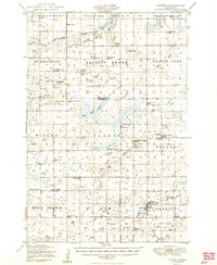
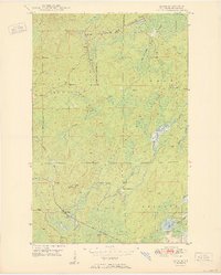
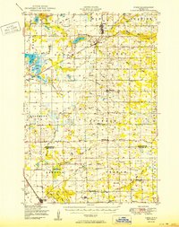
(357)- 1950 Map of Lake Elmo
 1950 Lake Elmo1950 Print · USGSThe townships of Oakdale and Woodbury are captured in the mid-fifties, showing a landscape of small lakes and rural schoolhouses. Genealogists can trace family roots at Union Cem or locate historic school sites like Gillie Sch and Salem Sch.2 unique versions available
 - 1950 Map of Lastrup
 1950 Lastrup1950 Print · USGSIn the late 1940s, the rural townships of eastern Morrison County were organized around a dense network of local school districts and small parish towns. Researchers can trace family roots at Riverside Cemetery or locate the sites of numerous vanished rural schools like District No 19 School and District No 84 School.2 unique versions available
 - 1950 Map of Isaac Lake
 1950 Isaac Lake1950 Print · USGSSt. Louis County is captured at mid-century as the timber and iron economies shaped this north woods landscape. You can trace early cemetery locations like Armanda Cem, find the local Town Hall, and follow the Duluth Missabe and Iron Range railroad.2 unique versions available
 - 1950 Map of Swanville
 1950 Swanville1950 Print · USGSCentral Minnesota at mid-century reveals a landscape of lakeside settlements and rural school districts across the Todd and Morrison county borders. Genealogists and historians can trace family roots through sites like Spring Brook Cemetery, the Bruce Town Hall, and Lake Beauty School.2 unique versions available
 - 1950 Map of Belle Prairie
 1950 Belle Prairie1950 Print · USGSMorrison and Crow Wing counties are captured here in the late 1940s, showing a landscape defined by the winding Mississippi and sprawling military grounds. Researchers can trace rural lineages through local landmarks like St Mathias Church, Darling Switch, and Rail Prairie Town Hall.2 unique versions available
 - 1950 Map of Embarrass
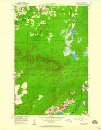
 1950 Embarrass1950 Print · USGSSt. Louis County in the post-war era reveals a landscape of Iron Range rail lines and northern forests. Genealogists and local historians can trace the early layout of Embarrass, the location of School No 70, and dozens of named water bodies like Heikkilla Lake.
 - 1950 Map of Webster
 1950 Webster1950 Print · USGSNorthern Wisconsin lake country is captured here at mid-century, centered on the growing village of Webster. Genealogists can locate rural landmarks like Karlsborg Cem, Yellow Lake Ch, and the Siren Landing Field.
 - 1950 Map of Graceville
 1950 Graceville1950 Print · USGSBig Stone and Traverse counties come alive in this mid-century survey of the Minnesota prairie at the peak of its rail-and-farm economy. Local historians can trace the foundations of Graceville and identify vanished rural landmarks like Golden Rule Sch and the Trinity Sch.
 - 1950 Map of Allen
 1950 Allen1950 Print · USGSThe Mesaba Range comes into focus during the mid-century as an active corridor of mining and rail transport. Genealogists and historians can trace the Duluth Missabe and Iron Range railroad through the forest to Allen and Niemi Camp.2 unique versions available
 - 1950 Map of Aurora
 1950 Aurora1950 Print · USGSThe Mesaba Iron Range was at a peak of industrial activity in the mid-twentieth century when this survey was conducted. Historians can trace the massive excavations of the St James Pit and Miller Pit alongside the rail-dependent settlements of Aurora and Old Mesaba.2 unique versions available
 - 1950 Map of Mankato East
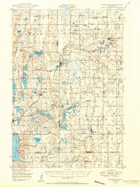
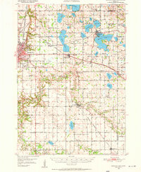 1950 Mankato East1950 Print · USGSBlue Earth County at mid-century reveals a dense network of rural school districts and rail sidings connecting farm towns to the regional hub. Researchers can trace the legacy of local education and industry through sites like Sugar Grove Sch, Lime Siding, and the St Clair settlement.3 unique versions available
 - 1950 Map of Little Falls
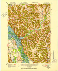
 1950 Little Falls1950 Print · USGSMid-century Morrison County reveals a landscape of river-driven industry and rural township life along the Mississippi River. Genealogists can trace family roots through numerous sites like St Stan Kostka Cemetery, School No 54, and Pike Creek Town Hall.2 unique versions available
 - 1950 Map of Hudson
 1950 Hudson1950 Print · USGSThe St. Croix River valley at mid-century shows a network of thriving riverfront towns and rural school districts along the Minnesota-Wisconsin border. Researchers can trace the footprints of old schools like Ellmann Sch and Rentz Sch or locate the Toll Bridge connecting these two states.2 unique versions available
 - 1950 Map of Rush City
 1950 Rush City1950 Print · USGSThe St. Croix River valley in the late 1940s reveals a quiet borderland where timber and rail infrastructure meet rural crossroads. Genealogists and historians can trace the foundations of local life at Indian Cem, the Rush City Ferry, and the Logging RR.
 - 1950 Map of Pierz
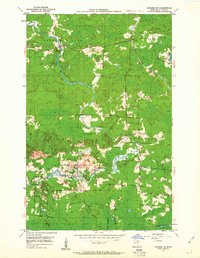
 1950 Pierz1950 Print · USGSIn the mid-twentieth century, this central Minnesota region was a bustling network of small farming townships and rail-connected villages. Genealogists can trace family roots through dozens of local landmarks like St Johns Church, Rosemarks Store, and numerous rural schoolhouses.
 - 1950 Map of Grantsburg
 1950 Grantsburg1950 Print · USGSBurnett County was a landscape of river crossings and rural outposts at mid-century, bounded by the winding St Croix River. Genealogists and historians can locate legacy sites like Ekdall Sch, Wood Lake Ch, and the village of Grantsburg.
 - 1950 Map of Cushing
 1950 Cushing1950 Print · USGSMorrison and Todd counties come alive in the postwar years, showing a landscape of small farming communities and a vast network of glacial lakes. Genealogists can trace family roots through numerous rural landmarks like Randall Cemetery, Zion Church, and over twenty numbered country schools.
 - 1950 Map of Alma, 1952 Print
 1950 Alma1952 Print · USGSThe Mississippi River valley serves as a bustling corridor for rail and river traffic at mid-century. Genealogists can trace family roots through numerous rural landmarks like St Paul Ch, Church Valley Cem, and the riverfront town of Alma.8 unique versions available
 - 1950 Map of Maiden Rock, 1952 Print
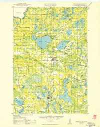
 1950 Maiden Rock1952 Print · USGSThe bluffs of Lake Pepin were a hive of rail and river activity at mid-century, supporting a dense network of upland farms and small towns. Researchers can trace rural life through dozens of named landmarks like Old Frontenac, the Villa Maria Academy, and Sleepy Hollow School.4 unique versions available
 - 1950 Map of St. Cloud, 1952 Print
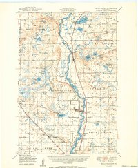
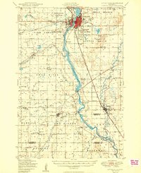
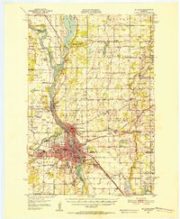 1950 St. Cloud1952 Print · USGSMid-century St. Cloud and its neighbors grew along the river as a hub of education, granite quarrying, and transport. Local researchers can locate the State Teachers College, the State Reformatory, and numerous rural schools like School No 5.3 unique versions available
 - 1950 Map of Biwabik, 1959 Print
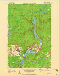 1950 Biwabik1959 Print · USGSIn the heart of the Mesabi Range during the mid-century mining boom, this map shows a landscape transformed by massive pits and rail lines. Genealogists and industrial historians can locate old company towns like Pineville and Belgrade or trace the early operations of the Canton Mine and Erie Mine.5 unique versions available
 - 1950 Map of Mc Kinley, 1960 Print
 1950 Mc Kinley1960 Print · USGSIron mining communities and the Duluth Missabe and Iron Range railroad define this mid-century survey of the Mesabi Range. Local historians can trace the industrial footprint of the Corsica Mine and the early layouts of McKinley and Elcor.4 unique versions available
 - 1950 Map of St Paul Park, 1962 Print
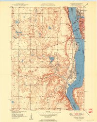
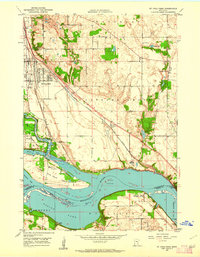 1950 St Paul Park1962 Print · USGSThe Mississippi River valley south of St. Paul is captured here at mid-century, showing the rail-dependent corridor between Newport and Nininger. Researchers can trace the legacy of local families through the Cottage Grove Cem and Sunny Hill Sch.
 - 1950 Map of Biwabik NW, 1963 Print
 1950 Biwabik NW1963 Print · USGSSt. Louis County's wooded lake country is captured here in the early fifties at the meeting of two great forests. Genealogists and local historians can locate the Florenton P O, School No 14, and old burial grounds like West Pike Cem along the Pike River.5 unique versions available
 - 1950 Map of Biwabik NE, 1963 Print
 1950 Biwabik NE1963 Print · USGSSt. Louis County's Iron Range is captured here in the early postwar era as the region's rail and river networks supported a mix of forest industry and rural life. Researchers can trace the paths of the Duluth Missabe and Iron Range and locate landmarks like Wahlsten, Salo Corner, and the Pike River Ch.4 unique versions available
Showing maps 1-25 of 357
Top cities of Minnesota
- Minneapolis historical maps
- Saint Paul historical maps
- Rochester historical maps
- Duluth historical maps
- Bloomington historical maps
- Brooklyn Park historical maps
See more
Top counties of Minnesota
- Hennepin County historical maps
- Ramsey County historical maps
- Dakota County historical maps
- Washington County historical maps
- Saint Louis County historical maps
- Stearns County historical maps
See more
Frequently asked questions
- What are the different types of historical maps available for Minnesota?
- What is the oldest map of Minnesota?
- Where can I purchase historical maps of Minnesota for my home or office?
- Where can I download high-res historical maps of Minnesota?
- Are there historical topographic maps available for Minnesota?
- Is there historical aerial imagery available for Minnesota?
- Where are historical maps of Minnesota sourced from?