1900s (20th Century) Maps of Minnesota
Explore 3,929 historic maps of Minnesota from the 1900s (20th Century). These maps offer a rare glimpse into what life looked like during the 1900s — showing old roads, neighborhoods, homes, and landmarks that have changed or disappeared over time.
Whether you're researching your family's past, planning a metal detecting trip, or studying how Minnesota's landscape evolved across the 1900s, these high-resolution maps are a powerful tool for exploring the history of this region.
- Focus on a specific era: All maps on this page are from the 1900s, giving you a focused view of this time period.
- See what’s changed: Compare century-old streets, trails, and buildings to today's modern landscape using overlays and satellite layers.
- Research with precision: Use these maps for genealogy, historical research, land use analysis, or educational projects.
- View, download, or print: Maps are fully viewable online in high resolution, and can be downloaded or printed for your own records.
Start exploring Minnesota's history through authentic maps from the 1900s. This is your window into the past.
Minnesota maps
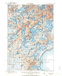
- 1900 Map of St Croix Dalles
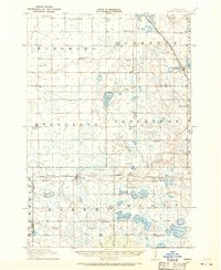
 1900 St Croix Dalles1900 Print · USGSThe river gorge at the Wisconsin-Minnesota border comes alive in this late nineteenth-century survey, showing the twin hubs of the Dalles before modern expansion. Genealogists can trace family roots in Dresser Junction, El Salem, and the scattered lakefront farms of Farmington.
 - 1901 Map of Minneapolis
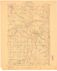
 1901 Minneapolis1901 Print · USGSThe Twin Cities suburbs begin to take shape in the late nineteenth century as rail lines weave through lake-studded prairies. Trace the origins of local industry and transit at Edina Mills, the Bloomington Ferry, and the St. Louis Park rail junction.8 unique versions available
 - 1901 Map of St Croix Dalles
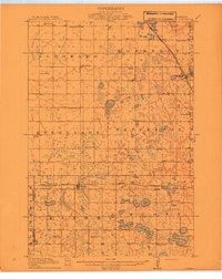
 1901 St Croix Dalles1901 Print · USGSThe river-border between Wisconsin and Minnesota was a hub of rail activity and river commerce at the start of the twentieth century. Genealogists and rail historians can trace the paths of the St. Paul and Duluth R. R. through Shafer and Taylors Falls, or locate old settlements like Franconia Station and Dresser Junction.6 unique versions available
 - 1902 Map of White Bear
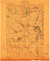
 1902 White Bear1902 Print · USGSThe lake-dotted landscape northeast of the Twin Cities is captured here at the start of the twentieth century. Researchers can trace early railroad junctions and industry at the Minneapolis Stock Yards, or locate old settlements like Lino, Cardigan, and New Brighton.4 unique versions available
 - 1902 Map of Anoka
 1902 Anoka1902 Print · USGSNorth of Minneapolis at the turn of the century, this area shows a landscape of glacial lakes and growing rail towns. Genealogists can trace family roots in early settlements like Osseo, Champlin, and Robbinsdale or locate long-standing landmarks near Medicine Lake.4 unique versions available
 - 1904 Map of Wahpeton
 1904 Wahpeton1904 Print · USGSThe Red River Valley at the start of the century was a landscape of burgeoning rail towns and river commerce along the Minnesota border. Genealogists can trace early homesteads and transport hubs between Wahpeton and Breckenridge, or follow the rail lines through Hankinson and Abercrombie.2 unique versions available
 - 1905 Map of Minnetonka, 1957 Print
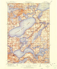
 1905 Minnetonka1957 Print · USGSLake Minnetonka and the Minnesota River valley are seen here during the early twentieth century as the region's resort and rail economy reached its height. Genealogists and historians can trace rail stops like Mound Sta, the summer colonies of Deephaven, and the riverfront streets of Chaska.
 - 1907 Map of Minnetonka
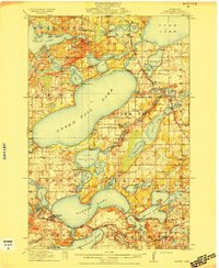
 1907 Minnetonka1907 Print · USGSLake Minnetonka was a premier summer destination at the turn of the century, crisscrossed by a Steamboat Route and multiple railroads. Genealogists and historians can trace old lakeside landings and early rail stops like Spring Park Sta, Mound Sta, and Zumbra Heights Sta.3 unique versions available
 - 1909 Map of Rockford
 1909 Rockford1909 Print · USGSWright and Hennepin counties are shown here in the first decade of the twentieth century as the railroads transformed rural Minnesota. Genealogists can locate family-named features like Berning Mill, Salem Church, and early schools in Burschville or Hassan.2 unique versions available
 - 1910 Map of Wendell, 1965 Print
 1910 Wendell1965 Print · USGSGrant and Otter Tail counties are shown here in the early twentieth century as a burgeoning network of rail lines and lakeside settlements. Genealogists can locate over twenty numbered schoolhouses and early stations along the Minneapolis St Paul and Sault Ste Marie line near Wendell and Hereford.
 - 1910 Map of Chokio, 1968 Print
 1910 Chokio1968 Print · USGSStevens County is shown here at the height of its rail-and-schoolhouse era in the early twentieth century. Genealogists can locate specific rural properties near landmarks like Harstad Slough, Town Hall, and over twenty numbered school sites including School No 35.
 - 1911 Map of Barrett
 1911 Barrett1911 Print · USGSGrant County is a mosaic of prairie lakes and early rail towns at the dawn of the twentieth century. Genealogists can locate over twenty numbered school sites and early settlements like Thorsborg, Erdahl, and the lake-front village of Barrett.2 unique versions available
 - 1911 Map of Herman
 1911 Herman1911 Print · USGSThe junction of two major rail lines at Herman defines this prairie landscape during a period of steady agricultural growth. Researchers can locate nearly twenty numbered rural schoolhouses and trace the original paths of the Great Northern RR and the Mustinka River.3 unique versions available
 - 1912 Map of Chokio
 1912 Chokio1912 Print · USGSWestern Minnesota prairie life is centered on the rail lines of Donnelly and Chokio during the early twentieth century. Genealogists and researchers can trace local school districts from School No 56 to School No 42 and locate landmarks like the Town Hall and Harstad Slough.
 - 1912 Map of Morris
 1912 Morris1912 Print · USGSThe rail hub of Morris and the surrounding Stevens County prairie are captured here at the height of the steam era. Genealogists and historians can trace dozens of early rural schoolhouses, the North Star Mill, and pioneer worship sites like Scandia Church.3 unique versions available
 - 1912 Map of Deerwood, 1963 Print
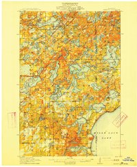
 1912 Deerwood1963 Print · USGSIn the decade before the region's full industrialization, this survey captures the lake-country settlements of Deerwood and Crosby just as the Northern Pacific railroad was driving local growth. Genealogists can locate dozens of early district schools and local landmarks like Doris Church and Katrine School.2 unique versions available
 - 1912 Map of Vergas, 1969 Print
 1912 Vergas1969 Print · USGSOtter Tail County was a patchwork of glaciated lakes and early rail lines in the years preceding the Great War. You can trace the path of the Winnipeg Line through Vergas and locate over twenty rural school sites including Jacobs School and School No 116.
 - 1912 Map of Battle Lake, 1975 Print
 1912 Battle Lake1975 Print · USGSOtter Tail County is captured here in the early twentieth century, showing a lake-rich landscape being shaped by new railroads and summer tourism. Genealogists can locate nearly twenty numbered schoolhouses and early communities like Battle Lake, Vining, and Ottertail.
 - 1913 Map of Ashby
 1913 Ashby1913 Print · USGSBefore the modernization of the Midwest, this part of Minnesota was a patchwork of numbered school districts and vital rail lines. Genealogists can trace family footprints near Dalton or search for local landmarks like School No 81, Tenmile Lake, and the Northern Pacific RR.4 unique versions available
 - 1913 Map of Fergus Falls
 1913 Fergus Falls1913 Print · USGSOtter Tail County is shown here in the early twentieth century, as rural townships were densely populated with family farms and dozens of small schoolhouses. Researchers can trace the Northern Pacific RR route through Carlisle and Elizabeth or locate the sprawling State Insane Asylum near Fergus Falls.3 unique versions available
 - 1913 Map of Wendell
 1913 Wendell1913 Print · USGSGrant and Otter Tail counties appear here just before the Great War, showing a landscape defined by prairie rail expansion and rural school districts. Genealogists can locate specific farmstead locations near School No 119, Dayton Dam, or the village of Wendell.
 - 1913 Map of Cuyuna, 1963 Print
 1913 Cuyuna1963 Print · USGSBefore the height of northern Minnesota's iron boom, this area centered on the nascent village of Cuyuna and the logging town of Emily. Genealogists and researchers can trace the early township school system through sites like Mud Brook School and Keeler School, or follow the competing routes of the Northern Pacific and Minneapolis St Paul and Sault Ste Marie railroads.2 unique versions available
 - 1914 Map of Battle Lake
 1914 Battle Lake1914 Print · USGSOtter Tail County’s lake country is captured here just before the Great War, showing a landscape defined by water and rail. Researchers can trace numerous rural schoolhouses and early lakeside retreats like Island Lodge, Camp Nidaros, and the village of Battle Lake.3 unique versions available
 - 1914 Map of Deerwood
 1914 Deerwood1914 Print · USGSCrow Wing and Aitkin counties are captured here just before the First World War, showing the growth of iron range towns and lakeside settlements. Genealogists and researchers can trace early rural life through nearly twenty numbered schoolhouses, the Dorris Church, and railroad stops at Crosby and Ironton.3 unique versions available
 - 1914 Map of Pelican Rapids, 1949 Print
 1914 Pelican Rapids1949 Print · USGSThe glacier-carved landscape of Otter Tail County is shown here just before the First World War, when rural schools and lakefront resorts defined the local character. Genealogists can trace family roots through sites like South Emmanuel Church and Bangor Cemetery or locate the many schoolhouses including Rollag School.
Showing maps 1-25
Top cities of Minnesota
- Minneapolis historical maps
- Saint Paul historical maps
- Rochester historical maps
- Duluth historical maps
- Bloomington historical maps
- Brooklyn Park historical maps
See more
Top counties of Minnesota
- Hennepin County historical maps
- Ramsey County historical maps
- Dakota County historical maps
- Washington County historical maps
- Saint Louis County historical maps
- Stearns County historical maps
See more
Frequently asked questions
- What are the different types of historical maps available for Minnesota?
- What is the oldest map of Minnesota?
- Where can I purchase historical maps of Minnesota for my home or office?
- Where can I download high-res historical maps of Minnesota?
- Are there historical topographic maps available for Minnesota?
- Is there historical aerial imagery available for Minnesota?
- Where are historical maps of Minnesota sourced from?